Landscape along Sichuan-Tibet highway in SW China
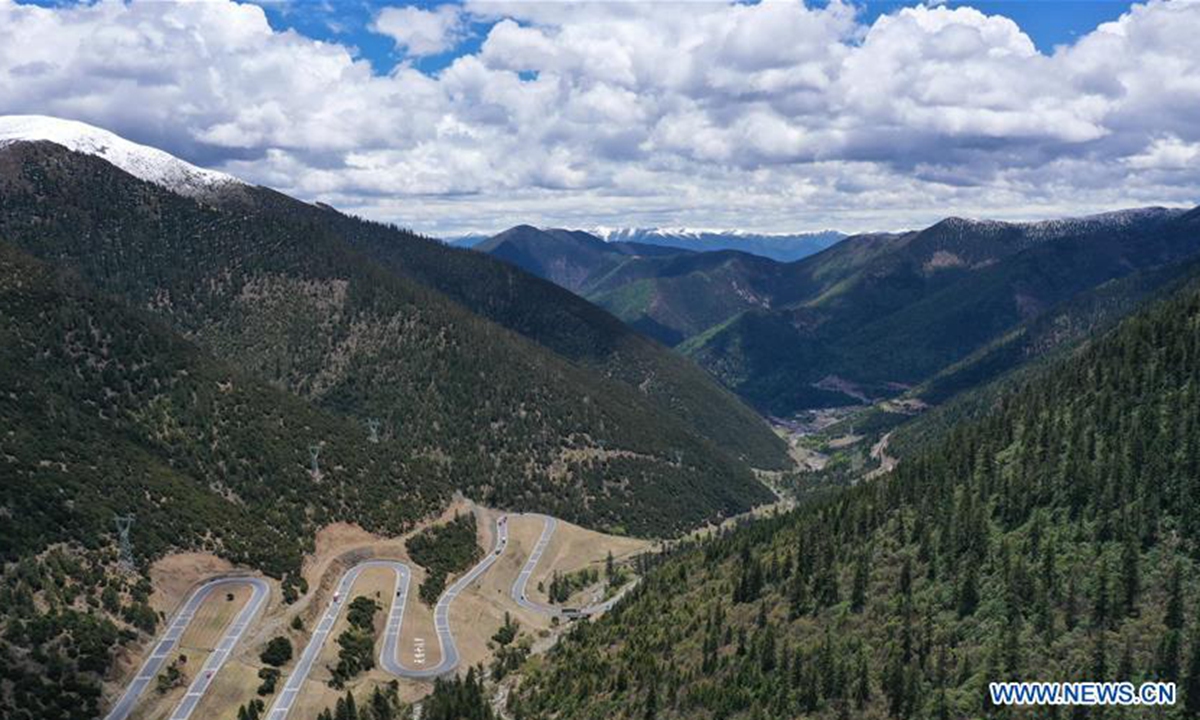
Aerial photo taken on May 31, 2020 shows the Sichuan-Tibet highway meandering in a valley in southwest China. The Sichuan-Tibet highway connecting southwest China's Sichuan Province and the Tibet Autonomous Region serves as the artery linking the plateau region and China's inland areas. The over 2,000-km highway meanders through snow-covered mountains, crosses a dozen raging rivers, traverses world-class fault belts and countless swamps, permafrost areas, earthquake zones, landslide areas, glaciers and primeval forests. (Xinhua/Li Mengxin)
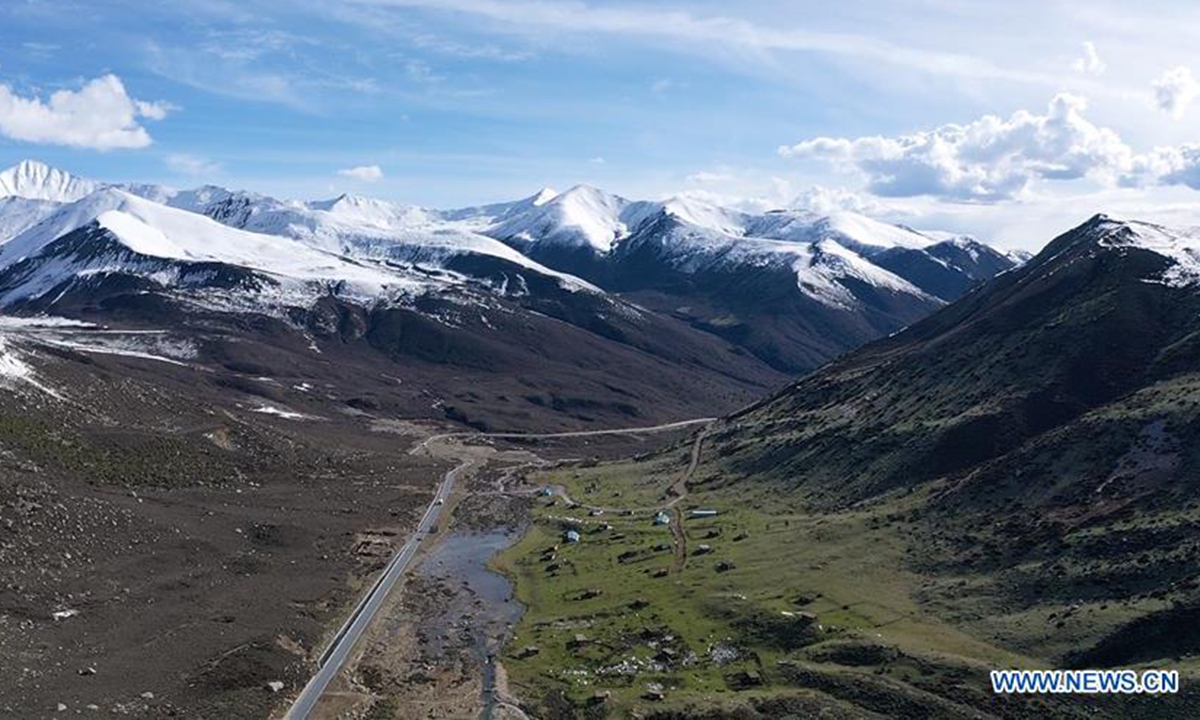
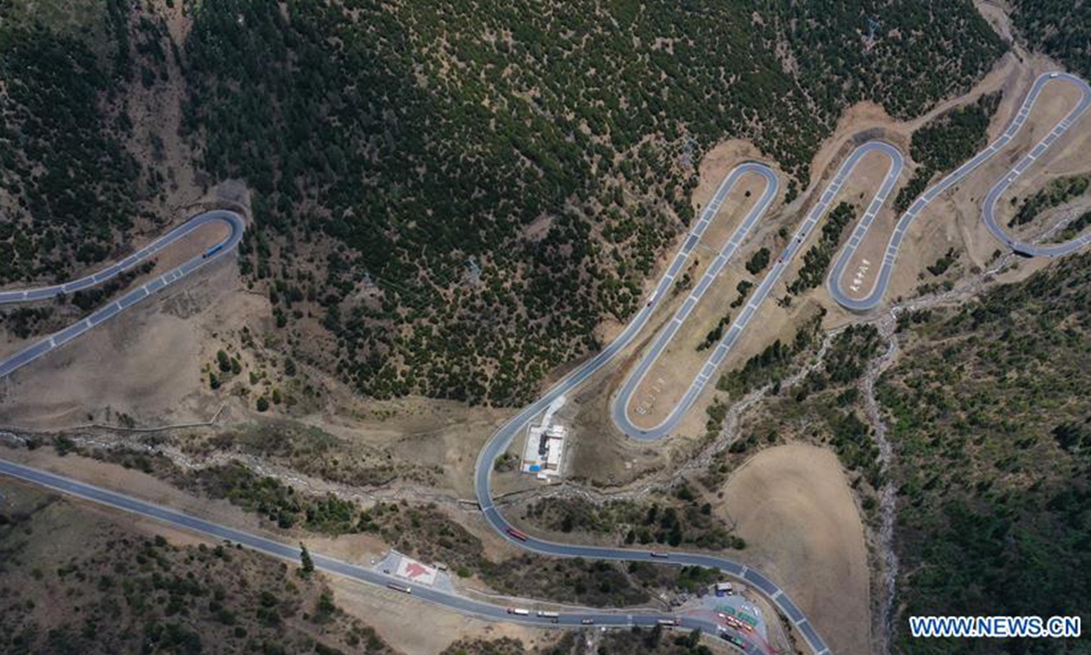
Aerial photo taken on May 28, 2020 shows the landscape along the Sichuan-Tibet highway in southwest China. The Sichuan-Tibet highway connecting southwest China's Sichuan Province and the Tibet Autonomous Region serves as the artery linking the plateau region and China's inland areas. The over 2,000-km highway meanders through snow-covered mountains, crosses a dozen raging rivers, traverses world-class fault belts and countless swamps, permafrost areas, earthquake zones, landslide areas, glaciers and primeval forests. (Xinhua/Li Mengxin)
Aerial photo taken on May 28, 2020 shows the landscape along the Sichuan-Tibet highway in southwest China. The Sichuan-Tibet highway connecting southwest China's Sichuan Province and the Tibet Autonomous Region serves as the artery linking the plateau region and China's inland areas. The over 2,000-km highway meanders through snow-covered mountains, crosses a dozen raging rivers, traverses world-class fault belts and countless swamps, permafrost areas, earthquake zones, landslide areas, glaciers and primeval forests. (Xinhua/Li Mengxin)
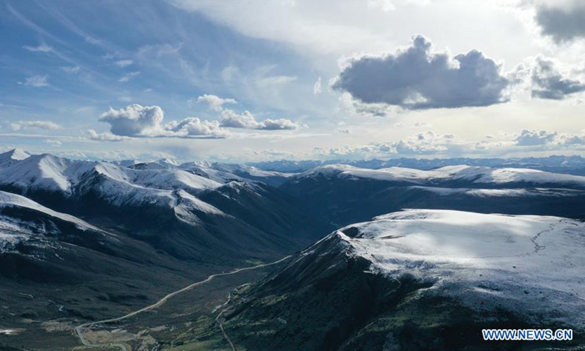
Aerial photo taken on May 31, 2020 shows the Sichuan-Tibet highway meandering in a valley in southwest China. The Sichuan-Tibet highway connecting southwest China's Sichuan Province and the Tibet Autonomous Region serves as the artery linking the plateau region and China's inland areas. The over 2,000-km highway meanders through snow-covered mountains, crosses a dozen raging rivers, traverses world-class fault belts and countless swamps, permafrost areas, earthquake zones, landslide areas, glaciers and primeval forests. (Xinhua/Li Mengxin)
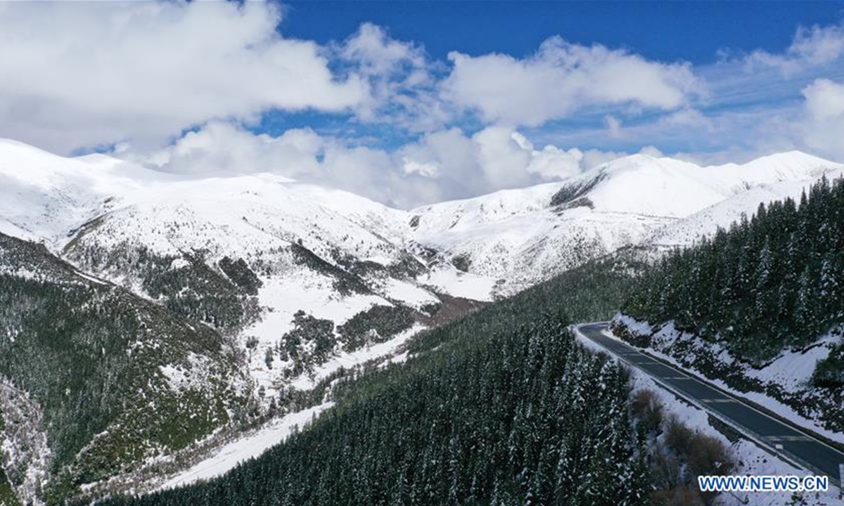
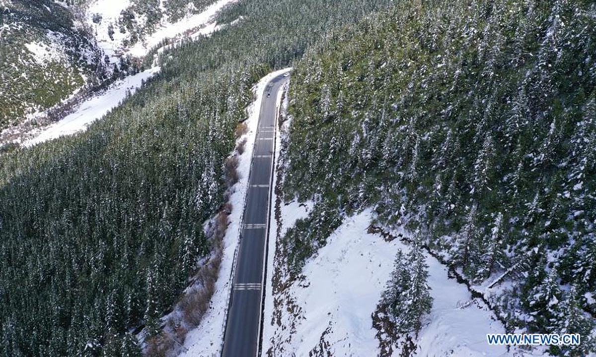
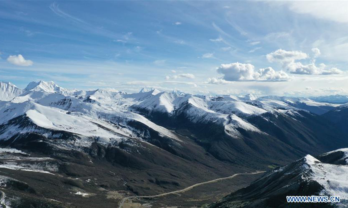
Aerial photo taken on June 1, 2020 shows the Sichuan-Tibet highway meandering in a valley in southwest China. The Sichuan-Tibet highway connecting southwest China's Sichuan Province and the Tibet Autonomous Region serves as the artery linking the plateau region and China's inland areas. The over 2,000-km highway meanders through snow-covered mountains, crosses a dozen raging rivers, traverses world-class fault belts and countless swamps, permafrost areas, earthquake zones, landslide areas, glaciers and primeval forests. (Xinhua/Li Mengxin)
Aerial photo taken on May 31, 2020 shows the Sichuan-Tibet highway meandering in a valley in southwest China. The Sichuan-Tibet highway connecting southwest China's Sichuan Province and the Tibet Autonomous Region serves as the artery linking the plateau region and China's inland areas. The over 2,000-km highway meanders through snow-covered mountains, crosses a dozen raging rivers, traverses world-class fault belts and countless swamps, permafrost areas, earthquake zones, landslide areas, glaciers and primeval forests. (Xinhua/Li Mengxin)
Aerial photo taken on June 1, 2020 shows the Sichuan-Tibet highway meandering in a valley in southwest China. The Sichuan-Tibet highway connecting southwest China's Sichuan Province and the Tibet Autonomous Region serves as the artery linking the plateau region and China's inland areas. The over 2,000-km highway meanders through snow-covered mountains, crosses a dozen raging rivers, traverses world-class fault belts and countless swamps, permafrost areas, earthquake zones, landslide areas, glaciers and primeval forests. (Xinhua/Li Mengxin)