ARTS / CULTURE & LEISURE
Seismic monitoring network provides early earthquake warning for Maijishan Grottoes
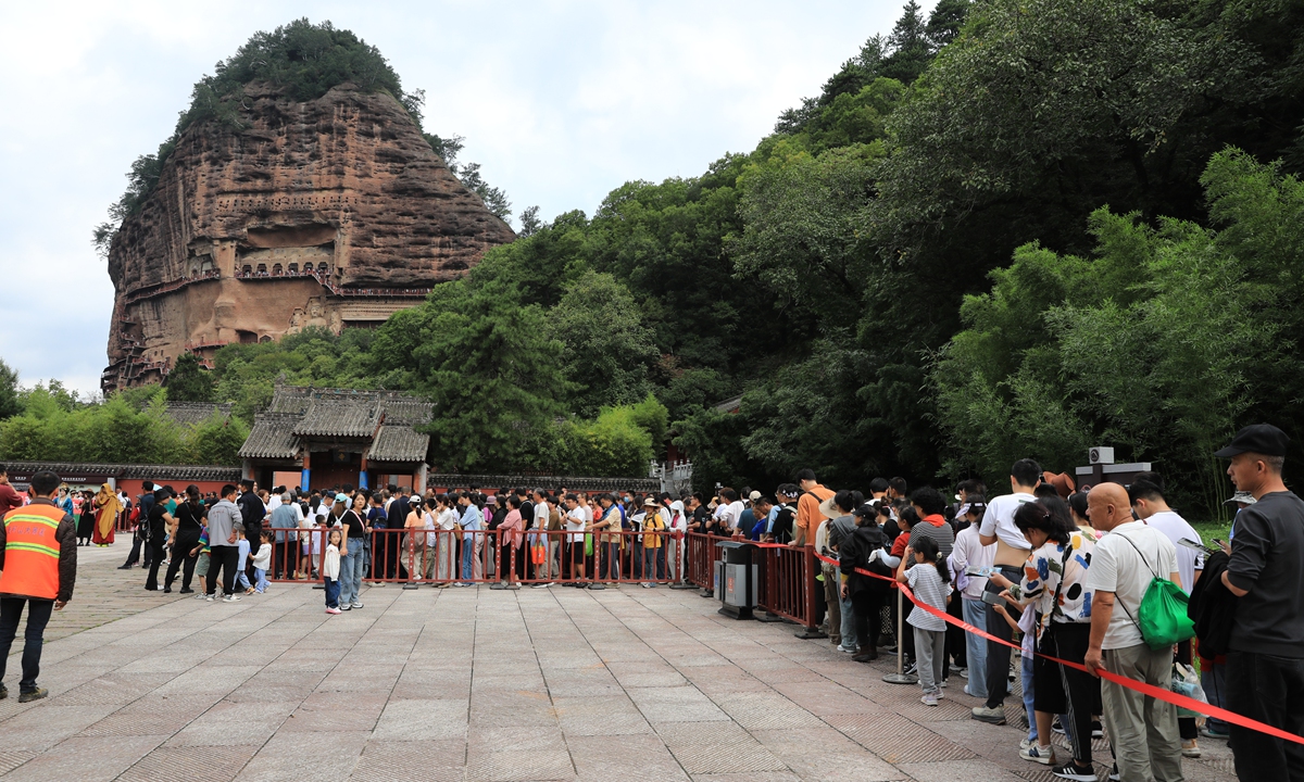
Visitors wait in line to explore the Maijishan Grottoes in Tianshui, Northwest China's Gansu Province. Photo: VCG
China has completed its largest seismic monitoring network dedicated to the protection of ancient rock-cut structures at the Maijishan Grottoes in Tianshui, Northwest China's Gansu Province, providing an advanced early warning and risk assessment system for this vulnerable heritage site, the Global Times learned from Gansu Earthquake Agency on Monday.According to the agency, the system integrates 251 existing seismic stations within a 100-kilometer radius of Maijishan, along with six new high-sensitivity monitoring stations installed directly on the cliff face. The dense array forms a comprehensive seismic observation network around the site.
Data from the network is transmitted regularly for analysis and used to build detailed 3D models of the cliff and caves. These models are essential for developing precise earthquake mitigation and conservation strategies.
"The network provides real-time monitoring and early warning capabilities for the grottoes and surrounding area," Zhou Weidong, senior engineer at the Gansu Earthquake Agency, told the Global Times.
"Most critically, the data collected from the cliff itself offers a scientific basis for future protection and reinforcement efforts."
Located in Tianshui, Gansu Province, the Maijishan Grottoes are one of China's four largest Buddhist cave complexes, along with Mogao, Yungang and Longmen grottoes in Gansu, Shanxi and Henan provinces. The site includes 194 caves and over 7,800 sculptures made from clay and stone, many anchored to a steep, haystack-shaped cliff face. A 1.5-kilometer-long suspended walkway connects 221 cliffside caves, with some walkways rising more than 70 meters above the ground.
The grottoes sit within the highly active Tianshui seismic zone and have suffered significant damage from earthquakes throughout history. Historical records document over 20 destructive earthquakes in the region, including a magnitude-8 quake, two between magnitude 7 and 8, and numerous smaller quakes.
Notably, a major earthquake during the Sui Dynasty (581-618) caused a large section of the cliff and parts of the Seven Buddhas Pavilion to collapse. During the Tang Dynasty (618-907), a magnitude-7 quake led to widespread cliff failure, dividing the cave complex into eastern and western sections. Rockfalls from these events still remain visible today. The 2008 Wenchuan Earthquake in Southwest China's Sichuan Province caused varying levels of damage to the cliff face, sculptures, and murals.
What makes conservation at Maijishan especially difficult is the site's rugged topography, which amplifies seismic waves.
"The uneven terrain can double the intensity of shaking in higher-elevation caves compared to the ground level," Zhou explained.
"This 'topographic amplification effect' increases the risk to both loose rock and fragile cave structures, rendering conventional seismic design methods inadequate."
To address the challenge, experts began by monitoring the "heartbeat" of the mountain using sensors to measure micro-vibrations and track structural health indicators such as frequency and deformation.
They then used simulations to recreate past earthquake scenarios, including the 734 and 1654 Tianshui earthquakes, combining fault modeling with Monte Carlo simulations to forecast how future quakes might affect the site. These findings revealed that nearby fault zones, such as the North Margin Fault of the Western Qinling Mountains and the Lixian-Luojiapu Fault, could generate moderate ground motion at Maijishan.
Using laser scanning and photogrammetry, researchers created a 3D model of the cliff to simulate seismic impacts across different areas. Results showed greater shaking near the mountaintop and highly variable resilience in uneven sections.
The new system also monitors the site's iconic suspended walkways, which are structurally vulnerable and difficult to inspect visually. Mobile sensors can now detect subtle damage that might otherwise go unnoticed.
In April 2024, the China Earthquake Administration and National Cultural Heritage Administration issued joint guidelines to improve earthquake preparedness for cultural relics. In December, the Gansu Earthquake Agency led the development of technical standards for seismic safety services for heritage sites.
Following the monitoring network's completion, the agency signed a partnership with the Dunhuang Academy to jointly study seismic risk and protection strategies for grottoes and earthen heritage, aiming to translate scientific research into practical conservation solutions.
RELATED ARTICLES