ARTS / CULTURE & LEISURE
Chinese photographer captures Mount Qomolangma ascent in single take
Lens on Everest
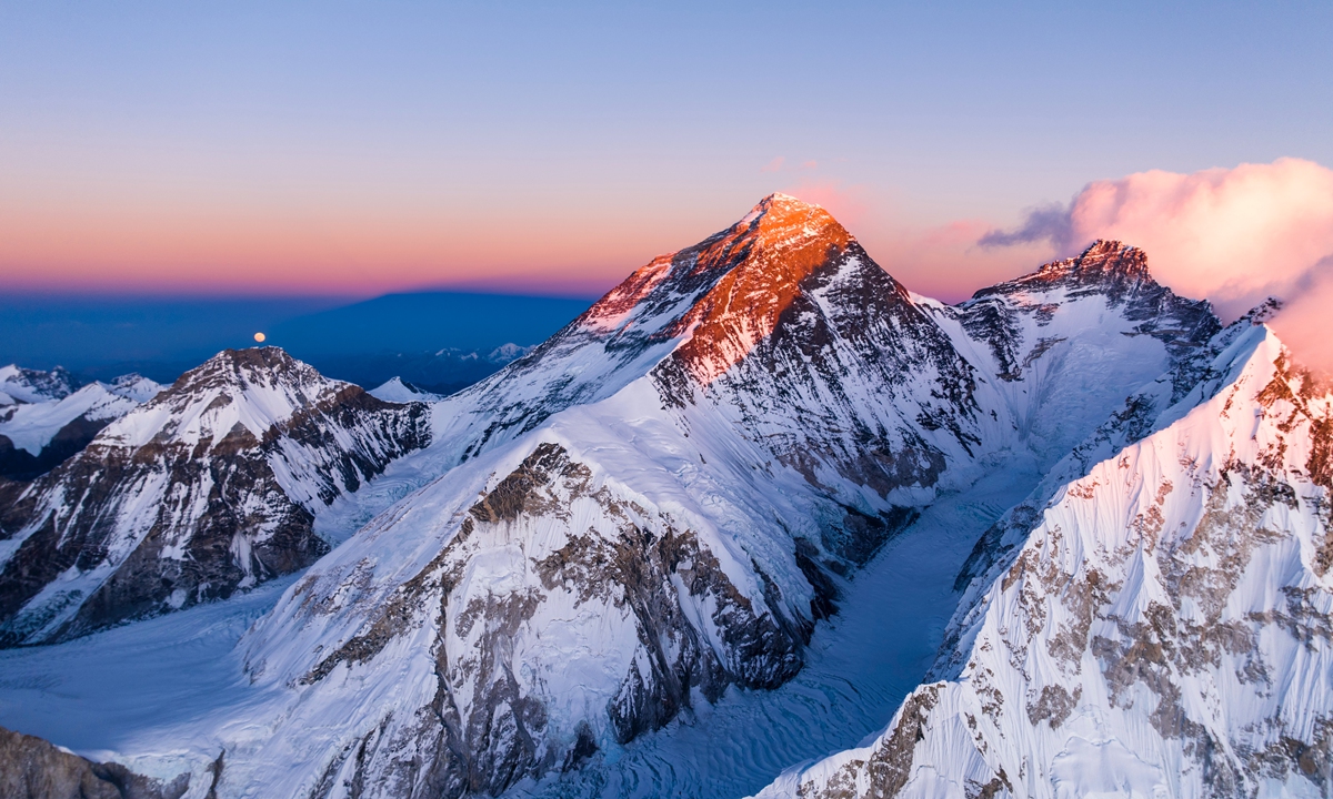
Mount Qomolangma Photo: Courtesy of Ma Chunlin
From 6,500 meters above sea level, a drone rises over the jagged icefields and snow-capped ridges of Mount Qomolangma. It glides past iconic waypoints: Camp I, the Windy Gap, Camp II, the Death Zone, Camp III, the Yellow Band, and the First, Second, and Third Steps.As climbers from both the south and north routes gradually converge toward the summit, the drone continues its ascent to the 8,848.86-meter summit, commonly known as Mount Everest in the West, where a mountaineer, silhouetted against the dawn, raises a hand in greeting.
This aerial shot achieves a world first reportedly by capturing the ascent of Mount Qomolangma from the north slope in a single, uninterrupted shot by Chinese photographer Ma Chunlin.
The video, only a few minutes long, has made waves beyond photography circles. Even China's Foreign Ministry spokesperson Mao Ning reposted the footage on X platform, writing, "Summiting Mount Qomolangma in a single continuous shot. March forward. Nothing is impossible."
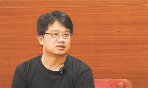
In an interview with the Global Times, Ma outlined the deliberate preparation behind the shooting and offered a glimpse into his future plans for high-altitude photographing projects.
Ma Chunlin Photo: Courtesy of Ma Chunlin
A decade in HimalayasMa, born in 1995, is no stranger to high altitudes or high stakes. The amateur photographer's fascination with the Himalayas began a decade ago.
"Photography in the mountains is where I find joy," he said. "I can almost always tell you where a photo of the Himalayas was taken."
Five years ago, Ma created a short film that documented the full ascent of Qomolangma from the Chinese side - but in segments. He realized that a continuous "one-take" aerial shot of the mountain would be a powerful visual story.
Since 2021, he has made multiple attempts, but problems with technology, weather conditions and climbing permits hampered his ambition.
In 2024, Ma trekked for two days to a launch site in Qomolangma at 6,500 meters, drone in hand. But powerful winds shut down the attempt as his drone stalled at an altitude of around 8,300 meters.
"That failure in 2024 made me realize how important it is to have climbers in the frame," said Ma. "Without them, you don't have perspective; you lose the human scale, and the audience can't grasp the difficulty or magnitude of the summit."
So, this year, he tried again and succeeded.
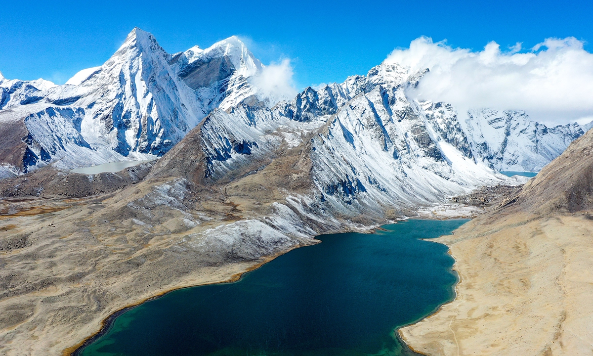
An aerial view of Zongcuo in Xigaze, Southwest China's Xizang Autonomous Region Photo: Courtesy of Ma Chunlin
Engineering the impossibleMa's ambitious aerial shot required thorough planning and precise execution. Starting from Qomolangma Base Camp at 5,200 meters, Ma trekked to the North Slope's Advanced Base Camp at 6,500 meters, the only location with a clear line of sight for a drone to fly straight to the summit, he said.
Due to the limitations of current drone technology - with an effective range of about five kilometers horizontally and two to three kilometers vertically - choosing the exact launch site is critical, Ma told the Global Times.
The failed attempt in 2024 taught him a hard lesson: The fierce winds near the summit must be accounted for. So he studied satellite imagery and wind forecasts to find the optimal weather window.
Equally important was human timing - he needed to coordinate with climbing teams so the drone could capture their movements.
"I included a thank-you list at the end of the video to acknowledge those who helped me along the way," Ma said.
In addition, every gram of the equipment mattered during his trek. Ma even stripped off unnecessary branding from gear and calculated battery usage down to the minute - which battery for sunrise, which for sunset, and which for specific terrain angles.
Since recharging on Qomolangma is impossible, each battery was assigned a precise task and launch time.
The drone lifted off at exactly 6:55:34 am on May 19, a time chosen after careful calculation. The golden window, he found, came 10 to 15 minutes before sunrise, when the light and the atmosphere are most ideal. Also, in this case, it was just enough time to reach the summit before the day broke fully.
"The first part of the flight went so smoothly but I was holding my breath," Ma recalled.
"Listening back to the audio I recorded during the shoot, it was almost entirely silent. When the drone neared the summit, I couldn't hold back my tears. The journey had been so difficult - and after all these years, it finally happened."
But the flight was far from risk-free. By the time the drone reached the summit, the signal had grown weak. At one point, it dropped entirely, and the drone went missing. Fortunately, the return-to-home function kicked in, and the drone made it back safely.
"We've always drawn to the mountains, and we always respect the power of nature," read a comment under Ma's WeChat video post. "6,500 might just look like a number, but only those who've been through it know the hardship behind it."
The Qomolangma shot is far from Ma's final act. He said he plans to explore more snow-capped mountains in the Himalayas. Additionally, he plans to climb the summit of Qomolangma from the southern slope.
"I hope that by capturing such an iconic mountain as Qomolangma, I can use it as a starting point to help more people discover and appreciate the Himalayas," he said.
RELATED ARTICLES