BRASIL 247 / MORE
Amazon records lowest first-half deforestation in a decade; vegetation loss alerts drop 38 percent from 2025 level
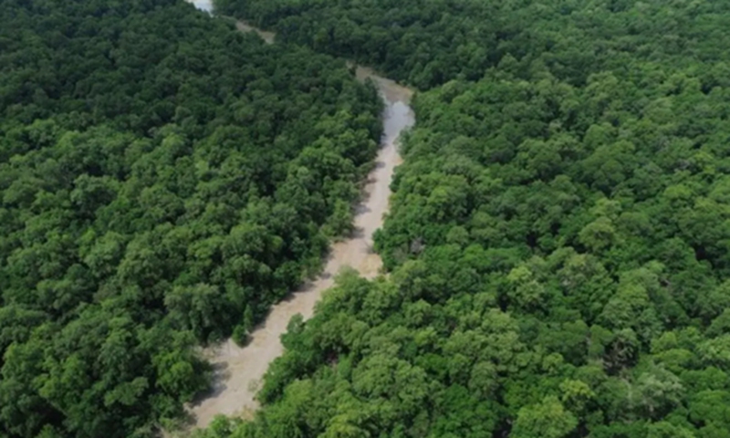
Photo: Fernando Frazão/Agência Brasil
By Brasil 247 - Brazil's Amazon rainforest recorded its lowest first-half deforestation level since the National Institute for Space Research (Inpe) began monitoring the biome through its Deter system in 2016, according to data released on Friday. The figures show a significant decline in forest loss compared with the same period last year.
Between January and June 2026, Deter issued alerts covering 1,295 square kilometers of native vegetation loss in the Amazon, a 38 percent decrease from the first six months of 2025. In the Cerrado savanna, alerts totaled 3,142 square kilometers, the lowest level since 2021 and a 6 percent reduction year-on-year.
The Deter system provides near real-time information to support environmental enforcement operations. Brazil's official annual deforestation estimates are produced separately by Inpe's Prodes system, which uses a more detailed monitoring methodology.
Together, the Amazon and the Cerrado account for about 73 percent of Brazil's territory, representing 49 percent and 24 percent of the country's land area, respectively. Combined deforestation alerts in the two biomes reached 4,437 square kilometers during the first half of 2026, an area nearly three times the size of the city of São Paulo.
In June alone, deforestation alerts covered 297 square kilometers in the Amazon and 482 square kilometers in the Cerrado. Compared with June 2025, the figures represent declines of 35 percent and 5 percent, respectively.
Executive Secretary of the Ministry of the Environment and Climate Change João Paulo Capobianco told Folha de S.Paulo that the data indicate a consistent downward trend in deforestation across both biomes.
"The numbers are showing that this reduction process has been cumulative, with reductions building on previous reductions. We are on a positive trajectory in both the Amazon and the Cerrado," Capobianco said.
According to the official, the results reflect coordinated action by federal, state and municipal authorities to combat illegal deforestation.
"This is a result achieved by the Brazilian state. It reflects multiple policies implemented by different agencies and different levels of government working together," he said.
Capobianco added that stronger environmental public policies could help ensure greater continuity in conservation efforts regardless of future political leadership.
For annual monitoring purposes, Inpe analyzes a 12-month cycle running from August to July because of the seasonal rainfall pattern in the Amazon. Between August 2025 and June 2026, deforestation alerts in the Amazon totaled 2,486 square kilometers, down 37 percent from the previous monitoring cycle, when 3,960 square kilometers were recorded.
In the Cerrado, accumulated alerts reached 4,686 square kilometers during the same period, representing an 8 percent decline compared with the August 2024-June 2025 cycle.
Specialists note that deforestation levels are typically lower during the first months of the year because the rainy season makes both forest clearing and satellite observation more difficult. Historically, deforestation peaks between May and September, when drier conditions facilitate land clearing.
Despite the positive trend, Brazilian authorities are monitoring the expected arrival of the El Niño climate phenomenon, which is likely to bring drier conditions to northern, northeastern and central-western Brazil during the second half of the year. Reduced rainfall could increase the risks of both deforestation and forest fires, testing the country's National Integrated Fire Management Policy, approved in 2024 following widespread wildfires.
Among Amazon states, Mato Grosso recorded the largest area under deforestation alert with 489 square kilometers, followed by Pará with 391 square kilometers and Amazonas with 184 square kilometers. In the Cerrado, Maranhão led with 839 square kilometers, followed by Tocantins with 825 square kilometers and Piauí with 368 square kilometers.
Deforestation dynamics differ between the two biomes. In the Amazon, forest loss occurs mainly on undesignated public lands and protected areas affected by illegal occupation. In the Cerrado, most vegetation clearing takes place on private properties.
Brazil's Forest Code also establishes different conservation requirements for each biome. In the Legal Amazon, landowners must preserve up to 80 percent of native vegetation, allowing clearing of up to 20 percent. In the Cerrado, under certain conditions, landowners may legally clear up to 80 percent of native vegetation on rural properties.
Deforestation remains Brazil's largest source of greenhouse gas emissions. According to the Greenhouse Gas Emissions and Removals Estimation System (SEEG), land clearing accounted for 42 percent of the country's carbon emissions in 2024, the latest year with consolidated data. Reducing deforestation is considered essential for Brazil to meet its climate commitments under the Paris Agreement.
(Reported by Brasil 247 on July 10, 2026)
