Chinese team completes measurement work on Mount Qomolangma using homegrown technology
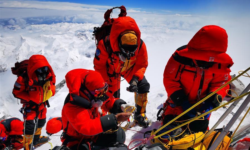
Chinese surveyors conduct surveying atop Mount Qomolangma on May 27, 2020. A Chinese surveying team reached the summit of Mount Qomolangma on Wednesday morning to conduct a series of surveys on the pinnacle of the planet. After summiting, team members began erecting a survey marker on the snow-covered peak, which measures less than 20 square meters. (Xinhua/Tashi Tsering)
China's new homegrown technology applications such as 5G and the BeiDou Satellite Navigation System have ensured the smooth undertaking of the country's latest quest to re-measure the height of Mount Qomolangma, the world's highest mountain located on the China-Nepal border, on Wednesday.
All eight warriors of the measuring team successfully conquered the peak of the world around 11 am on Wednesday.
The Chinese team set off to reach the summit of Mountain Qomolangma from a mountain camp at an altitude of 8,300 meters at around 2:10 am the same day, and after nearly 9 hours, the warriors in red, the color of the Chinese National Flag, managed to ascend to the top of the mountain.
Having completed all the measuring work, the Chinese height surveying team started to descend from the peak at around 1:22 pm.
During their more than two hours long stay at the world's peak, they were tasked to establish a survey marker to enable the other surveying team members at the height of 5,000 to 6,000 meters to aim in order to conduct intersection measurement, and to use radar to measure the depth of snow and use satellite positioning to determine the location of the summit.
The whole process, especially the literally breathtaking moment the team reached the top, was closely followed by millions of viewers via the livestreaming provided by national broadcaster CCTV, which was made available thanks to 5G communication technology.
Wang Yongfeng, the general commander of the mission who was at the Base Camp at an altitude of 5,200 meters, even managed to make calls with the team members using the 5G-driven phone terminals on their way up. "The 5G reception is excellent," he said.
The world's highest peak has been covered by the 5G network provided by China Mobile. And to ensure smooth communication as well as high definition livestreaming service for the quest, China's communication giant Huawei has worked with China Mobile to offer detailed terminal-to-terminal solutions, China Mobile told the Global Times on Wednesday.
The 5G tech was not the only new type of advanced gear in the mission. China's domestically developed BeiDou Satellite Navigation System, or BDS, and China's second generation Geostationary Meteorological system, the Fengyun-4, as well as the Zhongxing-6A communication satellite also significantly contributed to the completion of the mountain quest.
According to a press release from China's space contractor China Aerospace Science and Technology Corporation (CASC) on Wednesday, CASC's China Academy of Space Technology (CAST) was the developer of the BDS satellite family and the Zhongxing-6A communication satellite, and Fengyun-4 was developed by the CASC's Eighth Institute. All the satellites were launched by the Long March-3A carrier rocket family, which were also developed by the CASC's China Academy of Launch Vehicle Technology.
The receiver of the Global Navigation Satellite System, known as the GNSS, carried by the team to the peak can grasp key positioning information such as the height of the snow surface on the Qomolangma summit, which can help calculate the overall height.
"In the 2005 quest, the GNSS satellite measurement mainly relied on the US GPS system. But this year, we shall reference data from all four existing GNSS systems — the GPS, Europe's Galileo, Russia's GLONASS, and China's own BDS. And the BDS data will be at its center," Li Guopeng, an official with the Ministry of Natural Resources, was quoted as saying in the CASC statement sent to the Global Times on Wednesday.
It would mark a first by adopting BDS in the height survey, and the BDS-powered receiver can also monitor relevant region's crustal movement, according to Li.
Also, from Lhasa, capital of the Southwest China's Tibet Autonomous Region, to the Base Camp, and to the Advance Camp at 6,500 meters, the Zhongxing-6A communication satellite had been providing a vehicle-mounted Ku-band communication system, enabling the researchers to have stable access to internet services and emergency communication.
Also, an aerial gravimeter independently developed by China was also brought atop the mountain by the team members, and according to the CCTV live broadcast on Wednesday morning, such adoption of aerial gravimeters in the region will fill in a international blank, as no one has done this before.
"The aerial gravimeter is a highly precise and complex instrument to determine the region's gravity data, and the successful collection of such data from the world's highest point could help researchers to better understand how the inside of the Earth moves," said Wang Yanan, chief editor of Aerospace Knowledge magazine.
Wang told the Global Times on Wednesday that the use of the device at the top of Mount Qomolangma shows that China has accumulated sufficient skills to ensure the stability and precision of the device even in one of the harshest environments on the planet.
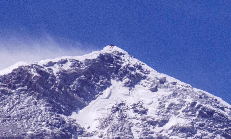
Chinese surveyors conduct surveying atop Mount Qomolangma in this photo taken with an ultra-telephoto lens on May 27, 2020. A Chinese surveying team reached the summit of Mount Qomolangma on Wednesday morning to conduct a series of surveys on the pinnacle of the planet. After summiting, team members began erecting a survey marker on the snow-covered peak, which measures less than 20 square meters. (Xinhua/Sun Fei)
Weather matters
China initiated this new round of measurements to determine the height of Mount Qomolangma in April.
However, the Wednesday victory of the eight-member team did not come easily. Xinhua reported that their charge to the mountain peak was delayed twice due to bad weather.
According to a statement the China Meteorological Administration provided to the Global Times on Wednesday, at one stage there was a west wind with a speed of 14 to 20 meters per second, and there was cloudy weather at the altitude between 8,000 to 9,000 meters, which was basically in line with the administration's forecast, ensuring a good weather window for reaching the peak.
Wang, who is also deputy director of the mountain sports management center under the General Administration of Sports of China, said that the team precisely picked the right summitting window.