China uses high-tech to fight floods, geological disasters
Source: Global Times Published: 2020/7/22 0:29:29
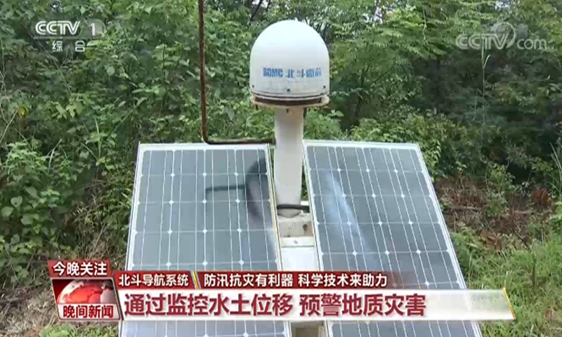
Photo: CCTV News
China uses high technology, such as Beidou Navigation Satellite System and drones, to fight floods, which have caused great damage to many provinces in Southern China this summer.
The Beidou navigation satellite System provides accurate and effective early warning of geological disasters.
In areas with a high risk of geological disasters, relevant departments install equipment with a Beidou chip on a mountain. Even a slight displacement of the mountain will be detected and an early warning will be issued, as China Central Television CCTV reported on Monday.
On July 6, a large landslide occurred in Leijiashan, Shimen county, Central China's Hunan Province, resulting in the collapse of five houses.
Before the disaster, Shimen county had received an orange alert issued by the Beidou satellite monitoring system. All 33 people of the 14 households were evacuated ahead of schedule, ensuring zero casualties.
The Beidou system can monitor the situation 24 hours a day in real time, and give early warning of possible landslides and rising water levels, according to the report.
Peng Jianwu, a researcher of the Natural Resource and Planning Bureau at Changde, Hunan, told CCTV that geological disasters should not only be measured and prevented by people, but also by technology. Human resources and technology should be combined to improve the ability to monitor and give early warning of geological disasters.
Drones have obvious advantages in flood control. They can responds quickly with a wide range of reconnaissance, which is not restricted by terrain.
Over Dongting Lake, Hunan province, a drone was able to inspect a flooded area within one minute, and send real-time pictures to experts.
Posted in: SOCIETY