How is the new height of Mount Qomolangma measured?
Source: Global Times Published: 2020/12/8 22:18:14
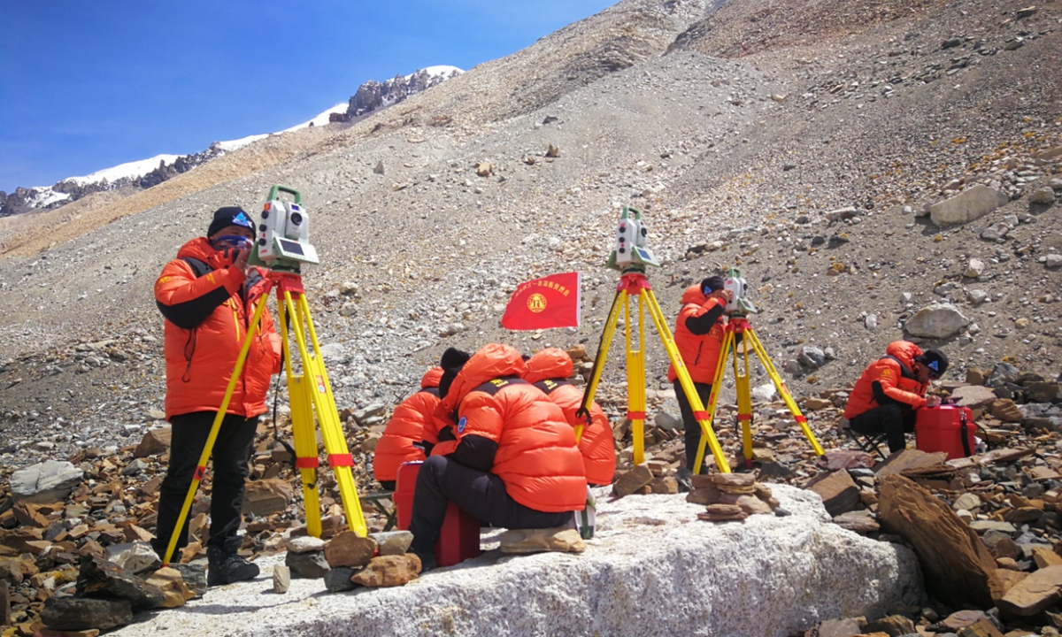
Photo: Ministry of Natural Resources
On Tuesday, China and Nepal, the two countries whose border the world's highest peak straddles, jointly announced the "historic" new calculation of the height of Mount Qomolangma - 8,848.86 meters, higher than China's previous calculations. How was the new height measured? Experts at the Ministry of Natural Resources gave their answers.
A Chinese measurement team made another successful quest to Mount Qomolangma on May 27. During their trip to the peak, researchers collected the latest topographic data across an area of more than 1 million square kilometers near the mountain, totaling 144 million pieces of information, achieving multiple "firsts" in the process, the People's Daily reported on Tuesday.
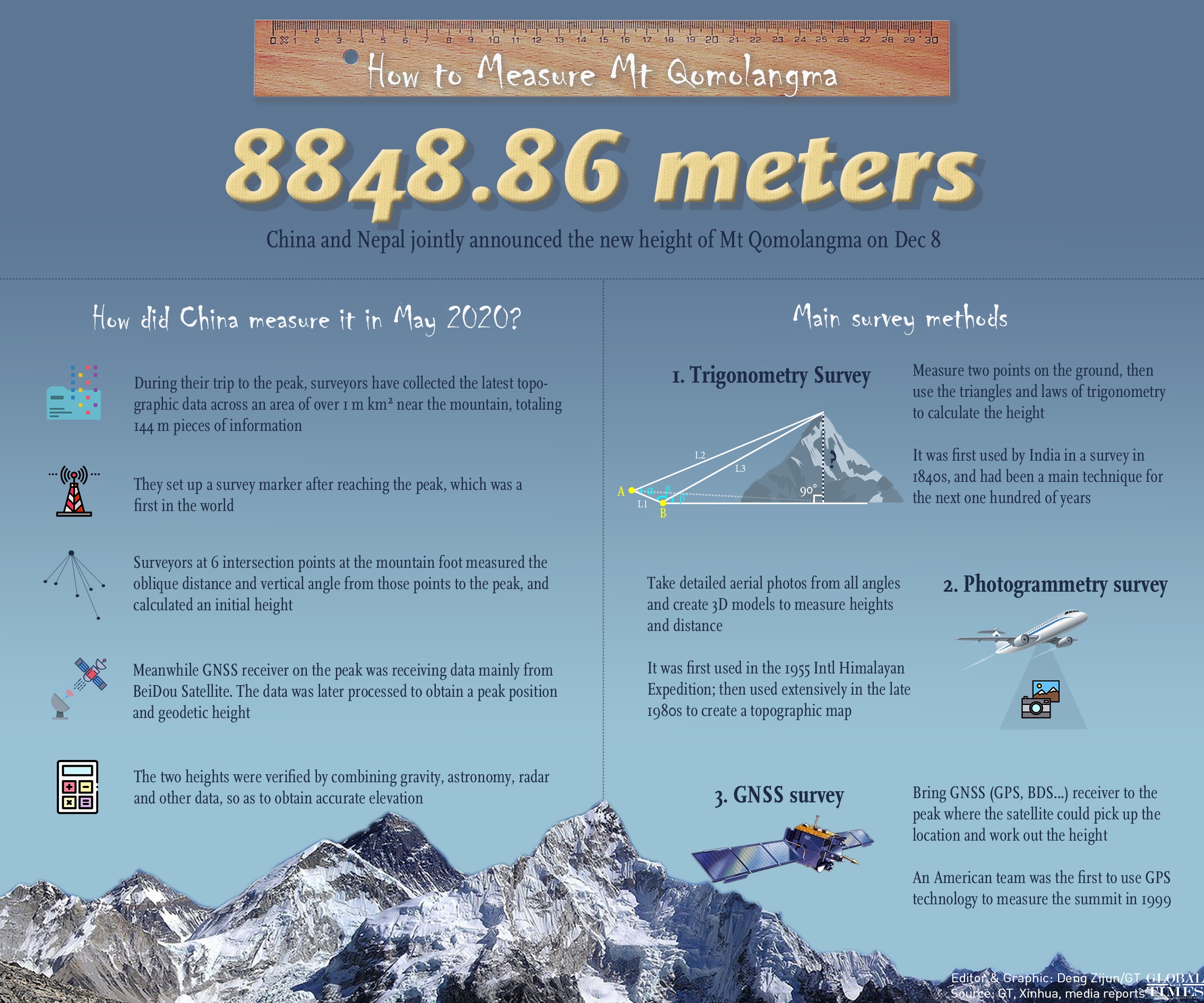
How to Measure Mt Qomolangma Infographic: GT
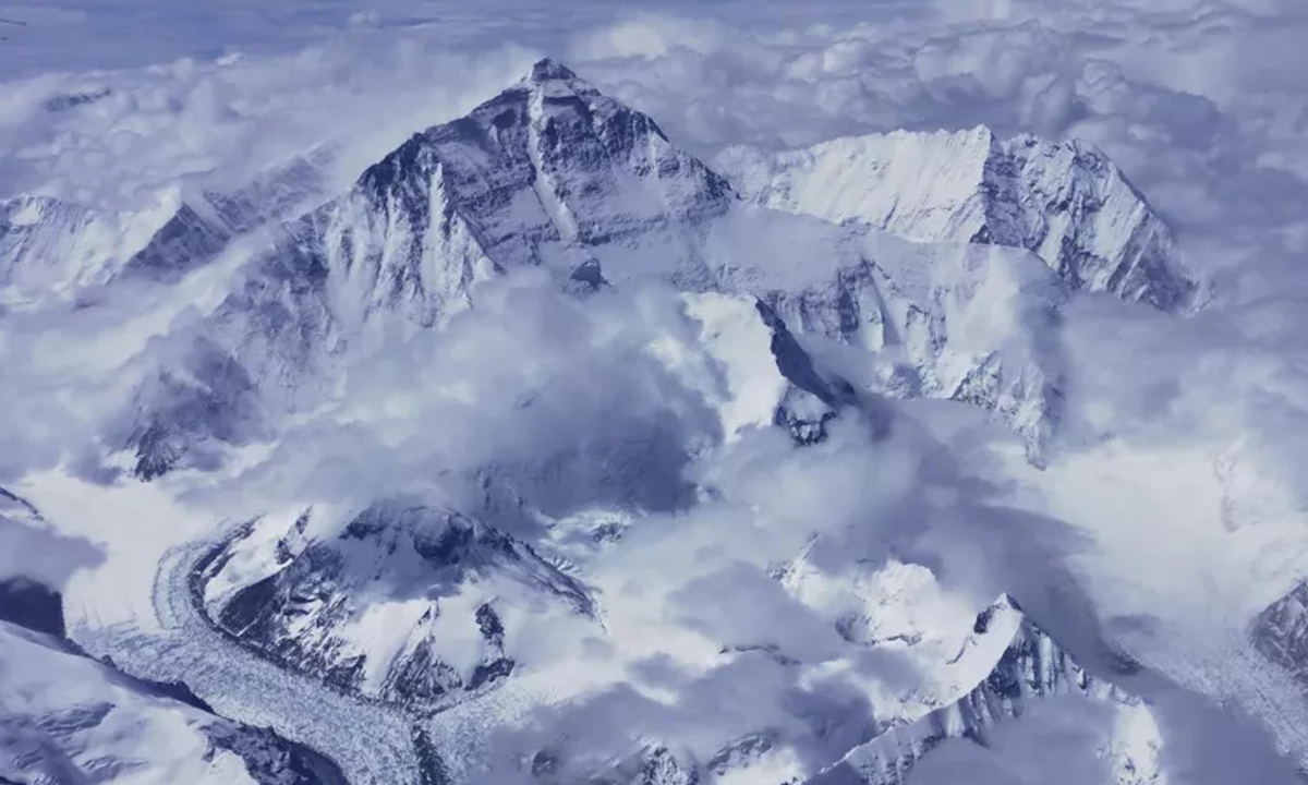
Photo: Ministry of Natural Resources
The height of Mount Qomolangma is the distance from the peak to the "geoid," a term that scientists use to refer to the level of still sea water extending toward the continent. However, the geoid cannot be measured directly. It requires a comprehensive calculation of gravity, leveling, terrain and satellite positioning data in the region.
Guo Chunxi, head of the Geodetic Data Processing Center at the Ministry of Natural Resources, said that the data processing included seven indicators: the Global Navigation Satellite System control network, elevation control network, peak rendezvous, gravity measurement, snow depth radar measurement, the comprehensive calculation of the gravity field in the peak area, the quasi-geoid refinement and the height of the mountain.
Affected by the movement of the earth's tectonic plates, including earthquakes, the stature of the mountain is constantly changing. China conducted its first exploration to measure the world's highest peak in 1975 with a result of 8848.13 meters; in 2005, new measurements by China put it at the lower height of 8844.43 meters, measured by the height of the rock rather than the snow cap, which explains the difference in measurements.
The quest this year achieved multiple "firsts," Li Guopeng, an expert at the Ministry of Natural Resources said. "It is the first time that the benchmark of the mountain's evaluation was extended to the border between China and Nepal, and we achieved the world's first measured gravity value of the mountain's peak. Also in a world's first, China used airborne gravity surveys to measure the gravity value of an area where humans cannot reach," he noted.
Dang Yamin, project leader of China's re-measurement task at the Ministry of Natural Resources, said that acquiring the field data for this year's measurement was a hard-won battle, with abundant high-quality data acquired. Experts also carried out considerable analyses to examine the quality of the data to ensure the accuracy of the calculation.
Global Times
Posted in: SOCIETY