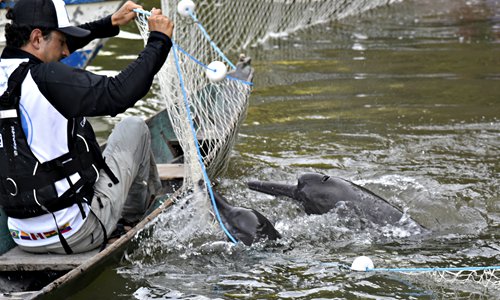
The photo released Wednesday by the World Wide Fund for Nature (WWF) shows dolphins being captured by WWF members in the Amazon River, Brazil. The dolphins of the Amazon are contaminated with mercury, possibly as a consequence of the use of the metal in mining activities in the region, a WWF report indicated. Photo: AFP
Indigenous peoples patrolling the Peruvian Amazon equipped with smartphones and satellite data were able to drastically reduce illegal deforestation, according to the results of an experiment published Monday.The study, which appeared in the Proceedings of the National Academy of Sciences [PNAS], showed that recognizing indigenous people's rights to their territory can be a powerful force against the climate crisis, the authors said.
The trial assessed the impact of indigenous forest community monitoring patrols in reducing deforestation when equipped with satellite-based alerts.
It found a 52 percent drop in deforestation in 2018 and 21 percent reduction in 2019, in villages that were randomly assigned equipment and training compared to those that were not.
The reductions in forest loss were especially concentrated in communities facing the most immediate threats from illegal gold mining, logging, and the planting of illicit crops like coca plants used to make cocaine.
Though national governments have invested heavily in satellite-based monitoring, empowering indigenous peoples is a departure from the orthodox reliance on local law enforcement.
What's more, deforestation alerts rarely filter down to rainforest communities, which lack reliable access to the internet.
The new study was led by researchers from New York University and Johns Hopkins University in collaboration with Rainforest Foundation US and the Indigenous People's Organization of the Eastern Amazon.
It was carried out in the indigenous Shipibo communities of Patria Nueva and Nueva Saposoa in the Peruvian Amazon, with photos supplied by PeruSAT-1, a satellite launched in 2016 that flies over the country 14 times daily.
Thirty-six villages were randomly assigned to the intervention, each identifying three representatives to conduct monthly patrols to verify reports of deforestation. They were paid $8 per patrol.
Once a month, couriers navigated the Amazon river to deliver USB drives containing satellite photos and GPS information to remote villages.
AFP
