Source reveals how China, Nepal resolved differences on Mt. Qomolangma's new height
By Li Sikun Source: Global Times Published: 2020/12/9 2:03:21
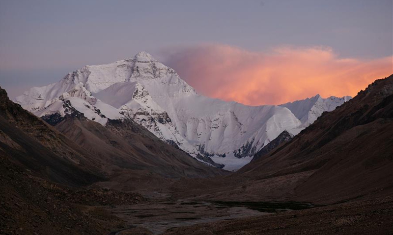
Photo taken on Sept. 4, 2020 shows clouds swirl around Mount Qomolangma. Photo: Xinhua
China and Nepal on Tuesday jointly announced the exact altitude of Mount Qomolangma is 8,848.86 meters. Seven rounds of discussions between China and Nepal settled discrepancies between the two sides over the height of the world's highest peak, a source close to the matter told the Global Times.
The Global Times had an exclusive interview with Jiang Tao, associate researcher at the Chinese academy of surveying and mapping, who is also a member of China-Nepal joint technology team measuring the mountain. Jiang told the Global Times that that scientists from the two countries completed all calculation and verification in November.
"Science requires precision … if there's any problem with the data, it will trigger a historical mistake. So the publication of the data isn't political," said Jiang.
The Chinese side had its rough result at the beginning of September, and held seven rounds of technological discussion afterwards with Nepal. A discussion was held once a week, said Jiang, noting that several academicians were invited to proof the result.
National bodies such as the Ministry of Foreign Affairs, and the Tibet Autonomous Region government were also involved, according to Jiang.
In each round of talks there were few major differences despite some minor technical gaps, such as the choice of measuring standards, according to Jiang.
The Chinese surveyors used the Yellow Sea as their sea-level base, while Nepal took the Indian Ocean as the sea-level base.
"In international cooperation, however, it is not actually appropriate to use either elevation benchmark. In line with international practice, we finally determined to take the parameters of the alternative Global Geodetic Observing System (GGOS) endorsed by the International Association of Geodesy," said Jiang, noting that after unifying the standard, the work progressed smoothly.
Reuters reported that Nepal had never previously measured the height of the mountain on its own but had used the 8,848 meters' estimate made by the Survey of India in 1954 that includes snow.
The Kathmandu Post reported in November that the consensus not only paves the way for the two countries to announce the "new height" of the highest mountain in the world, but also brings to an end a 15-year-old disagreement on whether to recognize the "snow height" or the "rock height" of the mountain as its official height.
For mountaineers heading to Mt. Qomolangma, an important pillar of Nepal's tourism industry, snow height of the mountain is more valued because climbers stand on it when they reach the summit of the mountain, Jiang suggested. For China, rock height measured in 2005 represented the perseverance and exploring spirit of Chinese scientists to measure the snow thickness with radar.
The joint announcement by China and Nepal of a unique Mt. Qomolangma height met the expectations of the leaders and people of the two countries, which should not be undermined by differences in standards, said Jiang.
The New York Times also reported in 2018 that having those extra feet recognized on summit certificates was enough for some mountaineers to switch routes, opting to climb from, and spend money in Nepal.
The compromise does not, as the New York Times misreported, mean that China has given up on adopting rock height so it can attract more climbers from the Tibetan side to Mt. Qomolangma and to compete with Nepal for visitors, Jiang stressed.
"We did not give up rock height. We were just carrying out the agreement by the two countries and to jointly announce the height," said Jiang, noting that "Nepal is a good friend, and we Chinese value peace."
Jiang said the main reason the consensus was reached is because in a joint statement issued after Chinese President Xi Jinping's state visit to Nepal last year, the two countries agree that they will jointly announce the height of the mountain and conduct scientific researches.
Scientists and technicians of both sides could not meet in person due to coronavirus, but atmosphere for discussion was friendly, so although there were scientific disputes, they solved them in a positive way.
The final result is recognized by both sides, said Jiang.