What has caused the once-in-a-century downpour in Henan?
By Published: Jul 21, 2021 08:46 PM

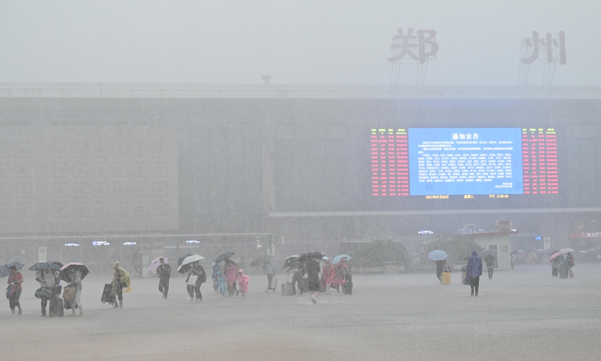
Zhengzhou, capital of Central China's Henan Province Photo: VCG
The heavy downpour in Central China's Henan Province that has killed at least 25 was the heaviest in 60 years. Meteorologists said this may have been the result of a typhoon near South China and the topography of the region, among other factors.The stable atmospheric circulation has contributed to the lingering precipitation in central and western parts of Henan, the China Meteorological Administration (CMA) said in a statement provided to the Global Times on Wednesday.
The West Pacific subtropical high pressure and the continental high pressure remained stable in the Sea of Japan and northwestern China respectively, causing the low-pressure weather system between the two to stagnate and seldom move in China's Huanghuai region, the CMA explained.
Meteorologists with the CMA noted that Typhoon In-Fa, which was formed on Sunday and approaching East China's Fujian Province, also exerted quite some influence on Henan even from afar, as it offers abundant water vapor supply to the long-term precipitation in Henan, even before it makes its landing.
The Global Times learned from the National Marine Environmental Forecasting Center (NMEFC), affiliated with the Ministry of Natural Resources of China, on Wednesday morning that Typhoon In-Fa is likely to land East China's Zhejiang and Fujian provinces on Sunday morning.
And due to the impact of the typhoon, southern waters in the East China Sea have seen high waves of six to 10 meters, prompting the NMEFC to initiate the orange warning for waves and blue alert for storm surge by Wednesday afternoon.
The unique landscape brought from the Taihang Mountain and Funiu Mountain in the province has enabled the strong precipitation area to remain stable and stagnate in the near-mountain regions, they said.
Just like a train of many compartments passing by, smaller and medium-sized convection currents that "carry rainstorms" moved along a Zhengzhou-bound route, leading to rather severe, long-term rainstorms in the Henan capital, even extreme precipitation in some regions.
According to the CMA, it has initiated emergency response for such severe weather disasters as early as on July 16, and Henan local meteorological authorities have released 1,427 early warnings and 162 pieces of red warnings of rainstorms since Saturday.
A total of 120 million instant messages containing such warnings for extreme weather were sent to the local residents and some 540,000 of such warnings have been sent to local emergency responding personnel, the CMA said in the statement.
Per forecast by the CMA on Wednesday, Henan will continue to see torrential rainstorms (50 to 120 millimeters) in the central, western, and northern parts of the province including Zhengzhou. And the rainfall will get lighter starting from Thursday.
Chen Tao, chief forecaster with the National Meteorological Center of CMA, told the Global Times on Wednesday that it remains a common problem faced by the global scientific community to effectively predict extreme weathers, as many medium and small weather development mechanisms could weigh on them.
He said that forecast of extreme rainstorms, extremely high temperatures, and super typhoons' path and intensity needs the world to solve together. The scientific mechanism of such extreme events is complicated. At present, the scientific laws of occurrence, development, and weather evolution have not been fully understood. This is a problem that the atmospheric science community has been working hard for a long time to overcome.
