World's 1st seismic activities monitoring system involving interdisciplinary research in trial operation in SW China's Sichuan
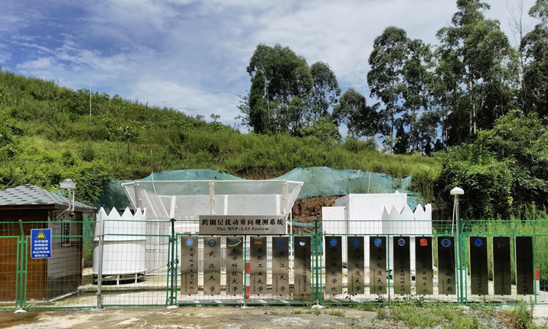
Monitoring of Vibrations and Perturbations in Lithosphere, Atmosphere and Ionosphere (MVP-LAI) system in Leshan city, Southwest China's Sichuan Province Photo: Courtesty of Chen Jiehong
Researchers of the world's first interdisciplinary-integration-research-based monitoring system of seismic activities which can simultaneously monitor about 20 physical parameters related to lithosphere, atmosphere and ionosphere, vowed to provide strong data support for geoscience research, including earthquake forecasting.
Located in the forests of Leshan city, Southwest China's Sichuan Province, the project of the Monitoring of Vibrations and Perturbations in Lithosphere, Atmosphere and Ionosphere (MVP-LAI) system led by China University of Geosciences, Wuhan, was recently put into trial operation and has started to send back real-time data to the data center for analysis.
"Most of the current monitoring systems only focus on one single sphere or a single physical parameter, which cannot effectively reflect complete abnormal evolution and mechanism, whereas the new system can perfect current mechanisms by comparing the multiple abnormal physical parameters to integrate or test known anomalies," Chen Jiehong, professor from Institute of Geophysics & Geomatics, China University of Geosciences, Wuhan, who led the project told the Global Times on Wednesday.
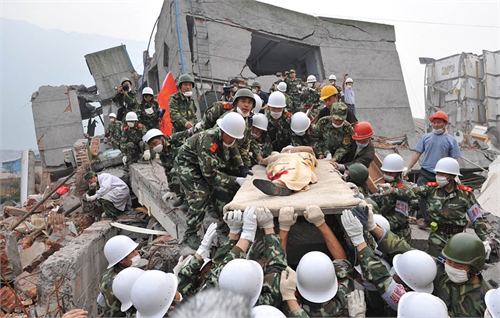
Through data analysis cooperated with the Institute of Earthquake Forecasting, China Earthquake Administration, Chen's research team has successfully identified the pre-earthquake vibrations and the standing wave effects of two earthquakes in May, the 7.4-magnitude earthquake in Maduo county in Northwest China's Qinghai Province and 6.4-magnitude earthquake in Yangbi Yi Autonomous County in Southwest China's Yunnan Province.
According to Chen, the monitoring system is the world's first interdisciplinary integration research system of geoscience which will provide strong data support for geoscience research in the years to come.
Occupying an area of 225 square meters, the system consists of at least 14 monitoring facilities such as a wind profiler, an important installation for observing atmospheric fluctuations, and a sonar detection system which measures temperatures within a range of 1,000 meters.
The location of the system in Leshan lies in the Sichuan Basin which is surrounded by the Qinghai-Tibet Plateau and mountains. "We mainly observe vertical disturbances or fluctuations. The vertical distance between the Qinghai-Tibet Plateau and the Sichuan Basin reaches over 3,000 meters, which makes it easier for us to monitor vertical disturbances or fluctuations," Chen said.
According to Chen, the system adopted a brand-new technology through which the observation data of the lithosphere, atmosphere and ionosphere are jointly monitored by a single system for the first time in the world. "Since a variety of instruments are involved, we must pay attention to the interference between the instruments," Chen said.
The system's vertical observation range can either monitor ground vibration, topographic variation, geomagnetic field, groundwater as deep as 5 meters under the ground or monitor atmospheric pressure, atmospheric wind field, atmospheric electric field or other changing data of physical parameters as high as 350 kilometers above the ground.
Through precise calculations of these data and the fluctuations of the data, researchers can forecast earthquakes as well as other severe space weather phenomena such as thunderstorms and squalls based on analysis combined with data obtained from other observation spots.
RELATED ARTICLES