China launches 1st real-time glacier monitoring system in SW.China’s Yunnan, ‘expected to expand to Xizang (Tibet)’
By Published: Oct 31, 2021 08:51 PM

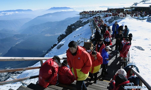
Tourists visit the Yulong Snow Mountain in Lijiang City, southwest China's Yunnan Province, Dec. 10, 2019. (Xinhua/Yang Zongyou)
Chinese scientists have put into use the country's first real-time glacier monitoring system in Southwest China's Yunnan Province. The system can help provide a better understanding of glacier melting caused by global warming, the system's developers told the Global Times on Sunday.
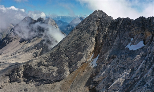
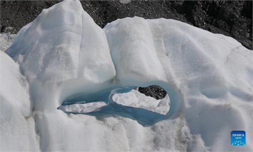
First installed on Baishuihe No.1 Glacier in Yunnan's Yulong Snow Mountain near Lijiang in July and upgraded in October, the system detects real-time information including glacial melting and accumulation, glacial velocity, ice quakes and temperature humidity pressure, the team said.
Scientists previously monitored glacier melting through images taken by drones, said a key member of the team -Yang Yuande, an associate professor of Chinese Antarctic Center of Surveying and Mapping (CACSM) at Wuhan University, Hubei Province.
"We found the glaciers on Yulong Snow Mountain have shrunk since 2018," Yang told the Global Times on Sunday.
The new system will be used in conjunction with drones to more precisely learn about how global warming influences glaciers, he said.
Yang's team plans to add more functions to the system and expand it to more glaciers in Southwest China including in Yunnan and Sichuan provinces and Xizang (Tibet) Autonomous Region.
"In Xizang, it can be used as an early-warning system to monitor glacier-related geological hazards, such as an ice avalanche," Yang said.
To install the system in remote areas like Xizang, scientists must overcome difficulties including the relatively erratic power supply and unstable signal transmission, as real-time monitoring is based on 4G network, Yang said.
"In areas without 4G, we could use the short messaging function of China's BeiDou Navigation Satellite System (BDS) [to update the data]," he told the Global Times.
In Yulong Snow Mountain, the system updates every five minutes via the 4G network, and realizes the continuity and accuracy of data collection and the visualization of data transmissions, according to the team.
This is much safer and more efficient than the previous artificial monitoring, which was usually conducted once a week between May and October, as other months were too cold, Yang said.
Jointly developed by CACSM and Northwest Institute of Eco-Environment and Resources of the Chinese Academy of Sciences, the system consists of modules that use the Global Navigation Satellite System (GNSS), laser distance measuring, cameras, meteorology equipment, ice temperature testing equipment and seismographs.
With similar technologies, the team is going to monitor the water areas of the glacier downstream of Yulong Snow Mountain to grasp the local situations of glacier movement and water level change, Yang said.
RELATED ARTICLES