Photo: General Administration of Customs of China
Chongqing Customs officers recently seized a batch of illegal maps suspected of violating the one-China principal and further investigation is underway, the General Administration of Customs of China (GACC) said on Thursday.
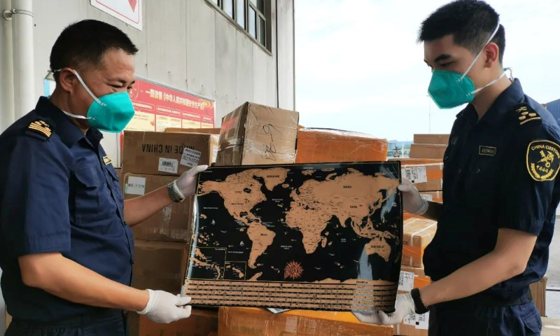
Yuzhou Customs affiliated with Chongqing Customs in Southwest China detected 24 sets of problematic maps which were scheduled to be exported to Europe, and the officers decided to implement a temporary seizure.
After identification by the local bureau of planning and natural resources, it was found that there were errors in the indication of China's Taiwan region, and the omission of important islands including the Diaoyu Islands and Chiwei Yu in the problematic maps, which is in violation of the Map Management Regulations and other relevant provisions, and is suspected of infringing upon China's sovereignty and territorial integrity and violating the one-China principle, according to the GACC.
The authorities said that a correct national map is a symbol of national sovereignty and territorial integrity. Map-related businesses should voluntarily provide the Customs with relevant approval documents for map products, and cooperate with the authorities in carrying out related inspections.
In recent years, some international companies have been found using problematic maps, threatening China's sovereignty and territorial integrity. In April 2021, the Shanghai authorities informed Swedish clothing brand H&M about a problematic map on its official website after being informed by netizens, and asked the company to rectify the map.
The State Council in 2015 issued a set of new regulations for maps, with the goal of tightening control over maps, safeguarding state sovereignty and boosting development of the geographic information industry. The Map Management Regulations cover compilation, examination and publishing of maps to be made public, internet mapping services, and supervision and inspection of maps.
