China issues alert as Typhoon Nesat approaches S.China’s Hainan; southern coastal areas ordered to take precaution measures

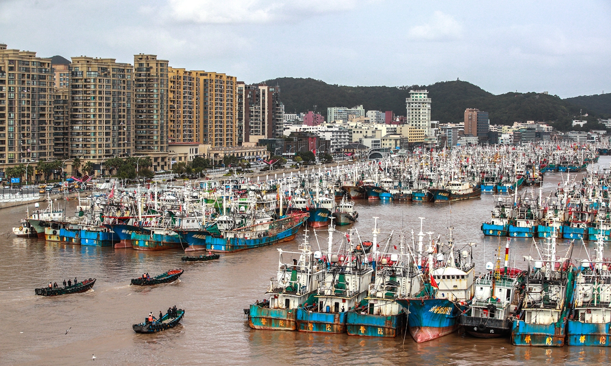
Boats harbor at a port in Zhoushan city, East China's Zhejiang Province, on October 17, 2022 due to the joint impact of Typhoon Nesat and a cold front. Photo: IC
China issued a yellow alert for typhoon on Monday with the State Flood Control and Drought Relief Headquarters and China's Ministry of Emergency Management ordering the return of boats to harbors and personnel to shore, as Typhoon Nesat has moved into the South China Sea near the country's eastern and southern coastal areas and is expected to affect the region with gales and rainstorms under a combination influence of the typhoon and a cold front between Monday and Friday.China's National Meteorological Center (NMC) issued Monday morning a yellow warning as the approach of Typhoon Nesat to the coastal region of the southern part of South China's Hainan Province.
Typhoon Nesat, the 20th of this year, was located at the sea in the northeast part of the South China Sea about 620 kilometers away from Sansha city in Hainan around 5 am on Monday.
It is expected that the typhoon will move westward and then toward west by south at the speed of 15 kilometers to 20 kilometers.
On Tuesday, the typhoon is expected to gradually weaken and move toward the coastal regions of the southern parts of Hainan. On Wednesday, it is expected to skim across the seas to the south of Hainan and move toward the northern part of Vietnam.
Affected by the joint influence of Nesat and a cold front, the NMC forecasted that a wide range of areas including the majority of the Yellow Sea and the East China Sea, the Taiwan Straits, the coastal areas of East China's Zhejiang and Fujian provinces and South China's Guangdong and Hainan provinces should expect strong gales between Monday morning and Tuesday morning.
Meanwhile, the northeastern part of Taiwan will expect heavy rainstorms of 50 millimeters to 95 millimeters.
The National Marine Environmental Forecasting Center (NMEFC) Monday continued to issue an original alert for sea waves - with red representing the most severe warning, followed by orange, yellow and blue. It also predicted poor sea conditions in the nearshore waters near Shanghai, Zhejiang, Fujian, Guangdong and Hainan due to the joint influence of Nesat and a cold front.
Between Monday noon and Tuesday noon, huge waves reaching from 6 to 9 meters high will be expected to occur in the northern and middle parts of the South China Sea and sea waves reaching 4 to 7 meters high will be expected across the Taiwan Straits.
The NMEFC reminded vessels operating in the aforementioned waters to pay attention to safety issues, and all relevant units in the coastal areas should take precautions against the sea waves in advance.
China's State Flood Control and Drought Relief Headquarters and China's Ministry of Emergency Management Saturday ordered the boats to return to the harbors and personnel back to the shore. The authorities emphasized a quick emergency response with a high alert in response to the Nesat and close attention paid to and strengthen monitoring, forecasting, early warning and analysis about the typhoon. The authorities also stressed shelter management and emergency preparations for disaster rescues.
Compared with the typhoons generated in July and August, Typhoon Nesat comes a bit late but its occurrence still falls within a normal period for typhoon every year between July and October, Huang Yiwu, senior engineer from Typhoon and Marine Weather Forecasting Center of the NMC, told the Global Times on Monday.
According to Huang, the impact of Nesat on the coastal regions isn't merely decided by the power of the typhoon itself but also the cold front that jointly affect the regions. Since the cold front is expected to brush past the coastal regions, the impact of the rainstorms it causes can't be underestimated, Huang said.
In response to Nesat, Hainan Province Flood Control and Drought Relief Headquarters launched the level-III emergency response to floods and gales on Monday following the Hainan Meteorological Service which forecast heavy rainstorms in parts of the province as Nesat, which has intensified with the maximum winds near the center being 137 kilometers per hour, approaches the southeastern coastal regions of the province with a speed of 20 kilometers to 25 kilometers per hour.
Meanwhile, the emergency response management depart in Zhuhai, South China's Guangdong Province, reminded local residents and departments to take precautions as the city is expect to see strong gales and plunging temperatures under the joint influence of the Nesat and the cold front which is not expected to end on Thursday.
Global Times


