Team with Gen-Z talent strives to build eco-security barrier on snowy plateau
Technology helps researchers explore the wonders of Xizang
By and Fan Wei in Lhasa Published: Apr 13, 2023 04:53 PM

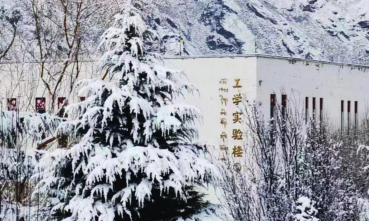
The Engineering School of Tibet University in snow Photo: Courtesy of Bo Wu from Engineering School of Tibet University
Known as the "Third Pole of the Earth" and covering an area of more than 1.2 million square kilometers, Southwest China's Xizang Autonomous Region is the main body of the Qinghai-Xizang Plateau - the roof of the world - with an average altitude of over 4,000 meters.
On this vast snowy plateau, the Asian water tower formed by tens of thousands of glaciers nourishes the starry Asian civilizations, while the strong neotectonic movement and the special geological, geographical, and geomorphic features have made this magnificent and beautiful land often face the threat of frequent geological disasters such as collapse, landslide, debris flow, and ice (snow) collapse.
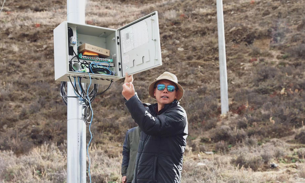
Photo: Li Junjie, founder of the Plateau Major Infrastructure and Environment Research Center of Tibet University
Due to the natural environment and engineering technology limitations, railway construction in the Xizang region started late, and few lines were open to traffic. At present, only three trunk railway lines are in operation. In July 2006, when the construction of the Qinghai-Xizang Railway, known as the "Heavenly Road," was completed and the railway was open to traffic, the era of the Xizang region having no trains came to an end. In 2014, the Lhasa-Xigaze Railway, an extension of the Qinghai-Xizang Railway, was open to traffic. In 2021, the Lhasa-Nyingchi section along the Sichuan-Xizang Railway was operational, becoming the first electrified railway in the region.However, as the global climate continues to get warm, the glaciers on the Qinghai-Xizang Plateau have a strong trend of melting, which seriously threatens the construction and safe operation of major national projects such as the Belt and Road Initiative and the Qinghai-Xizang Transportation Corridor.
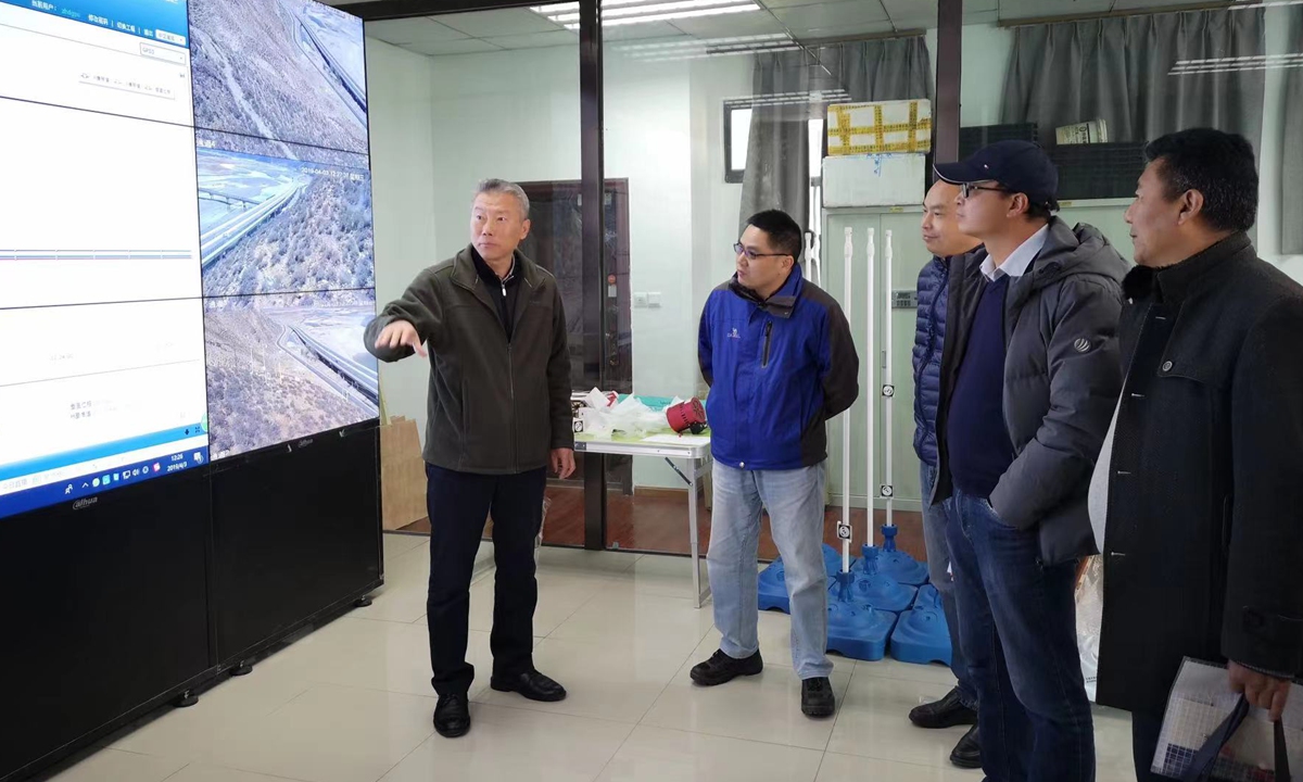
Photo: Li Junjie, founder of the Plateau Major Infrastructure and Environment Research Center of Tibet University
Recently, two Global Times reporters paid a visit to the Plateau Major Infrastructure and Environment Research Center of Tibet University. From the frontline survey maps of key ecological corridors, the real-time monitoring screens, and the data collected from more than 30,000 kilometers of field research, the Global Times reporters found out that the secrets behind the blueprint of transportation development miracles in the Xizang region are inseparable from the continuous efforts of a group of scholars and scientists - many of whom are Generation Z - who are willing to take root in Xizang and strive to build the snowy plateau. They provide strong support of scientific data for improving the construction of the national ecological security barrier and protecting the fragile ecological environment on the Qinghai-Xizang plateau.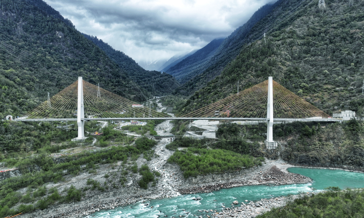
The Poulonggou bridge across the Palong watershed Photo: VCG
Fragile eco-environment
The Global Times reporters learned from the Engineering School of Tibet University, where the research center is located, that since the construction began in 2017, the center has accumulated a large amount of data on the Qinghai-Xizang plateau through the second scientific expedition to Xizang and the construction of the Sichuan-Xizang Railway and has been carrying out research on major infrastructure and environment-related issues on the plateau for a long time.
Teachers and students of the team visited key ecological corridors, areas prone to geological disasters, Sichuan-Xizang Railway, Beijing-Xizang Expressway, hydropower stations and other major projects in the Xizang region, covering more than 30,000 kilometers, and fully accumulated first-hand geological and engineering data of the Xizang region.
Li Junjie, founder of the center, was studying the monitoring data of the Tianmo watershed project with his students when the Global Times reporters met him on March 26. Tianmo watershed is located in the Palong Zangbo Basin of Nyingchi city. With the change of global climate, the frequency of glacier debris flow in Tianmo watershed has increased significantly.
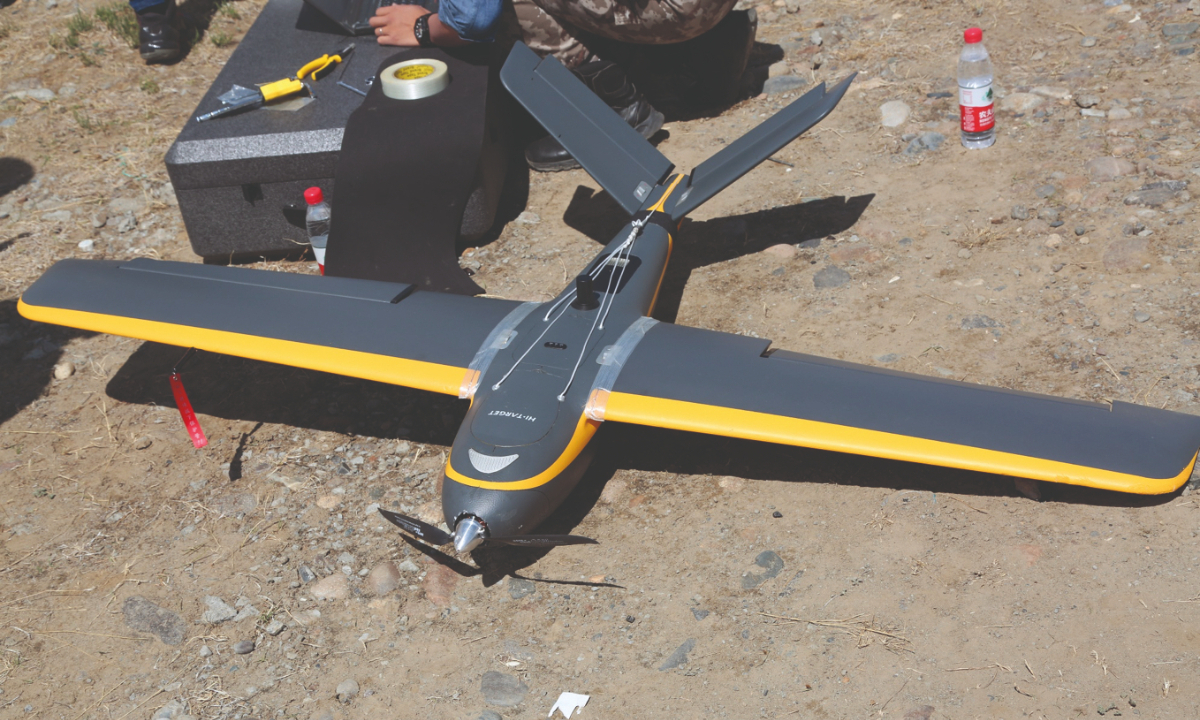
IFLY U0 drone used for emergency monitoring Photo: Engineering School of Tibet University
Between 2007 and 2018, seven large-scale mudslides occurred in Tianmo watershed. For example, in the early morning of July 11, 2018, a large mudslide occurred in Tianmo watershed in Songrao village, Bomi section of National Highway G318, burying about 220 meters of the highway and destroying about 60 meters of the roadbed. The traffic of G318 was suspended for two days, and Palong Zangbu was blocked to a certain extent, causing the water level in a small area upstream to rise, and the road into Songrao village was flooded. From September 5 to 8, 2010, a mudslide broke out in Tianmo watershed, causing the 16-day closure of Sichuan-Xizang highway and incurring direct economic losses of more than 19.7 million yuan, according to official website.
"The biggest difficulties of the Tianmo watershed project are the monitoring of the rainy season, transportation, power supply, and internet access. We decided to use GNSS [Global Navigation Satellite System], binocular vision, and 3D laser technology, adding RTK [real-time dynamic carrier phase difference technology] and unmanned aircraft to monitor rainfall, intensity, and soil moisture. Round-the-clock monitoring and warning of debris flow activities in Tianmo watershed will provide valuable data for landslide dynamics research and disaster assessment," Li told the Global Times.
The Global Times reporters learned from the center that under the influence of strong and deep river cracks, the southeastern part of Xizang region has steep terrain, high mountains and deep valleys, complex hydrogeological conditions and geological structures, and widespread distribution of glaciers. Due to the increasing influence of multi-period tectonic movement, glaciation, water erosion and human activities, southeastern part of Xizang has been widely known as "museum of geological disaster" due to high frequency of geological disasters.
"By integrating dispersed engineering monitoring and environmental monitoring resources, we have built a unified, standardized major infrastructure and environmental research center for the entire Xizang region, providing an important data source for big data analysis on the plateau," said Li.
In addition to the Tianmo watershed project, the Global Times reporters also noticed that the monitoring screens of the center showed real-time data of the high-risk landslide projects near Tongmai bridge, Palong watershed, and Dazilamu village.
According to Li, in order to understand and study geological disasters in Xizang's ecological corridor and form an effective emergency monitoring and early warning system for key parts of the corridor, the center uses many highly advanced technologies such as synthetic aperture radar interferometry technology, high-resolution remote sensing technology, global navigation satellite positioning technology, UAV machine vision monitoring technology and 3D laser scanning technology, which can provide an important reference for the assessment of disaster chain and the safety construction of large-scale projects, and also provide a scientific basis for the monitoring and prevention of the same type of regional geological disasters.
"Thanks to the perseverance, patience, braveness and professionalism of these young students and scholars, the center could constant update the first-hand information and data of geological situation in various parts of the Xizang region and provide valuable support for building an ecological security barrier on snowy plateau," Li said.
RELATED ARTICLES