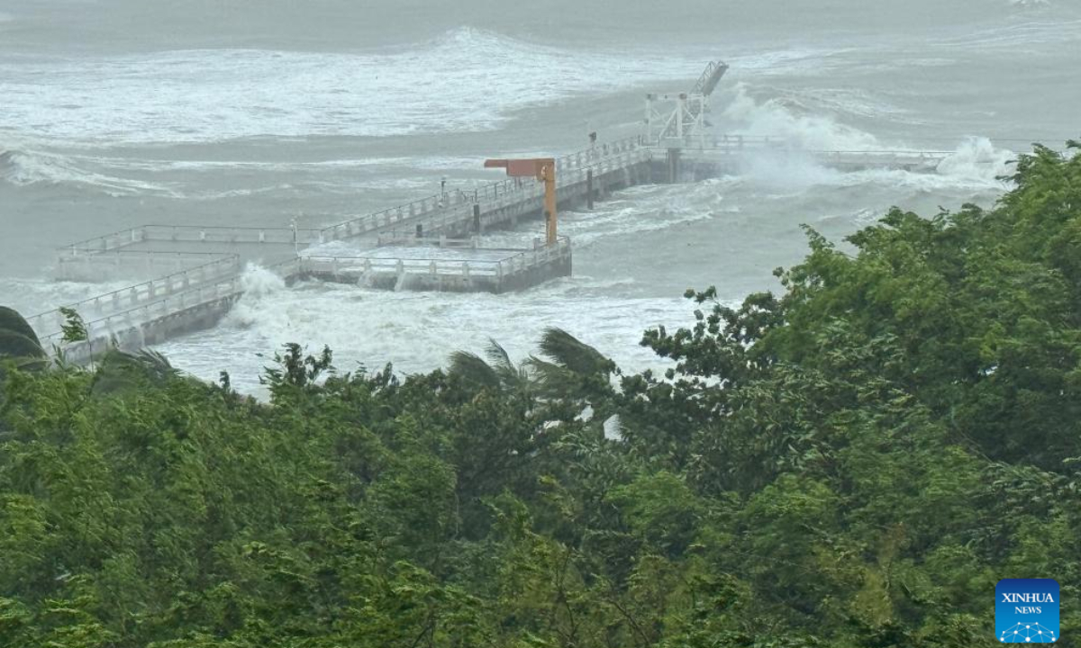
Strong winds and rough waves are seen at the Dadonghai sea area in Sanya, South China's Hainan Province, on June 13, 2025. Photo: Xinhua
Typhoon "Wutip" rapidly weakened after making landfall in Leizhou,
South China's Guangdong Province, at 12:30 pm on Saturday. The National Marine
Environmental Forecasting Center accordingly downgraded the wave and storm
surge alerts at 4 pm the same day.
Typhoon "Wutip," the first typhoon of the 2025 season, was expected to move northeastward at a speed of 20 to 25 kilometers per hour from South China's Hainan Province and make a second landfall around midday on Saturday along the coastal areas between Leizhou in Guangdong Province and Beihai in Guangxi Zhuang Autonomous Region, while maintaining severe tropical storm intensity. After landfall, it was forecast to weaken gradually, according to a report from China Meteorological Administration (CMA) on Saturday morning. The CMA issued alerts for typhoon, heavy rainfall, and severe convective weather at 6 am on Saturday, warning relevant regions to prepare emergency responses.
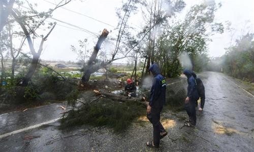
According to Guangdong provincial flood control and drought relief headquarters, the province recorded an average rainfall of 21.8 millimeters over the past 24 hours, state broadcaster CCTV reported on Saturday, noting that as of 6 am on Saturday, a total of 28,661 people had been evacuated across the province.
"Wutip" strengthened to typhoon level at 8 pm on Friday, before making landfall near Dongfang in Hainan around 11 pm. At landfall, the system had weakened to a severe tropical storm, with maximum sustained winds of 30 meters per second and a central pressure of 980 hPa.
Due to the combined impact of typhoon "Wutip," the southwest monsoon, and cold air from the north, parts of eastern and central regions of South China, as well as eastern and southern regions of the area south of the Yangtze River, will experience heavy to torrential rainfall from Saturday to Sunday, with some areas seeing extreme downpours. The CMA forecast accumulated precipitation between 80 to 200 millimeters, with some areas exceeding 300 millimeters, and issued yellow alerts for typhoon and heavy rain.
Guangdong elevated its emergency response to wind control from Level III to Level II at 9 pm on Friday, and raised its water conservancy and typhoon response measures to Level II simultaneously. Guangxi also upgraded its response to Level III at 5 pm Friday, the Xinhua News Agency reported.
Extensive preparatory measures are underway in both regions. All offshore fishing boats have been ordered to return to port, personnel have been directed to return from fishing rafts, marine ranches and offshore wind power platforms and have been fully evacuated, and coastal tourist sites have been closed, according to the report.
Under the influence of "Wutip," the National Marine Environmental Forecasting Center warned that from noon on Saturday to noon on Sunday, the western region of the South China Sea and the Beibu Gulf will experience rough to very rough seas, with wave heights ranging from 3 to 5 meters. Vessels operating in these waters are advised to take precautions, and coastal authorities are urged to implement wave prevention and mitigation measures in advance.
Aquatic farms in affected areas have also been advised to make emergency preparations for storm surge defense. All marine-related enterprises should take proactive and effective measures to secure fishing vessels, aquaculture rafts, and farms. Coastal aquaculture and fishery facilities, as well as fishing ports, should be reinforced, and precautions against tidal flooding should be well in place, according to the forecasting center.
Global Times