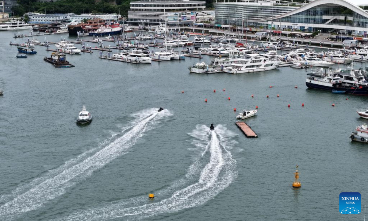
An aerial photo taken on Aug 23, 2025 shows yachts returning to a dock in Sanya, south China's Hainan Province. China on Saturday activated a Level-IV emergency response to flooding and typhoon in Hainan Province as Typhoon Kajiki, the 13th typhoon of this year, is approaching, according to the Ministry of Emergency Management. (Xinhua/Zhao Yingquan)
South China's Hainan and Guangdong provinces have been placed on alert as Typhoon Kajiki, the 13th typhoon of the year, is forecast to bring gales and rainstorms.
On Sunday, the Sanya Meteorological Observatory in Hainan raised its typhoon warning from orange to red as Kajiki gained strength. Forecasters said that over the next 12 hours, sustained winds across the city's coast and inland areas could reach force 12, with gusts as high as force 13 to 15, bringing torrential rain and frequent lightning. Officials urged residents and institutions to remain on high alert.
On Sunday, Sanya announced the suspension of classes, work, business operations, public transportation, and maritime travel, as well as the closure of tourist sites, in preparation for the typhoon.
Besides, the State Flood Control and Drought Relief Headquarters has initiated emergency response measures and dispatched a work team to Hainan to assist with local flood and typhoon relief efforts, according to the Ministry of Emergency Management.
China's National Meteorological Center on Saturday issued a yellow alert for Typhoon Kajiki.
Meanwhile, Guangdong's headquarters for flood and typhoon control and drought relief launched a Level IV emergency response for typhoon control, as the province's waters saw strengthened winds.
According to Guangdong's provincial meteorological observatory, heavy rains and strong winds are forecast to sweep the Leizhou Peninsula and the coastal areas of the cities of Maoming, Yangjiang and Jiangmen between Sunday and Monday.
Kajiki developed from a tropical depression over the South China Sea on Saturday morning. At 8 am, its center was located around 770 kilometers east of Sanya over the sea, with a maximum wind speed of 18 meters per second and a central pressure of 998 hectopascals.
The typhoon is forecast to continue moving in a west-northwest direction at about 25 kilometers per hour, with its intensity further strengthening. It is likely to make landfall or pass close to the southern coast of Hainan around Sunday evening, before heading toward the central and northern coastal regions of Vietnam.
China has a four-tier emergency response system, with Level I being the most severe response, and a four-tier weather warning system, with red representing the most severe warning, followed by orange, yellow and blue.
Global Times
RELATED ARTICLES
