China’s Smart Dragon rocket delivers 2 AI-empowered smart satellites to orbit via sea launch; mission also marks international collaboration: payload developer
By Published: Aug 05, 2026 01:34 PM

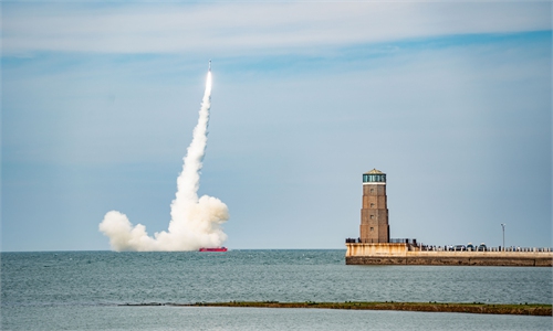
China succeeded in another orbital launch from sea on Wednesday, with Smart Dragon-3, developed by China Academy of Launch Vehicle Technology (CALT), delivering Satellite 01 and 02 of the Dongfang Huiyan spatiotemporal intelligent constellation hyperspectral remote sensing satellite system into their designated orbits.
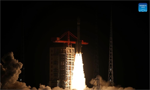
At 10:38 am Wednesday, the Smart Dragon-3 ignited and lifted from the sea waters near Haiyang, East China's Shandong Province. The mission marked the fourth launch of the rocket model this year, Global Times learned from its developer CALT.
In this mission, the model team further enhanced the reliability of pre-launch testing and launch communications, while deeply advancing the rocket's mission-independent general assembly and testing. This achieved streamlined production and delivery of component products as well as pulsating assembly and testing, thereby shortening the delivery cycle. The team also continued to promote standardized design, continuously improving production and design efficiency, and efficiently completed the satellite launch and constellation networking mission, per the CALT.
Since its first flight, the Smart Dragon-3 rocket has deeply cultivated the commercial space market, establishing a mature technical system characterized by "rapid response, high-frequency launches, controllable costs, and safety and reliability." Going forward, the model team will continue to tap its potential to provide users with higher-quality and more efficient commercial launch services, read a CALT statement it provided to the Global Times on Wednesday.
The mission was the 12th flight of the Smart Dragon-3 model.
The Dongfang Huiyan hyperspectral 01 and 02 satellites were developed by Wuhan University under the guidance of STAR.AI Spatio-temporal Intelligence Technology Co, Ltd. They are mainly used for monitoring water quality, suspended solids in water bodies, vegetation and crops, and mineral deposits, serving industries such as agriculture, forestry, grassland, water resources, and mining.
The two satellites will form a collaborative network with the already in-orbit Dongfang Huiyan high resolution 01 satellite to build an integrated "general survey + detailed survey" system, further validating a new model that combines hyperspectral remote sensing with AI.
Global Times also learned that the two satellites are empowered by AI capabilities provided by the Star Vision Aerospace Group Ltd, a Chinese AI-native aerospace company based in Hangzhou and a work of international collaboration under the Dongfang Huiyan constellation project.
Per the Star Vision, the twin satellites are equipped with 22 hyperspectral channels and powerful onboard AI inference capabilities. They can perform real-time understanding and analysis of data in orbit, compressing response times from "several days" to the "minute level" and significantly improving data utilization. This means the satellites are no longer merely cameras that record images, but intelligent nodes with judgment and decision-making capabilities - truly achieving the leap from "seeing the Earth" to "understanding the Earth."
The satellites were also named Samarkand-2028 and Lampung-1. Samarkand-2028 is named after the cooperation with the Uzbekistan Space Agency, while Lampung-1 pays tribute to the deep involvement of Indonesia's Lampung Province. The partners from both sides are not only joint developers of the onboard AI algorithms, but also co-builders of the satellite ecosystem and core users of the future data, Global Times learned.
Uzbekistan President Shavkat Mirziyoyev watched the live broadcast of the launch and extended warm congratulations on the collaborative achievement. Indonesian guests were present at the launch, according to the STAR.AI Spatio-temporal Intelligence Technology Co, Ltd.
The Wednesday mission also marked the second orbital launch from the sea by a Chinese rocket within two weeks. Gravity-1, developed by ORIENSPACE, launched from the East China Sea on July 22, sending nine satellites into their preset orbits while conducting one payload experiment and marking the first far-sea launch of a private commercial rocket.
RELATED ARTICLES