SCI-TECH / OTHERS
China unveils upgraded ‘Mazu’ ocean forecasting model to boost precision in key waters
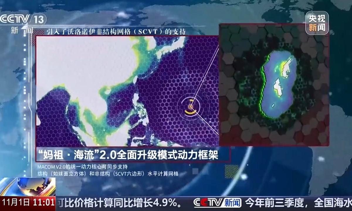
Version 2.0 of China's independently developed "Mazu" numerical ocean forecasting model is unveiled on November 1, 2026. Photo: CCTV News
China unveiled version 2.0 of its independently developed "Mazu" numerical ocean forecasting model, which provides forecasts at varying resolutions across key waters worldwide to meet major national needs, including deep-sea and polar exploration and maritime passage security, CCTV News reported on Sunday.Developed by the National Marine Environmental Forecasting Center under the Ministry of Natural Resources, the upgraded model marks a major advance in China's independent ocean forecasting capabilities, enabling more precise forecasts in strategically important maritime areas.
Ocean numerical models are core technologies underpinning marine forecasting. Since 2018, China has successively introduced the first-generation "Mazu Ocean Current" and "Mazu Ocean Wave" models. They were the country's first global operational ocean forecasting models to support GPU acceleration. Their source code was made publicly available worldwide in 2024, and the models have since been deployed in coastal provinces and cities across China.
The global forecasting system of the 2.0 version has a resolution of 5 kilometers, doubling that of its predecessor. In key waters, including China's offshore areas and the Western Pacific, the resolution has been further increased to 1 kilometer, allowing the model to more accurately capture seabed topography and hydrological characteristics in critical maritime areas.
The upgraded model retains the advantages of GPU-based high-performance computing, lightweight operation and low energy consumption. It has also successfully completed operational tests aboard China's icebreaker and research vessel Xuelong 2.
The model's overall performance has reached an internationally advanced level, according to the center. In addition to supporting various maritime production and operational activities in China, it will also facilitate international cooperation and technology transfer to Pacific island countries.
Separately, China has also been advancing the application of its independently developed "Mazu" early warning system as part of global efforts to strengthen disaster preparedness amid intensifying climate change and increasingly frequent extreme weather events.
In 2022, the UN launched the Early Warnings for All initiative, which aims to ensure that everyone on Earth is protected by early warning systems by the end of 2027.
At the opening ceremony of the 2025 World Artificial Intelligence Conference in July 2025, the China Meteorological Administration (CMA) unveiled its "Mazu" initiative, integrating traditional Chinese culture with modern technologies to establish a global early warning service network covering multiple types of disasters. The initiative shares China's experience and technological achievements in early warning services and is the world's first national-level action plan in response to the UN initiative, according to CMA.
Since its launch, the system has been put into operation in seven foreign countries - Pakistan, Ethiopia, the Solomon Islands, Jordan, Sri Lanka, Mongolia and Djibouti - while more than 40 other countries have been able to access it for trial use through cloud-based services.
Integrating meteorological satellites, AI meteorological models and urban multi-hazard early warning applications under the Mazu initiative, the system provides capabilities for global disaster and high-impact weather monitoring and analysis, forecasting and early warnings, meteorological services and information dissemination. It can also deliver customized comprehensive meteorological disaster early warning services based on the needs of specific countries and regions.
In April 2026, an upgraded cloud-based meteorological early warning service platform was launched, offering more than 200 meteorological service products across 30 major categories. The upgrade significantly improved system performance and extreme weather monitoring and warning capabilities, while bringing AI technology into broader application and expanding services from weather forecasting to impact-based forecasting.
Meteorological and hydrological authorities, disaster management agencies and international organizations can select resources according to their needs from catalogs covering observation equipment, satellite remote-sensing products and AI forecasting models, allowing them to develop customized solutions. The platform has so far launched more than 100 international cooperation projects.
RELATED ARTICLES