First major cold wave in 2026 sweeps China with plummeting temperatures, strong wind and heavy snow
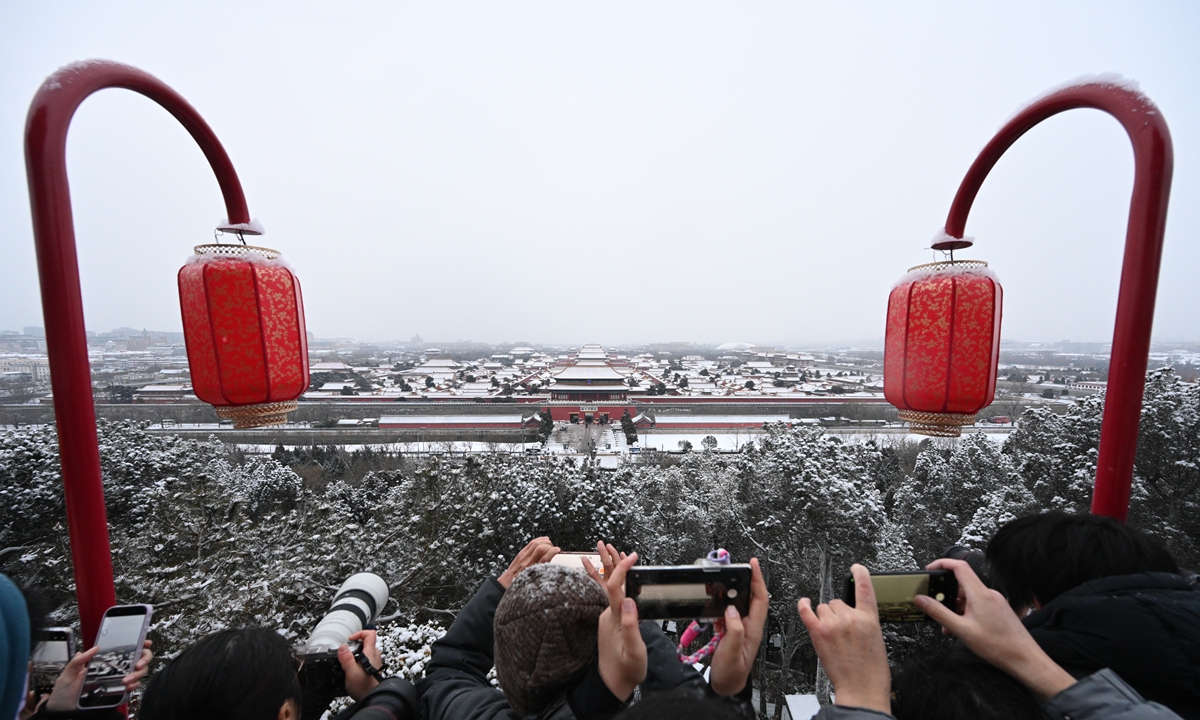
Tourists at Jingshan Park in Beijing brave the snow to capture panoramic photos of the snow-covered Palace Museum or known as the Forbidden City on January 18, 2026. Photo: Chen Tao/GT
China's national commission for disaster prevention, reduction and relief on Sunday activated a Level IV emergency response for freezing rain and snow on Sunday evening in Anhui, Henan, Hunan and Guizhou provinces, urging heightened coordination, protection of key sectors and rapid rescue efforts to prevent casualties and major losses amid the first major cold wave in 2026 sweeping across much of the country.
The National Meteorological Center (NMC) elevated the cold wave alert to yellow on Sunday, warning that the cold wave is affecting the majority of the country, and the sharp temperature drops, strong winds, rain, snow and freezing conditions are expected to sweep from north to south across the central and eastern regions of the country between Sunday and Wednesday.
The NMC renewed a yellow alert for the cold wave on Sunday. Accompanied by strong winds, average or minimum temperatures across the central and eastern regions of the country are expected to fall by 6 to 12 degrees from Sunday to Wednesday due to the cold wave moving southward. By Wednesday morning, the 0 C line is forecast to shift southward to areas including southern Guizhou, southern Hunan, central Jiangxi and southern Zhejiang.
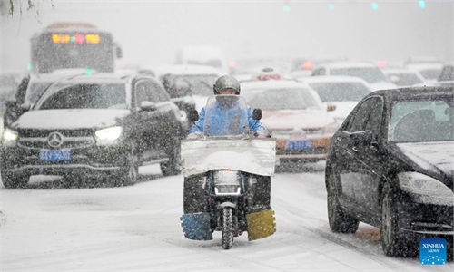
Meanwhile, central and eastern China are set to undergo the largest, strongest and most extensive rain, snow and freezing event since the start of winter. From Saturday to Sunday, eastern North China and the Huang-Huai region are expected to see light to moderate snow or sleet. Monday is forecast to be the peak period of the process, with complex transitions between rain, snow and freezing rain south of the Qinling Mountain-Huaihe River line.
To cope with the evolving weather conditions, national authorities on Saturday dispatched multiple departments to provinces including Shanxi, Anhui and Guizhou to assess the risks posed by low temperatures, snow and ice and to deploy preventive measures.
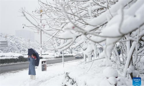
Beijing's plain areas continue to see light snow on Sunday morning, with yellow alerts in place for icy roads and prolonged low temperatures, according to the Beijing Meteorological Service. Many districts in the capital welcomed their first snow of 2026 on Saturday night. The weather authority also urged the public to stay warm, guard against freezing conditions and pay attention to travel safety, noting that northerly winds would strengthen after the snow.
Meteorological data showed that from 6 am on Saturday to 7 am on Sunday, the city recorded an average snowfall of 1.2 millimeters, with urban areas averaging 1.6 millimeters. The heaviest snowfall was reported at the Qianlingshan in Beijing's Fengtai district, at 9.9 millimeters.
Light snow was expected to continue across most parts of the city from Sunday morning through midday, with more noticeable snowfall in some western and southern areas, per meteorological service.
The snowfall drew widespread attention on social media, with the hashtag asking why this round of snow featured such large flakes climbing to the top of trending lists on Chinese social media platform Weibo.
Ma Jun, director of the Institute of Public and Environmental Affairs, told the Global Times on Sunday that Beijing's southwestern suburbs are covered by nearly 20 centimeters of soft, fluffy snow. Snow of this depth is very rare in Beijing.
According to Ma, the reason for this thick, fluffy snow is a combination of high moisture, a long duration of snowfall and ideal upper-air temperatures ranging from -10 C to -20 C. These conditions cause the snowflakes, while falling, to repeatedly shift between ice and water states, creating a sticking effect. The snowflakes clump together, visually resembling heavy, feathery snow, and accumulate on the ground to form a deep snow layer.
RELATED ARTICLES