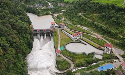
Photo: Courtesy of the PowerChina Chengdu Engineering Corporation
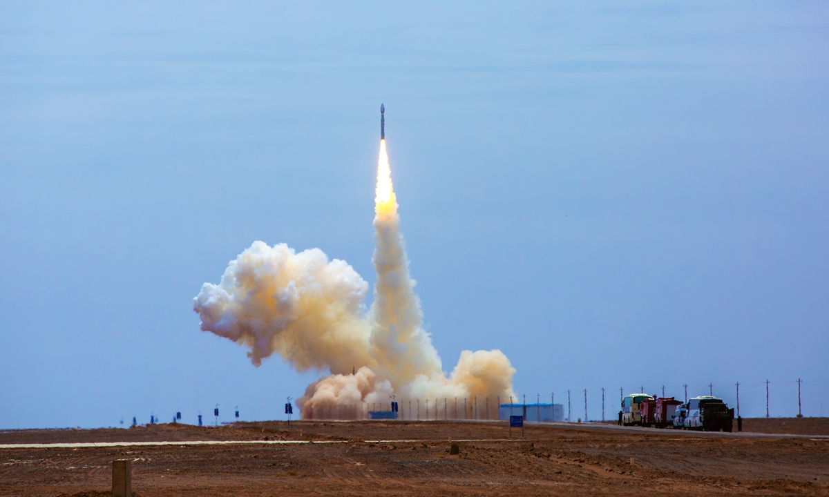
China on Friday successfully sent PowerChina-1, the country's first dedicated satellite for energy engineering, into its predetermined orbit with a Lijian-1 Y13 carrier rocket at the Dongfeng commercial space innovation pilot zone in northwest China, the Global Times learned from the developer on Friday.
As China's first dedicated X-band Synthetic Aperture Radar (SAR) satellite for the energy infrastructure sector, the successful launch fills the gap in dedicated space-based monitoring satellites for the energy sector, building an independently controllable "space security guardian" for major national energy projects, according to a statement the developer, the PowerChina Chengdu Engineering Corporation, sent to the Global Times.
According to the statement, PowerChina-1 was developed over two years under the lead of the PowerChina Chengdu Engineering Corporation, in collaboration with China University of Geosciences (Wuhan) and Chinese commercial satellite developer Spacety Co. Ltd. The satellite weighs approximately 300 kilograms.
Equipped with an advanced planar phased array radar system, it achieves a spotlight imaging resolution better than 0.5 meters and a scanning width of up to 200 kilometers, boasting powerful all-weather, all-time observation capabilities that can penetrate clouds and rain. Unlike traditional optical satellites, it operates in a 500-kilometer low-Earth orbit relying on low-orbit X-band interferometric radar technology and repeat-track interferometry.
Adopting time-series InSAR technology with atmospheric correction, it can precisely capture millimeter-level subtle deformations of the ground surface and large structures, accurately identifying tiny displacement changes as small as the diameter of a human hair, per the statement.
For a long time, major infrastructure projects such as hydropower stations, highways and railways in remote mountain valleys of western China have been plagued by insufficient ground monitoring coverage, poor continuity and high operation and maintenance costs. Traditional optical satellites are vulnerable to cloud and rain interference, and core monitoring data once relied heavily on foreign sources for a long time. In contrast, PowerChina-1 acts like an orbital CT scanner for engineering projects, effectively solving long-standing monitoring bottlenecks in the industry.
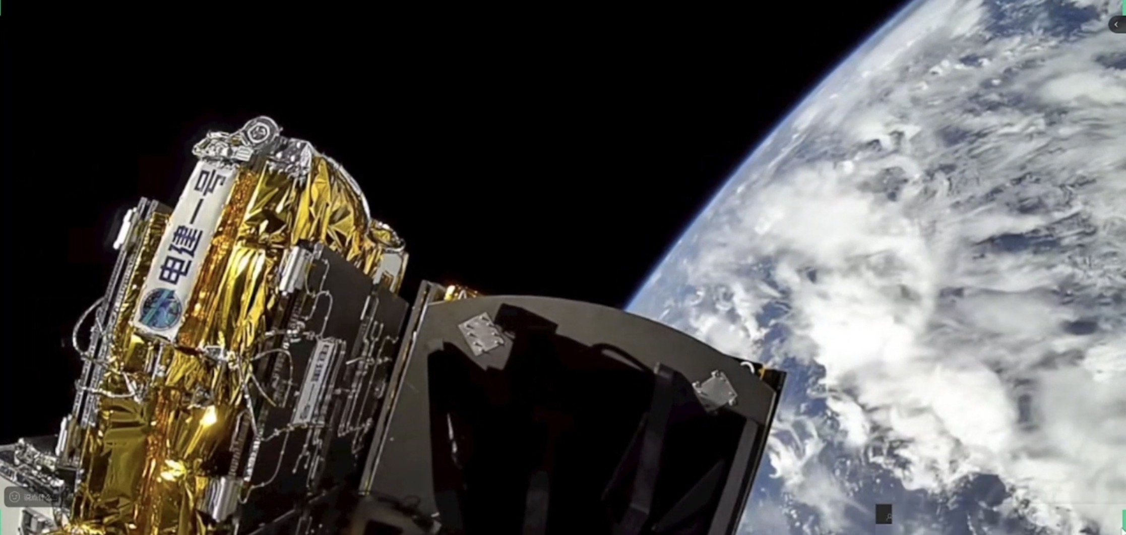
Power-China-1 Photo: Courtesy of the PowerChina Chengdu Engineering Corporation
Zhang Shishu, Chief Scientist of the PowerChina-1 satellite, chief technical expert at PowerChina and Chairman of the PowerChina Chengdu Engineering Co, introduced that after entering orbit smoothly, the satellite will fully support the full-life-cycle safety guarantee of major national infrastructure including hydropower, water conservancy, transportation and new energy. It can identify potential geological hazards such as landslides, rock collapses and ground subsidence on a large scale with high precision, helping shift disaster prevention and mitigation from passive emergency response to active early warning.
Meanwhile, it conducts non-contact planar continuous deformation monitoring on key structures including dams, bridges, tunnels and high slopes, providing high-precision data support for engineering health diagnosis and predictive maintenance. By accumulating spatio-temporal deformation big data through long-term continuous observation, it also facilitates engineering design optimization and long-term operation and maintenance, and boosts the construction of an integrated intelligent perception system covering space, low altitude, ground, underground and underwater, Zhang said.
The complete success of the launch marks that PowerChina has built a full industrial chain covering satellite development to data application, realizing full independent controllability of core technologies and data resources.
The Global Times learned that PowerChina-2, a low-orbit microwave link rainfall measurement satellite, has entered the development phase. In the future, PowerChina-1 will form a constellation with PowerChina-2 and other follow-up satellites, gradually establishing a spatial information support system covering the entire life cycle of energy engineering survey, design, construction and operation. This will achieve a major strategic shift from reliance on foreign data to self-developed dedicated satellite constellations, according to the statement.
Global Times
RELATED ARTICLES