Super Typhoon Bavi enters China's 48-hour warning zone; level IV emergency response activated for coastal provinces
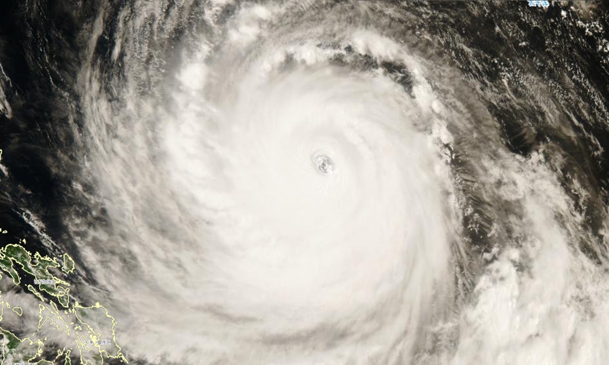
Satellite image of Super Typhoon Bavi Photo: Weather China
Following Maysak, Super Typhoon Bavi, which formed on July 2, is set to enter China's 48-hour typhoon warning zone on Wednesday. As the massive typhoon - characterized by its enormous size and wide-ranging wind and rain impacts - approaches, China's National Flood Control and Drought Relief Headquarters activated a Level IV emergency response for flood and typhoon prevention in East China's Zhejiang and Fujian provinces.According to Weather China on Wednesday, Bavi strengthened slightly overnight, with its maximum sustained winds increasing to 62 meters per second, exceeding Force 17 on China's wind scale and reaching its peak intensity. As of 2 pm Wednesday, the storm had maintained super typhoon strength for 108 consecutive hours, indicating that it remains an extremely powerful system.
Satellite imagery shows Bavi to be an exceptionally large and dangerous storm, featuring a highly symmetrical cloud structure, a well-defined eye and vigorous convection within its eyewall. Its cloud system spans more than 1,000 kilometers in diameter, making it a rare giant typhoon. The storm is expected to enter China's 48-hour warning zone at peak intensity, meaning it will soon begin affecting the country's offshore waters.
Under China's classification system, a typhoon with maximum sustained winds of at least 51 meters per second near its center is categorized as a super typhoon. As one of the most powerful weather systems on Earth, a super typhoon can bring destructive winds, torrential rainfall, storm surges and severe convective weather, including thunderstorms and tornadoes, according to Weather China.
The next three days will be critical in determining both Bavi's track and intensity. Lin Nan, a meteorological analyst with Weather China, said the storm is expected to remain at super typhoon strength as it moves northwest through Wednesday and Thursday. After entering waters closer to China's coast on Thursday night, it is likely to weaken gradually. Even so, Bavi is still forecast to make landfall as a severe typhoon, with the potential of causing significant damage.
Current forecasts indicate that Bavi is most likely to make landfall along China's eastern coast.
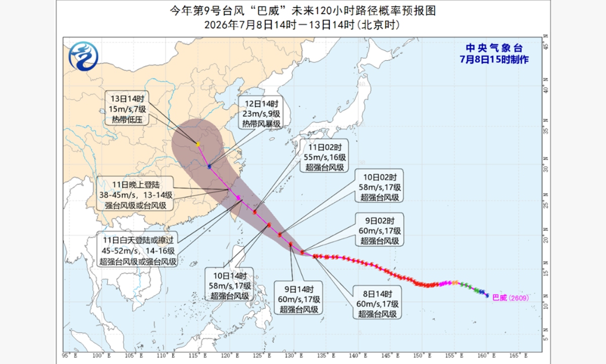
The projected track probability forecast map for Super Typhoon Bavi over the next 120 hours, from 2 pm Wednesday to 2 pm Monday. Photo: China's National Meteorological Center
According to the latest forecast, the Taiwan island is expected to experience heavy rainfall first between Friday and Saturday. Zhejiang and Fujian are forecast to see the heaviest rainfall on Saturday, with widespread torrential rain and isolated areas potentially receiving extremely heavy rainfall. From Saturday to Sunday, the rain belt is expected to expand westward and northward, affecting provinces including Hunan and Hubei. Beginning Sunday, heavy rainfall may also spread to Henan, Hebei, Shandong, Liaoning and Jilin, according to Weather China.Starting on Thursday, winds over China's eastern coastal waters are expected to strengthen significantly, with Friday through Saturday marking the peak period for strong winds affecting offshore and coastal areas, according to Weather China. From Saturday night through Monday, strong winds are also forecast to intensify across inland regions including East and Central China, and residents are advised to secure outdoor structures and take precautions against damaging winds.
Global Times
RELATED ARTICLES