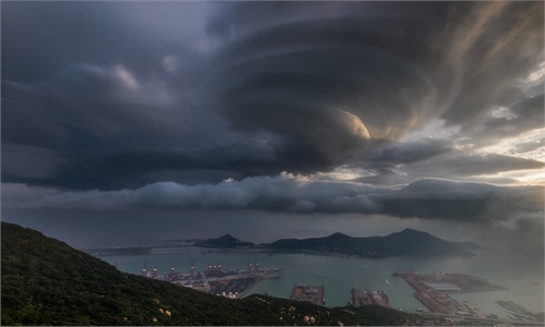
Typhoon Dolphin expected to make landfall between Zhejiang and Fujian; meteorologist calls it exceptionally rare as it formed near International Date Line
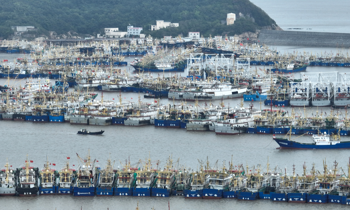
More than 1,000 fishing boats take shelter at Ruoshan Fishing Port in Wenling, East China’s Zhejiang Province, on August 5, 2026, as Typhoon Dolphin approaches. Photo: VCG
Provinces including Zhejiang, Fujian, and Guangdong have activated emergency responses and taken preventive measures as Typhoon Dolphin, the 13th typhoon of the year, approaches, potentially bringing strong winds and heavy rain. Dolphin is about to enter the 48-hour warning zone of China and is expected to make landfall along the coastal areas between Zhejiang Province to northern Fujian Province as a typhoon or severe typhoon between Sunday afternoon and Monday Morning, China Central Television (CCTV) reported on Thursday.
Typhoon activity has intensified recently, with Typhoon Dolphin (No.13 of the year), Typhoon Kujira (No.14), and Typhoon Chan-hom (No.15) forming one after another. Kujira has weakened after making landfall in the Philippines, while Chan-hom is unlikely to affect China. Dolphin maintains strong typhoon intensity despite traveling a long journey, and is expected to approach the coast of East China, bringing strong winds and heavy rain, CCTV reported.
According to Dong Lin, chief forecaster at the National Meteorological Center (NMC), the key characteristics of Typhoon Dolphin are that it formed over distant open waters, has a long lifespan, features a large circulation system, and experiences frequent fluctuations in intensity.
According to Dong, Typhoon Dolphin formed near the International Date Line, something that has never happened since meteorological records began. Then it moved toward China, and is expected to make landfall at an intensity above the tropical storm level. This makes Typhoon Dolphin an exceptionally rare system.
Typhoon Dolphin was located 1,130 kilometers east of East China’s Zhejiang coasts as of 5 pm on Thursday. Large to very large waves are expected in Zhejiang’s coastal waters, and an orange alert for waves is maintained by the National Marine Environmental Forecasting Center, according to China’s Ministry of Natural Resources.
Affected by Typhoon Dolphin, rainfall is expected to begin this weekend. The National Meteorological Center has forecast heavy to torrential rains in parts of central and eastern China from Saturday to Wednesday, followed by further downpours in North China, Inner Mongolia, and southern Northeast China from Wednesday to Friday as the typhoon’s remnants interact with cold air.
China's National Flood Control and Drought Relief Headquarters and the Ministry of Emergency Management activated a Level IV emergency response for Zhejiang and Fujian provinces on Thursday as Typhoon Dolphin was forecast to bring strong winds and heavy rain to East China, according to CCTV.
Affected by Typhoon Dolphin, the Zhejiang Provincial flood control and typhoon prevention headquarters decided to adjust the maritime typhoon emergency response to Level IV at 2 pm on Thursday. Due to strong winds over the sea, 21 water passenger transport routes in Zhoushan, Zhejiang Province, had been suspended as of 3 pm on Thursday, CCTV reported.
Ningbo in Zhejiang had temporarily shut down all coastal attractions and high-risk marine tourism activities by 6 pm on Thursday due to Typhoon Dolphin.
Besides, Fujian activated a Level IV typhoon emergency response at 2 pm on Thursday as Typhoon Dolphin is forecast to enter Fujian’s tropical cyclone warning area on Friday and move closer to the East China coast, CCTV reported.
Fujian has ordered stronger safety management for offshore vessels, marine facilities, and ferry services as Typhoon Dolphin approaches. Coastal areas will reinforce shelter management and prevent people from returning to risky areas, while authorities prepare for heavy rain and wind on land, according to CCTV.
Guangdong Maritime Safety Administration activated a Level IV tropical cyclone response on Wednesday and imposed traffic controls from 6 pm on Thursday on vessels traveling northward through the southern entrance of the Taiwan Straits, CCTV reported.
Global Times
RELATED ARTICLES