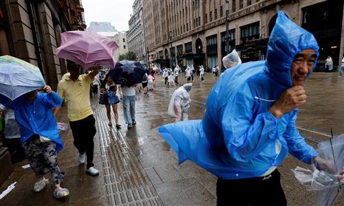
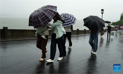
80 percent of flights in Shanghai canceled, over 100 streets see waterlogging as Typhoon Dolphin sets record to travel 6,000km before landfall
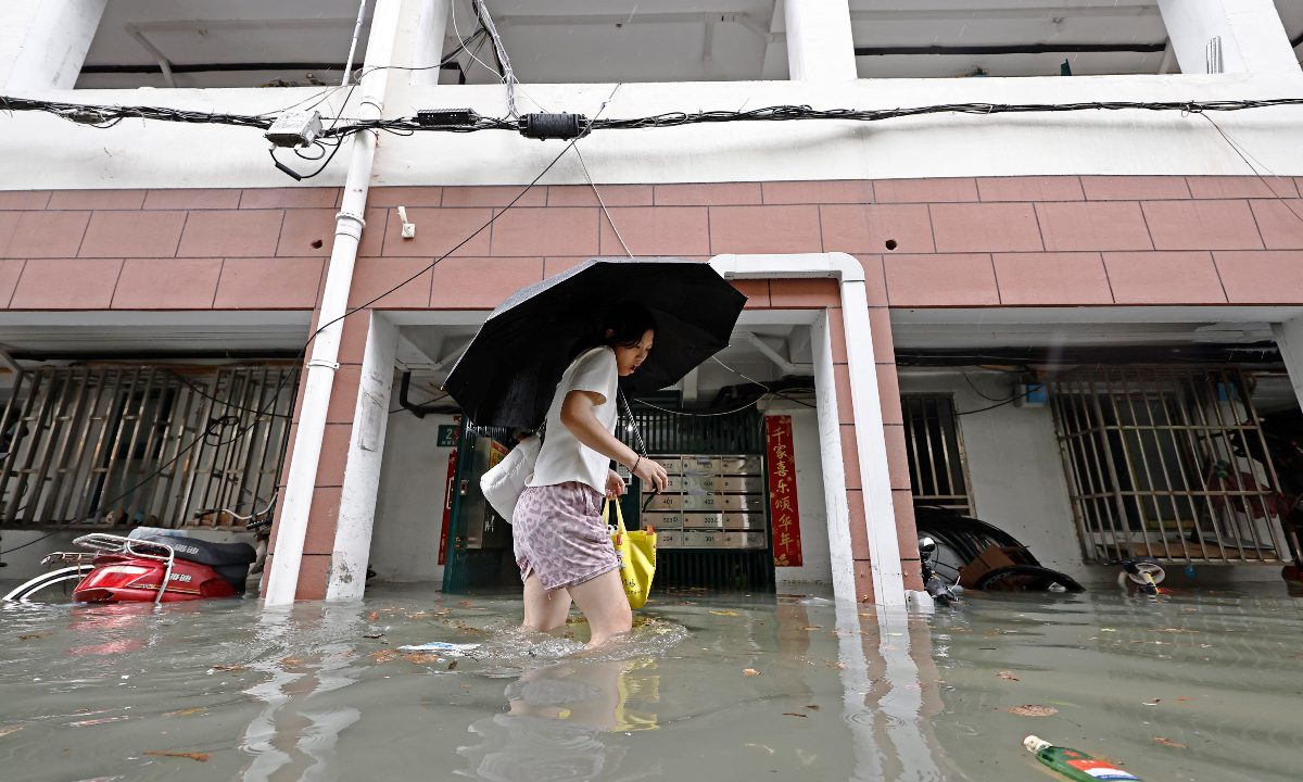
A resident wades through floodwaters in a residential compound in Changning district after heavy rain from Typhoon Dolphin drenched Shanghai on August 9, 2026. Photo: IC
As Typhoon Dolphin continues to batter eastern China from Sunday afternoon after making landfall, a new typhoon system, Peilou, the 16th typhoon of the year, formed in the western North Pacific on, creating a rare situation with three typhoons Dolphin, Chan-hom and Peilou active simultaneously.
The National Meteorological Center (NMC) issued its second typhoon red alert of the year on Sunday morning, weather.com.cn reported.
Under the influence of Typhoon Dolphin, Shanghai experienced significant winds and rainfall. As of 5 pm on Sunday, a total of 215,600 people had been relocated from high-risk areas across Shanghai, China Radio International (CRI) reported on Monday.
Shanghai put in place preparatory measures in response to strong winds and heavy rainfall created by Typhoon Dolphin. As of 5 pm on Sunday, waterlogging had been cleared at 155 of the city’s 181 reported waterlogged sites, with response teams from different departments working to address the remaining 26, according to CRI.
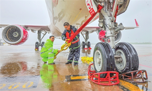
Meanwhile, air traffic across East China was seriously influenced by the weather system, with widespread flight cancellations at multiple airports.
More than 80 percent of flights at Shanghai’s Pudong and Hongqiao airports were canceled as of 6 pm on Sunday. Of Shanghai Pudong International Airport’s 889 scheduled arrivals, 760 were canceled, while 729 of 897 departures were grounded. At Shanghai’s Hongqiao International Airport, almost all 431 scheduled arrivals were canceled, while 342 of 431 departing flights were unable to depart.
Typhoon-related flight restrictions also impacted Southwest China’s Sichuan and Chongqing, prompting widespread cancellations of flights to and from the Yangtze River Delta.
A typhoon track and airport impact forecast map from aviation information platform Variflight.com revealed that as many as 44 airports were likley to be affected by Typhoon Dolphin between August 9 to 12.
According to China Meteorological Administration, Typhoon Dolphin has three notable characteristics.
First, it traveled a long distance across the open ocean, showing an unusually long lifespan. The typhoon formed near the International Date Line, and its track length before landfall exceeds 6,000 kilometers. Its period of activity is expected to exceed 15 days – three times that of a typical typhoon. It become the first typhoon on record to form near the International Date Line and made landfall in China with at least tropical-storm strength, Beijing News reported on Sunday.
Second, it underwent explosive intensification and remained at high intensity for an extended period. Within 48 hours of its formation, the typhoon rapidly strengthened into a super typhoon, reaching a peak intensity of 65 meters per second, making it the second-strongest typhoon of the year so far. It maintained super typhoon strength for as long as 5.5 days and has remained at typhoon strength or above for nine days, according to weather.com.cn.
Third, Typhoon Dolphin has an exceptionally large circulation, with a 7-level wind radius of 420 to 450 kilometers and a circulation diameter of about 1,300 kilometers. It is expected to bring more than three days of strong winds to the East China Sea and torrential rain across much of East China, with local rainfall exceeding 600 millimeters at some places. Authorities urge the public to guard against flash floods and geological hazards and avoid coastal, mountainous and river-valley areas, weather.com.cn.
Typhoon Peilou formed at a tropical storm level. At 2 pm, the typhoon’s center was located over the western North Pacific, about 740 kilometers north-northwest of Saipan, Guam, packing winds of up to 65 kilometers per hour near its center, China Central Television (CCTV) reported on Sunday.
The name “Peilou” comes from China’s Macao, referencing a common migratory bird found in the region.
Typhoon Peilou is forecast to move rapidly eastward at a speed of 25 to 30 kilometers per hour, with its intensity gradually strengthening. It is expected to have no impact on China in the coming days, CCTV reported.
According to Zhou Guanbo, the chief weather forecaster at the National Meteorological Center (NMC), July to September is the peak season for typhoon formation, with August seeing the most storms form and make landfall in China.
Zhou said that typhoon activity reaches its peak in August, when the number of storms forming and making landfall in China is the highest of the year. Therefore, having three typhoons or two typhoons active at the same time is not unusual, Beijing News reported on Sunday.
According to Zhou, the Pacific entered an El Nino state in May 2026, with sea surface temperatures in the central and eastern equatorial Pacific continuing to rise. Compared with last year’s La Nina year, typhoons this year are expected to form farther east, allowing them to gain more energy and moisture over the open ocean.
This year, the number of typhoons that have formed and made landfall in July was higher than usual. Five typhoons formed over the western North Pacific and the South China Sea in July, three of which made landfall in China, Beijing News reported, citing the China Meteorological Administration.
In August, six to seven storms are forecast to form – above the long-term average of 5.6 – with two to three expected to make landfall in or significantly affect China, near the average of 2.3.
In August, one to two strong typhoons are expected to move northward into northern and northeastern China. Experts noted that even as the main body of these northward-moving typhoons weaken, their outer circulation and interaction with cold and warm air could trigger widespread extreme rainfall, which need heightened precautions, according to Beijing News.
Global Times
RELATED ARTICLES