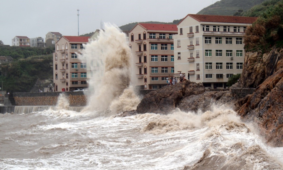
On August 26, 2026, strong winds and huge waves batter the coast off Wenling, East China's Zhejiang Province, under the influence of Typhoon Shadel. Photo: VCG
Typhoon Shadel, the 18th typhoon of the year, made landfall in Yuhuan, Taizhou, East China's Zhejiang Province, at around 8:05 am on Friday, bringing torrential downpours to Zhejiang and Fujian Province. The storm is expected to move further inland, bringing widespread and prolonged wind and rain to nine provincial-level regions, including Jiangxi, Hunan, Hubei, Guangdong, Guangxi, Guizhou and Yunnan, according to the China Meteorological Administration.
Shadel is the third typhoon this year, after Bavi and Dolphin, to make landfall in Yuhuan, Zhejiang. The city has been struck by three typhoons in less than two months — an unusually rare sequence, according to the administration.
Zhejiang raised its typhoon emergency response to Level I, the highest level, at 8 pm Thursday. Measures have been taken to ensure that no people, vessels or activities remain at sea, according to the Xinhua News Agency.
Shadel is a large, well-organized typhoon with a nearly symmetrical structure. Its circulation spans more than 1,000 kilometers in diameter and covers over 400,000 square kilometers - roughly four times the size of Zhejiang Province. Its outer cloud bands had already begun affecting Shanghai and the eastern coast of Zhejiang on Thursday, according to a report from weather.com.cn.
After making landfall, Shadel is expected to push deeper inland, bringing widespread and prolonged wind and rain from Friday through Monday. Its impacts are forecast to extend to other regions. Zhejiang and Fujian are expected to bear the heaviest rainfall, with exceptionally heavy downpours possible in some areas.
Particular attention is being paid to areas near and north of the landfall point, where an astronomical high tide is expected to coincide with a storm surge, causing significant coastal water-level rises. This could create a dangerous combination of strong winds, heavy rain and high tides in the landfall area.
In response to Typhoon Shadel, the China Meteorological Administration has upgraded its emergency response for major meteorological disasters, including typhoons, rainstorms and severe convective weather, to Level II. Some train services in the province on sections of the Hangzhou-Wenzhou high-speed railway, Hangzhou-Taizhou high-speed railway, Jinhua-Wenzhou railway, Jinhua-Taizhou railway and Ningbo-Jinhua railway will be suspended during certain periods.
So far this year, 22 typhoons have formed over the northwestern Pacific and the South China Sea, significantly more than the average for the same period in previous years. Seven have made landfall in China, also above the seasonal average. Three typhoons - Bavi, Dolphin and Shadel - have struck Zhejiang in succession, tying the record for the highest number of typhoons to make landfall in the province in a single year since 1949.
The report also warned that landfall does not mean the danger has passed. Shadel is expected to bring extensive and prolonged wind and rain as it moves inland. The public is advised to closely follow weather forecasts and warnings, avoid unnecessary outdoor activities during the storm, and remain alert to secondary disasters including landslides, flash floods, flooding of small and medium-sized rivers, and urban and rural waterlogging.
Global Times
RELATED ARTICLES