Intl experts stress risk monitoring against future potential hazards after Nepal mudslide hits Gyirong Port in China’s Xizang
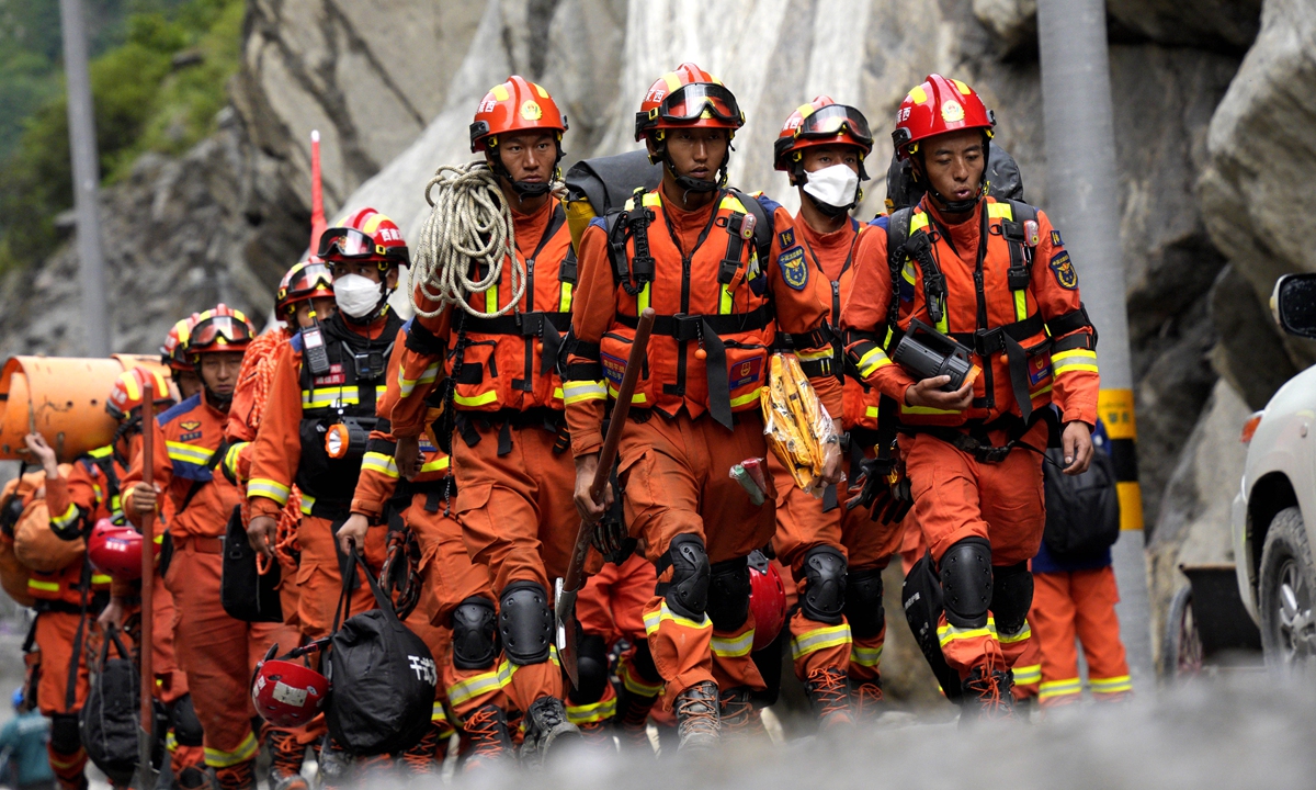
Rescuers carry supplies and equipment into the core disaster area on September 2, 2026. Road access to the core area of the mudslide-hit Gyirong Port in Southwest China's Xizang Autonomous Region was basically restored at 10 am on the day. Photo: VCG
Recovery efforts at the mudslide-hit Gyirong Port in Southwest China's Xizang Autonomous Region moved forward Wednesday, with road access to the port basically restored after days of round-the-clock repair work.Twenty-one people have been confirmed dead and 541 others remain missing as of Wednesday noon, according to the regional government's latest news briefing.
The mudslide, triggered by a high-altitude glacier collapse in Nepal, struck Gyirong Port on the China-Nepal border in Xizang region on August 26. Chinese rescuers have launched all-out efforts to reach the mudslide-hit port area and search for the missing.
In a latest development, the road access to the core area of the Gyirong Port was basically restored at 10 am on Wednesday after days of repair work on the damaged G216 national highway. Rescue teams, relief supplies and some rescue equipment have entered the core rescue area via the road, rescuers said.
In the early stage, firefighting and rescue teams could only reach the core area of the port on foot, relying on drone reconnaissance and airdrops of light equipment to conduct preliminary grid searches of surface and shallow areas, the Global Times learned from National Fire and Rescue Administration on Wednesday. As the vital access route was opened, the firefighting and rescue teams immediately adjusted their tactics in response to evolving conditions, reorganized personnel and resources in a coordinated manner, and fully expanded the efficiency and scope of rescue operations.
Rescuers have also established a coordinated model in which large engineering machinery is deployed first to clear obstacles and open up working areas, followed by specialized firefighting and rescue teams conducting targeted searches, with life-detection equipment used to verify specific locations.
In the next phase, firefighting and rescue teams will work in coordination with other rescue forces to carry out comprehensive, in-depth searches across the entire affected area, leaving no buried blind spot unchecked and giving up on no possibility of finding survivors, per the administration.
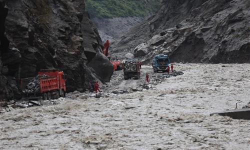
Before the reopening of the route to the Gyirong Port, the damaged road was covered in thick mud, blocking passage for large vehicles and making it extremely difficult for rescuers to advance on foot, according to the rescue teams, Xinhua reported.
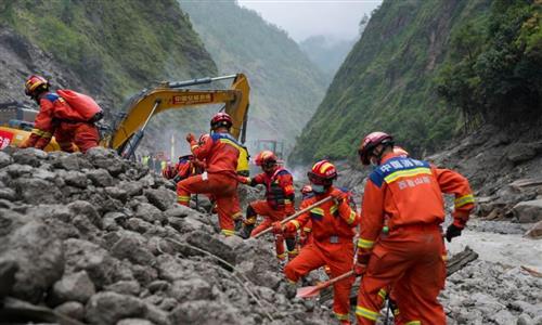
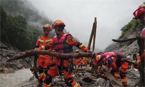
On the debris-strewn river banks and along the steep mountain slopes, rescue teams brought search dogs through the gaps between twisted steel bars and massive boulders, scouring the affected areas for any sign of life.
The second batch of emergency relief supplies provided by China to Nepal arrived in Kathmandu on Tuesday's afternoon. Five DNA forensic experts were also on the plane to assist Nepal in its operations. The Nepalese side thanked China for urgently sending more supplies and providing technical support, a Chinese Foreign Ministry spokesperson said on Wednesday.
The spokesperson Guo Jiakun noted that China is preparing the third batch of emergency relief supplies based on the request of Nepal. These supplies will include Bailey bridges, mortuary refrigerators, epidemic prevention supplies and emergency communication equipment. China will also send a second group of DNA experts.
A week after the disaster, attention is also turning to a broader challenge: how regions can better detect, warn of and respond to cross-border hazards. In light of this, the Global Times spoke with several international experts to address this issue.
Further risks loom
The cause of the devastating mudslide has been identified, local authorities said during a press conference on August 30. A glacier on the north slope of Mount Langtang Lirung in Nepal fractured at an altitude of about 5,200 meters, triggering an ice-rock avalanche.
The avalanche plunged rapidly to an altitude of around 4,000 meters, scouring the mountainside and developing into a massive debris flow, which surged about 22 kilometers before reaching Gyirong Port at an altitude of around 1,800 meters.
The findings were made by a cryosphere emergency disaster response team from the Institute of Mountain Hazards and Environment under the Chinese Academy of Sciences, based on the analysis of remote-sensing monitoring data and field-transmitted data, as well as on-site surveys and investigations, per the authorities.
A joint research team led by the Institute of Tibetan Plateau Research under the Chinese Academy of Sciences has also made new progress in studying the mechanisms behind the disaster, explaining why did the devastating Nepal mudslide occur, and what caused it to intensify rapidly. One of the key findings was that the scale of the eventual destruction was determined not only by the volume of the initial collapse, but by the substantial entrainment of additional material as the debris traveled downstream.
The scale of the destruction was largely because the ice collapse occurred at high altitude and on a very steep slope. When such a massive body of ice collapses, it can strike the mountain slope and trigger large amounts of rock and debris to move downhill with it, Dr Husayn Anwar, who studied Geotechnical and Environmental Engineering at Stanford, told the Global Times.
"We are seeing an increasingly severe impacts of global warming on glaciers," Anwar warned, noting that global warming is likely to have been one of the triggers of this event.
Jakob Steiner, a geoscientist at the University of Graz in Austria, told the Global Times in a written response that the event was a bedrock failure due to the depth of the scar. The ice just added material and likely contributed to the flood wave and extent.
Analyzing satellite imagery for concerning patterns before such events may be a more useful approach, Steiner said, warning that the event is not an isolated occurrence and that people need to be prepared to see such events more often.
Intl efforts required
China has maintained sound communication with Nepal on the information sharing for search and rescue and the prevention of secondary disasters, continuously provided meteorological and hydrological information, conducted professional consultations, and sent relevant early warnings, Guo said during a previous press conference.
International experts also highlighted the need for stronger monitoring, risk assessments and cross-border cooperation to better prevent and mitigate future glacier-related disasters.
"The Langtang Lirung event is very extreme in terms of its magnitude. I expect more rock and ice avalanche flood cascades in the future in High Mountain Asia, but much smaller ones," said Kristen Cook, a geomorphologist at the Institute of Earth Science at Grenoble Alpes University, in France.
Even a collapse 100 times smaller than the Langtang Lirung event can lead to a flood that causes a disaster, most recently in the 2023 mudflow in Shovi, Georgia, she said. "To me, the key is to develop automated slope deformation monitoring using remote sensing."
Anwar said such disasters cannot be predicted with precision. However, risk assessments can be conducted to identify potential hazards. The first is to monitor the condition of the glaciers themselves. For example, if a large section of a glacier changes shape or begins to sink, it may indicate that meltwater is flowing beneath the glacier and gradually eroding its base, Anwar said.
The glacier terminus also needs to be monitored, including whether cracks have appeared and whether the glacier has significantly retreated from or become detached from surrounding mountain walls. The amount of rock and debris on the glacier surface, the condition of permafrost, and the situation of the surrounding lakes are also important factors to monitor, he added.
Anwar also suggested that a monitoring system could be established using remote sensing and various measurement technologies. These risk indicators can be fed into models to estimate the probability of a localized glacier collapse. Once a high level of risk is identified, appropriate measures should be put in place, including strengthening emergency plans and organizing the evacuation of downstream communities to safer areas, he continued.
Anwar said glacier related disasters transcend national borders and represent a shared challenge for the region and the wider world, proposing establishing an internationally inclusive cooperative commission. "Geography does not respect political boundaries," he said.
RELATED ARTICLES