Exclusive: Chinese scientific community's analysis crucial for Nepalese understanding of mudslide disaster triggers; proactive joint monitoring needed: Nepali expert
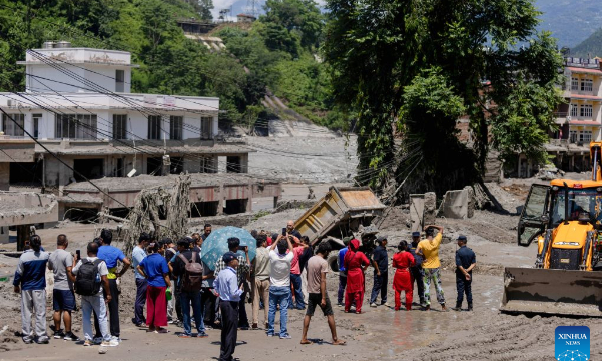
People gather as rescue and search operations are underway after a massive flash flood in Nuwakot, Nepal, on Aug. 27, 2026. Nepal's National Disaster Risk Reduction Management Authority said that as many as 359 bodies had been recovered from flood-hit areas by Thursday evening, with 910 people still missing. (Photo by Sulav Shrestha/Xinhua)
The mudslide disaster on August 26 differs from past glacial collapses in several key ways, and Nepal's response experiences can be assessed from two angles, a senior Nepali geologist told the Global Times, citing his own research and front-line exchanges. Considering China-Nepal cooperation mechanisms, he suggested that the current framework should move toward a more proactive joint monitoring network that combines remote sensing with real-time collaborative data analysis.
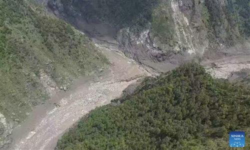
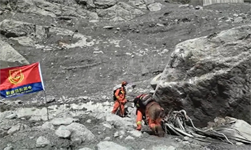
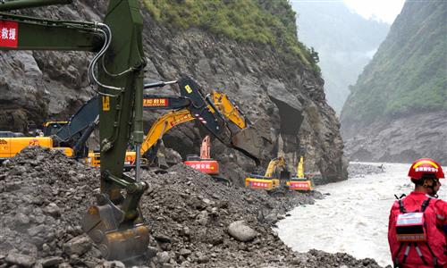
An ice-rock avalanche originating from a high-mountain glacier in Nepal triggered the disaster that struck Gyirong Port on August 26, according to assessments by Chinese authorities, Nepali officials, and international scientists.
"This event represents a fundamental typological shift in Himalayan cascading hazards, dwarfing historical regional cryospheric events in kinetic energy, velocity, and downstream run-out impact," said Amod Mani Dixit, founder of the Nepal National Society for Earthquake Technology, senior geologist and disaster risk management specialist, and a PIFI visiting scientist at the Aerospace Information Research Institute, Chinese Academy of Sciences. He discussed the distinctive features of this disaster compared with past glacial collapse events.
According to the expert, historically, regional emergency frameworks have been calibrated against predictable snow avalanches or typical Glacial Lake Outburst Floods. Massive glacial ice-rock detachments of this scale constitute an entirely unfamiliar hazard paradigm for local populations and governance structures. The extreme velocity of the surge nullified traditional civil defense mechanisms.
This disaster serves as a stark indicator of a changing regional risk profile. Driven by accelerated global warming and climate change, mass-movement events of this magnitude and velocity are projected to increase in both frequency and intensity, Dixit said.
We must anticipate the emergence of complex, syngenetic, and co-occurring hazard typologies. For example, a single thermal event could simultaneously trigger an ice-rock avalanche, breach a moraine dam, and coincide with a cloudburst, creating a compound disaster that overwhelms standard single-hazard defenses, Dixit said.
He noted that crucially, this disaster demonstrated that standard hydro-meteorological telemetry, such as precipitation gauges and downstream river-level monitors, is functionally obsolete when confronting high-velocity mass movements. Capturing these sudden events requires a shift toward lithospheric and cryospheric telemetry, utilizing real-time seismic arrays and low-frequency acoustic noise monitoring.
Regarding the broader application of Nepal's past disaster response experiences to this event, Dixit said that this institutional application can be viewed through two distinct lenses: Nepal's domestic evolution in disaster risk reduction, and the burgeoning bilateral protocols for transboundary hazard management.
Over the past decade, Nepal has made significant strides in aligning its legislative and policy frameworks with the Sendai Framework for Disaster Risk Reduction, thereby enhancing institutional capacity for emergency deployment. However, during the initial phases of this crisis, domestic response mechanisms became severely overextended. The sheer physical scale and kinetic magnitude of this event surpassed the threshold of what Nepal's economic and logistical frameworks could autonomously absorb.
The expert noted that in terms of transboundary cooperation, the bilateral exchange frameworks between China and Nepal developed after the July 2025 Bhotekoshi mudflow disaster proved highly functional. The established communication protocols operated systematically, enabling relevant authorities on both sides to share real-time hazard data and disseminate early warnings both during and immediately after the run-out event.
And in this instance, Dixit said, the comprehensive scientific analysis provided by the Chinese scientific community proved instrumental in helping Nepalese authorities and the public understand the trigger mechanics of the disaster.
China will continue to share information on barrier lake risks, glacial lake risks and emergency hydrological monitoring with Nepal to support disaster rescue and relief efforts, an official with the Ministry of Water Resources said Wednesday, reported the Xinhua News Agency on Thursday.
Nevertheless, Dixit noted that this disaster highlights an urgent operational lesson: Conventional communication protocols are insufficient for ultra-high-velocity events. To mitigate future risks, the current framework must transition from passive data sharing to an active, joint monitoring network characterized by integrated scientific telemetry and collaborative real-time data analysis.
The expert said that Nepal lacks dedicated academic and state institutions tasked with advanced cryospheric research. National capabilities are currently restricted to basic inventories and rudimentary lake-level tracking, leaving the country without the technical capacity required for deep glaciological modeling.
The extreme vertical relief, severe weather, and absolute lack of physical access roads in high-altitude zones present major obstacles to installing and maintaining real-time telemetry networks, he said.
Despite sharing a highly vulnerable border, there is a lack of structured, direct contact and collaborative data exchange between Chinese and Nepalese earth science institutions, he added.
"To address these gaps, we should establish a formal, dedicated China-Nepal Science and Technology Forum. This body should operate independently of fluctuating political portfolios, drawing experts from state departments, academic institutions, and the private sector. Its primary mandate would be to co-design transboundary monitoring networks, standardize data-sharing protocols, and build collaborative scientific capacity to protect vulnerable communities across the Himalayan corridor," Dixit said.
Looking ahead, China will work with Nepal to promote the signing of an agreement on hydrological information sharing for transboundary rivers and establish a regular cooperation mechanism, with the aim of jointly strengthening disaster prevention and mitigation, China's Ministry of Water Resources said, according to Xinhua.
RELATED ARTICLES