ARTS / CULTURE & LEISURE
Three Chinese sites added to global geological heritage list, bringing total to 13
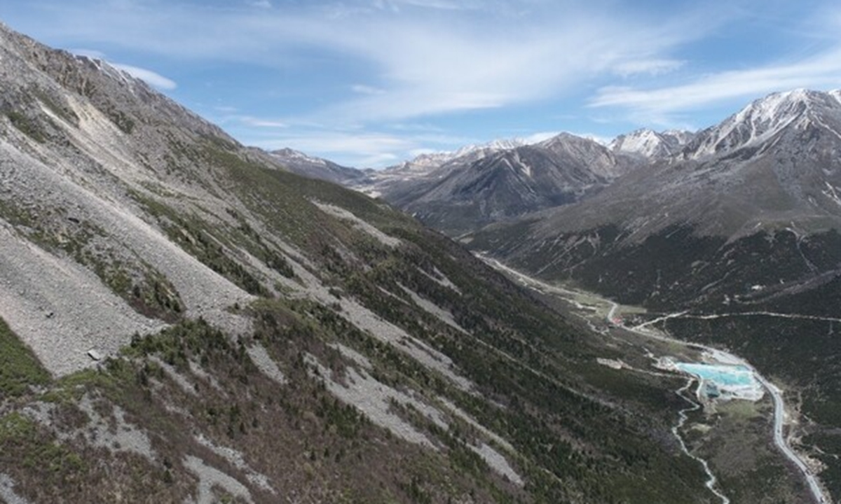
The Xianshuihe Fault
China has secured places for three more locations on the International Union of Geological Sciences (IUGS) list of Geological Heritage Sites, raising its total to 13 and placing it among the countries with the largest number of entries.The IUGS announced its third batch of 100 sites on November 6 at a geoheritage event in Monchique, Portugal. The newly recognized Chinese sites are the Xianshuihe Fault in Sichuan Province, the Middle Jurassic dinosaurs of Yunyang in Chongqing Municipality, and the Triassic Dabie ultrahigh-pressure metamorphic belt in Anhui Province.
Geological heritage sites are features or processes of international scientific importance. They serve as global reference points or mark key moments in the development of Earth sciences. The designation is separate from UNESCO World Heritage status and is administered by the IUGS, one of the world's largest and most authoritative geological scientific organizations, founded in 1961.
China first gained recognition for seven sites in 2022. These included the Changxing section in Zhejiang Province, which preserves the Permian-Triassic mass extinction boundary and is known as a "golden spike" in the geological timescale. A further three sites were added in 2024, among them the Guilin karst landscape in Guangxi Zhuang Autonomous Region.
Each of the latest additions fills a distinct gap in the global record.
The Xianshuihe Fault, listed in the tectonics category, is a 350-kilometer-long strike-slip fault that slices through the eastern Qinghai-Xizang Plateau. It shares this batch with other globally renowned tectonic heritage sites, including New Zealand's Alpine Fault and the San Andreas Fault in the United States. It helps accommodate the ongoing collision between the Indian and Eurasian plates and moves at a rate of 8 to 15 millimeters a year. Historical records show it has produced 29 earthquakes of magnitude 6.5 or greater and 17 of magnitude 7 or above since 1700, with an event of magnitude 7 or above roughly every 30 years.
Li Haibing, a researcher at the Institute of Geology of the Chinese Academy of Geological Sciences and a member of the team that has studied the fault for years, described the feature as a natural laboratory for earthquakes, in which continuous creep and sudden stick-slip behavior occur side by side. He said, as reported by China Media Group, that its inclusion marks a natural window for studying active faults within continental interiors as having received the highest international recognition. Three shallow boreholes have already been drilled; a fourth, nearly 3,000 meters deep, is due to begin soon, with long-term monitoring equipment to be installed in the deep well.
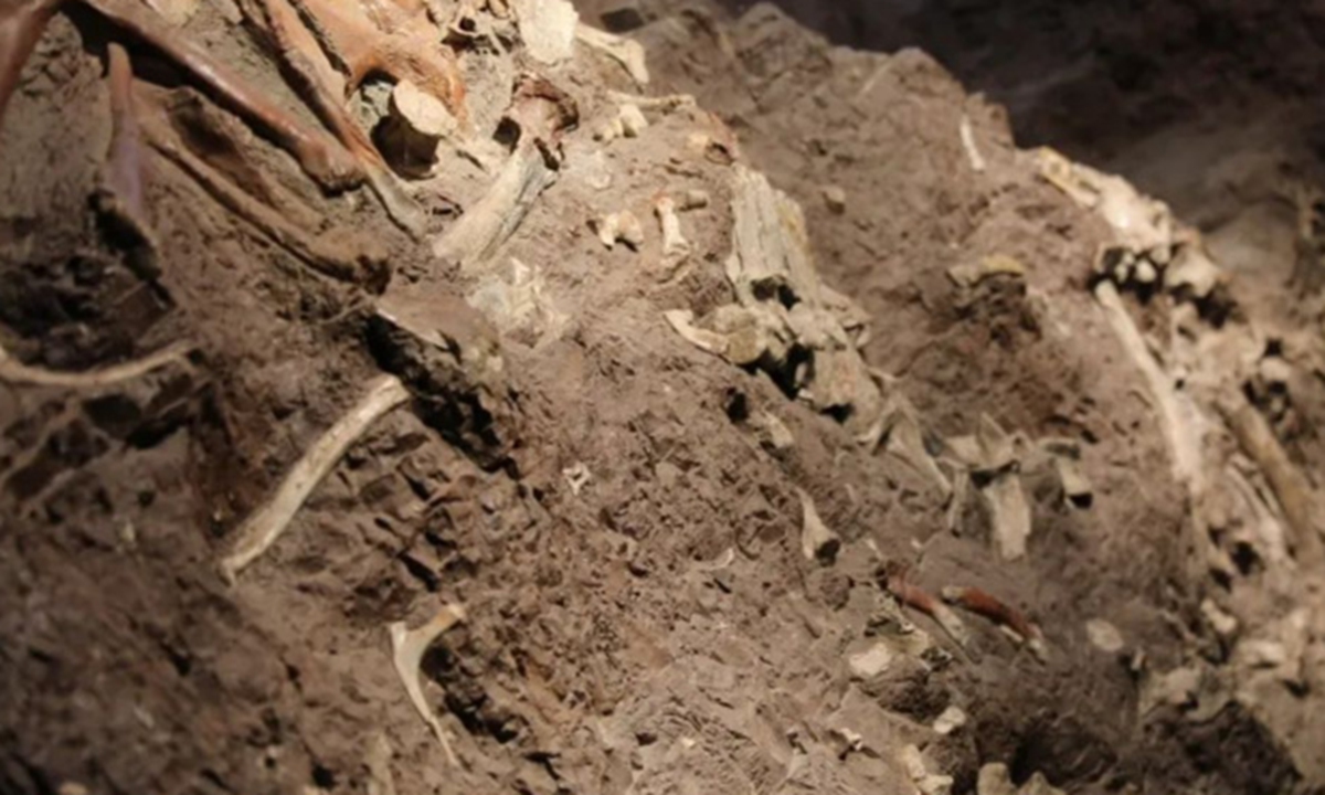
The Middle Jurassic dinosaurs of Yunyang
The Middle Jurassic dinosaurs of Yunyang, placed in the paleontology category, have yielded fossils from 19 families, 12 orders and six classes. The site contains what researchers describe as the world's largest in-situ Jurassic fossil wall. The fossil-bearing outcrop stretches 18.2 kilometers and covers 54 square kilometers. The Xintiangou Formation, dating to the earliest Middle Jurassic, reaches a thickness of 459 meters, far thicker than the few meters recorded at comparable sites in Zigong of Sichuan Province. Scientists say the continuous sequence helps link the evolutionary history of Asian Jurassic dinosaurs and closes a gap that previously hindered comparisons with other continents.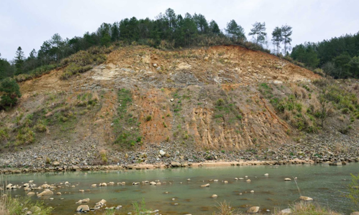
The Triassic Dabie ultrahigh-pressure metamorphic belt in Anhui Province
The Triassic Dabie ultrahigh-pressure metamorphic belt falls under igneous and metamorphic petrology. It is described as one of the largest, most extensive and best-preserved ultrahigh-pressure metamorphic belts on Earth. The rocks record the collision of the Yangtze and North China cratons between roughly 240 and 220 million years ago. During that event, continental crust was forced to mantle depths exceeding 120 kilometers before returning to the surface.Minerals such as coesite and diamond provide direct evidence that continental crust, not only oceanic crust, can be subducted - an insight that has broadened understanding of how mountain belts form.
Wang Qin, a professor at Nanjing University's School of Earth Sciences who has studied the belt for more than four decades, said the research has also illuminated how rocks deform and how fluids and melts behave during deep subduction. These findings have implications for assessing regional geological hazards and the distribution of mineral resources.
Li urged China to use the listings to strengthen systematic protection of geological features, expand public education in the Earth sciences and deepen international scientific cooperation. The three new sites illustrate different aspects of Earth's dynamic history - from active tectonics and dinosaur evolution to the extreme conditions of continental collision - each offering scientists a clearer window into processes that have shaped the planet.
RELATED ARTICLES