Typhoon orange warning in effect as Kajiki lashes southern China with heavy rain, strong winds
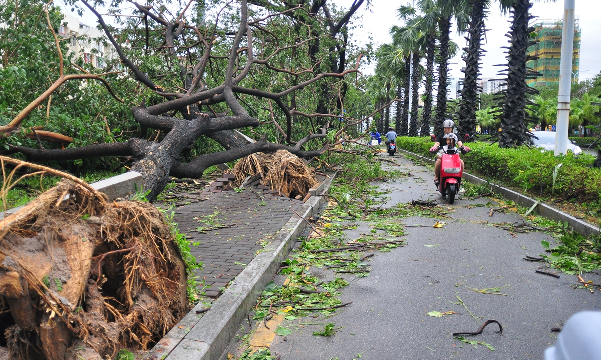
Fallen trees are seen in Sanya, South China's Hainan Province on August 25, 2025, in the wake of Typhoon Kajiki. Photo: VCG
The National Meteorological Center at 6 am on Monday continued to issue an orange typhoon warning as the center of this year's 13th typhoon, Kajiki (strong typhoon category), moved from the central and western South China Sea into the Beibu Gulf in the early hours of Monday. The maximum wind force near the center is 14th grade (45 m/s), with a minimum central pressure of 950 hPa.
The National Meteorological Center reported Monday that Kajiki is forecast to move west-northwest at 15 to 20 kilometers per hour and make landfall near Vinh City, Vietnam, from Monday evening to nighttime, after which it will rapidly weaken.
It is forecast that from Monday morning to Tuesday morning, strong winds of force 6 to 8 are expected in the western South China Sea, the waters near the Xisha Islands, the Beibu Gulf, the Qiongzhou Straits, the coastal areas of Hainan Island, the coastal areas of Guangxi, and the coastal areas of western Guangdong. Some areas in the southern Beibu Gulf and the central and western South China Sea will experience winds of force 9 to 11, with gusts reaching force 12 to 13. Winds in areas near the center of Kajiki may reach force 12 to 14, with gusts of force 15 to 16.
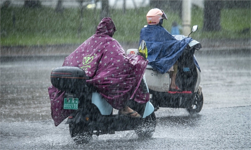
Also, from Monday morning to Tuesday morning, parts of southeastern Yunnan, southern Guangxi, coastal areas of southwestern Guangdong, and most of Hainan Island will experience heavy to torrential rain. Some areas, including the southern coastal areas of Guangxi and southern Hainan Island, will experience heavy rainfall (100 to 130 mm).
South China's island province of Hainan upgraded its emergency response to the highest level on Sunday with Typhoon Kajiki approaching, according to the Xinhua News Agency.
In Hainan, authorities have evacuated a total of 20,728 people from potentially hazardous areas. All 30,769 local fishing boats have returned to port or are sheltering safely -- with over 21,000 crew members moved to the shore, Xinhua reported.
Hainan has prepared more than 770,000 items of emergency supplies for vulnerable areas. Over 2,800 rescue personnel are on standby and are equipped with vehicles and equipment.
Sanya in Hainan bore the brunt of the severe winds and heavy rainfall. The city has implemented a series of measures, halting classes, work, business operations, public transport and shipping, while also closing scenic areas, Xinhua reported.
"The building was shaking," described a resident of Sanya, Yicai Global reported.
On the streets of Sanya, videos captured by netizens showed rows of coconut trees swaying violently, fallen trees, damaged barriers, and sheet-metal houses shaking in the wind.
Yicai Global reported Monday that, according to officials from the Hainan meteorological authority, Typhoon Kajiki could become the strongest typhoon to make landfall in Sanya in nearly 40 years. As reported by Sanya authorities on Sunday evening, Kajiki had intensified to a strong typhoon. Over the next 12 hours, coastal and land areas of Sanya were expected to experience average wind forces of 12-13, with gusts reaching 14-16, accompanied by heavy rainfall.
According to Yicai Global, at 7 am on Monday, the Hainan meteorological authority downgraded the typhoon warning from Level 1 to Level 3. The bureau forecast that during the daytime on Monday, the southern half of Hainan Island would still experience significant wind and rain. Starting Monday evening, wind and rain across Hainan Province were expected to further weaken.
Global Times
RELATED ARTICLES