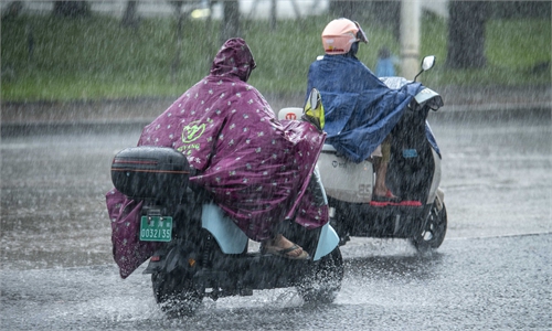
Citizens ride amid rainfall on the street in Yangjiang City, south China's Guangdong Province, Sept. 8, 2025. Tapah, the 16th typhoon of this year, made landfall in south China's Guangdong Province on Monday morning, forcing school closures and the evacuation of tens of thousands of residents. (Xinhua/Tian Jianchuan)
The intensity of the two typhoons, Neoguri and Ragasa, which were active at sea, both increased to super typhoon level by Sunday, as the slow and delayed start of clustered autumn typhoons this year has already brought widespread rainfall across much of Southwest and South China.
Typhoon Ragasa, the 18th of the year, intensified into a super typhoon on Saturday night, was located over the northern latitude in the western Pacific, about 770 kilometers northeast of Manila, the Philippines, at around 5 am on Sunday. Its intensity reached 55 meters per second at around 9:30 am on Sunday, making it the strongest typhoon of the year in the western Pacific, according to the weather.com.cn.
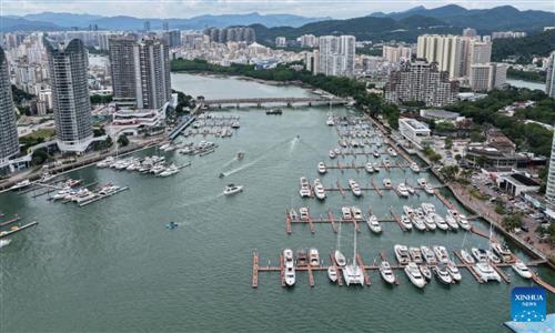
It is forecast that Ragasa will move northwestward at a speed of about 15 kilometers per hour, with its strength continuing to increase. Ragasa is expected to pass through the Bashi Channel on Monday, and by the early hours of Tuesday it will enter the northeastern part of the South China Sea, before it heads toward the coast of South China's Guangdong Province, China Central Television (CCTV) reported. Affected by typhoon Ragasa, the coastal waters and land areas of Guangdong will experience severe winds and heavy rainfall from Tuesday to Thursday.
Meanwhile, the year's 19th typhoon, Neoguri strengthened into a super typhoon at around 5 am on Sunday, with its center about 1,600 kilometers east-southeast of Tokyo, Japan. The maximum wind speed near its center reached 52 meters per second.
It is expected that Neoguri will move northwestward at a speed of 15 to 20 kilometers per hour, with its intensity expected to further increase. After Tuesday, it will gradually turn northeastward and will have little impact on China's offshore waters, CCTV reported on Sunday.
According to Ma Jun, director of the Institute of Public and Environmental Affairs, July to October is typically the most active period for typhoons, with August and September being the peak months. He noted that cases of multiple landfalls are uncommon, but when such a powerful typhoon shows the possibility of making landfall at any time or multiple times, its impact becomes significantly greater. For typhoons with unstable tracks like Ragasa, forecasting subsequent landfall locations is especially challenging, Ma said.
RELATED ARTICLES