Geo-STEP model offers systematic land engineering approach for Global South countries: TWAS Fellow
Disaster-hit Lankao pilots land governance model
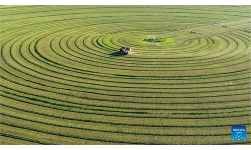
A golden wheat field is seen during the harvest season in Lankao, Central China's Henan Province, on June 2, 2026. Photo: VCG
As many Global South countries face overlapping pressures from land degradation, food security challenges and the need to raise farmers' incomes, a Chinese geographical engineering model being applied in Lankao county, Central China's Henan Province, could offer a new way to address complex land use and high-standard farmland construction problems through scientific diagnosis, engineering design and localized practice, a Chinese scholar said.The model, known as Geo-STEP, was created by Liu Yansui, a Fellow of The World Academy of Sciences and Director of the Faculty of Geographical Science and Engineering, Henan University. It integrates geography-based Science (S), Technology (T), Engineering (E) and Practice (P) to form a logical closed-loop system, aiming to turn land restoration and farmland improvement from experience-based work into a systematic process that can be diagnosed, designed, implemented and evaluated.
"The real international value of Geo-STEP is not to provide a standard answer, but to offer a complete problem-solving capacity that countries can adapt to their own conditions," Liu told the Global Times in a recent exclusive interview.
The model has been put into engineering practice in Lankao, a county closely associated with late county Party chief Jiao Yulu, who led local people in the 1960s in fighting sandstorms, salinization and waterlogging, known locally as the "three hazards."
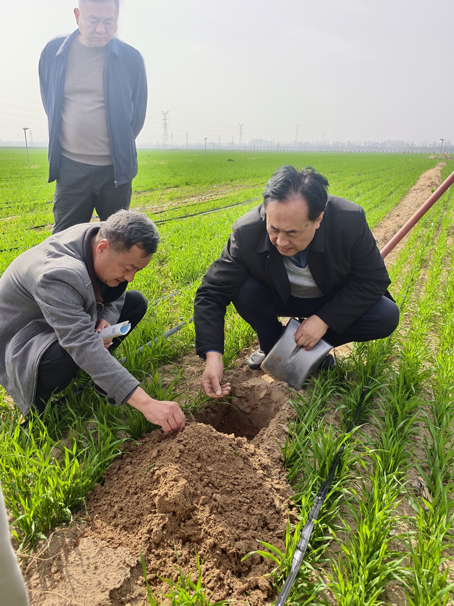
Liu Yansui and his research team member evaluate soil conditions in Lankao, Central China's Henan Province on April 16, 2026. Photo: Courtesy of Liu Yansui
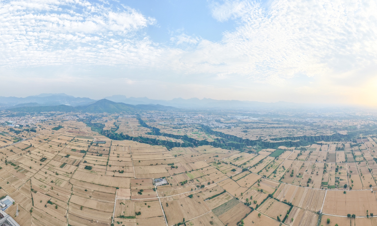
Lankao experienceLankao lies in the old course of the Yellow River and the Yellow River floodplain. Repeated flooding, sediment deposition and changes in the river course left the area with complex land problems. More than six decades after Jiao's efforts turned unusable land into cultivable fields, the county now faces a different task: how to make farmland capable of stable, high-yield and sustainable production.
According to research materials on the Lankao practice sent to the Global Times by Liu, some farmland in the county already meets the surface-level requirements of high-standard farmland, with leveled fields and improved infrastructure. However, yields and production stability in some areas still lag behind nearby counties under similar management and input conditions.
The deeper constraint lies beneath the surface. Historical Yellow River flooding and sedimentation formed special soil-body structures in Lankao, causing weaker soil water and fertilizer retention capacity, limiting yield improvement and stable production.
To solve the structural problems of Lankao, a more systemic practice was introduced to the region - the Geo-STEP model. Rather than simply leveling fields or increasing fertilizer input, the approach starts with scientific diagnosis of soil profiles, soil-layer structures and hidden limiting factors before forming engineering plans, according to the research material.
According to Liu, preliminary work has included the construction of more than 30 soil profiles and large sample plots, with researchers analyzing indicators such as particle size, soil bulk density and pH values across different soil layers. The goal is to identify where degraded soil structures are located, why they form and how they affect production.
Under Geo-STEP, the Lankao practice follows a four-step logic. Science identifies the problem and its mechanism; technology provides tools such as soil testing, remote sensing and spatial analysis; engineering turns scientific conclusions into farmland construction plans; and practice tests and improves the model in real production settings.
Liu told the Global Times that this is the main difference between Geo-STEP and conventional land improvement approaches. In the past, land projects often relied on experience or single technical measures, with research, engineering and farming practice separated from one another. Geo-STEP seeks to integrate the full chain, from scientific diagnosis to engineering implementation and field feedback.
For farmers, the most direct benefit is not merely a short-term rise in yield, but more reliable farmland, Liu noted. If soil-body structures are improved, water-salt regulation strengthened and water and fertilizer retention enhanced, farmland can become less vulnerable to weather fluctuations and extreme events, improving long-term production confidence.
The Lankao case also reflects a broader shift in China's high-standard farmland construction. China achieved the construction and renovation of 75.68 million mu (5.05 million hectares) of high-standard farmland in 2025, bringing the national total to more than 1 billion mu, Xinhua reported, citing the Ministry of Agriculture and Rural Affairs. Bringing China's total grain output to reached 714.88 million tons in 2025, up 1.2 percent year-on-year, according to the National Bureau of Statistics.
Through the Geo-STEP practice in Lankao, this case offers a more systematic approach to farmland governance. The value of the Lankao model does not lie in simply replicating a single technology, but in applying the systematic Geo-STEP methodology, which could ultimately move into production practice and regional promotion.
Its significance extends beyond one county. Research materials show that the old course of the Yellow River covers about 54,000 square kilometers and contains around 36 million mu of farmland, much of which faces common problems such as flood-deposited soil layers, sandification, salinization, poor soil structure and low fertility. Lankao, with the new Geo-STEP model is therefore exploring a method that may be expanded from one pilot area to a wider regional practice.
For Global South countries, Liu said, the most useful lesson from Lankao is not a fixed technical package, but a method for dealing with complex human-land systems.
"Land degradation is rarely caused by one factor alone. It is often the result of many factors, such as climate change, human activity, soil structure evolution, hydrological processes and socio-economic behavior," Liu said.
Geo-STEP can help different countries find suitable paths in several ways, he noted. It first provides a diagnostic framework, enabling countries to identify the type, degree and mechanism of land degradation under their own conditions. It then offers a modular technology system, allowing tools such as remote sensing, spatiotemporal big data and artificial intelligence simulation to be combined according to local capacity.
More importantly, Liu said, it emphasizes localized engineering design. Dryland areas may focus on water regulation, saline-alkali areas on soil-body improvement, and sloping farmland on soil and water conservation and ecological restoration. Through field feedback, the model can be continuously adjusted rather than exported as a one-time, fixed solution.
The model therefore could provide a customized solution to land degradation management and land consolidation, as land degradation has become a major global concern. The UN Convention to Combat Desertification has warned that up to 40 percent of the world's land is degraded, affecting more than 3 billion people.
"The core goal is not to replace local experience, but to strengthen the capacity of different countries to solve complex problems on their own," Liu said. "In the context of climate change, land degradation and food security challenges, this capacity is more important than any single technology."
RELATED ARTICLES