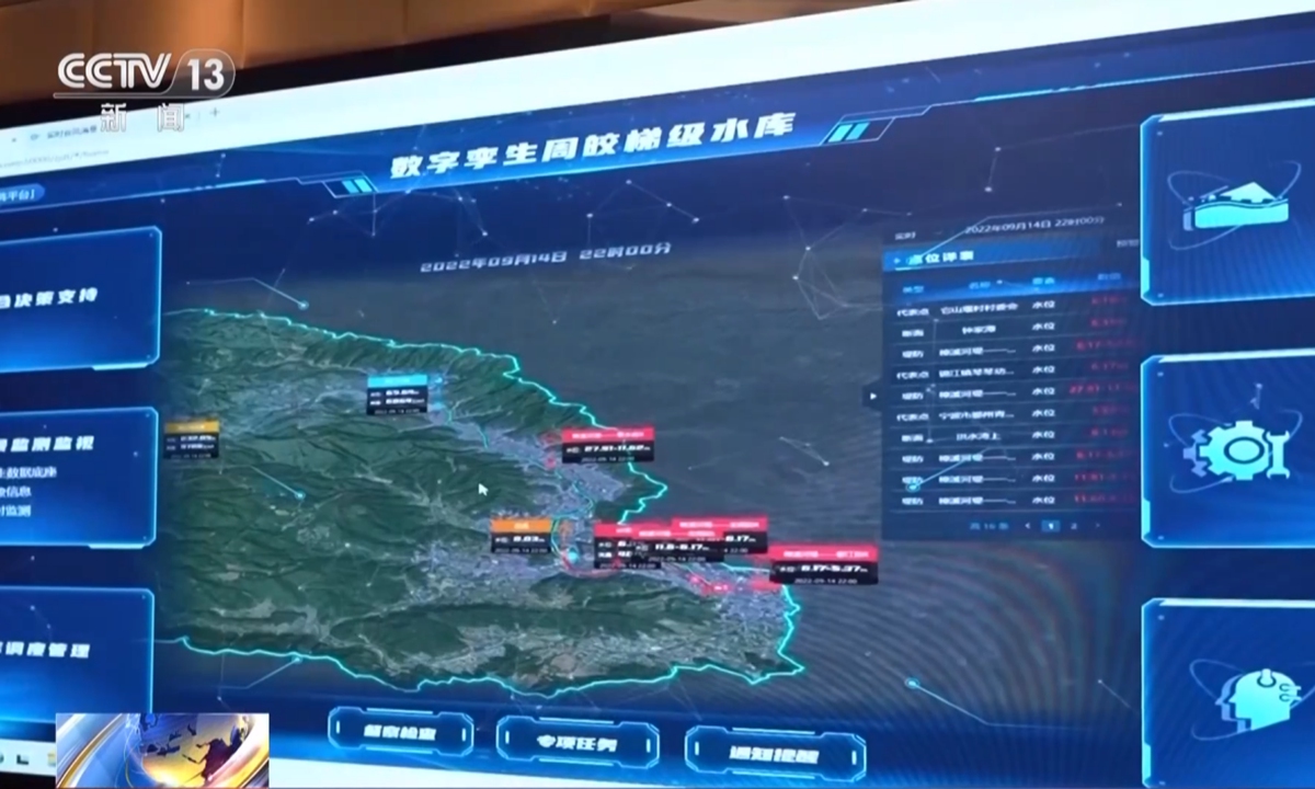
The user interface of Ningbo's reservoir dispatching software, which is powered by an AI forecasting model. Photo: CCTV News
From AI-powered flood forecasting and digital twins to smart reservoir management, phased-array radar networks and ground-based remote sensing systems, a new generation of high-tech equipment and systems is helping Chinese cities sharpen weather forecasts, improve flood control and make faster, more precise decisions to stay one step ahead of extreme weather.
In Ningbo, East China's Zhejiang Province, where water resources are relatively limited, the calculation of reservoir water release is tricky. If you release too much, the city could find itself short of water after the storm, however if you release too little, the reservoir may struggle to accommodate the floodwater brought by torrential rain.
Finding that balance is now increasingly a job for AI.
"The balance point has to be continuously analyzed and calculated by the dispatching software," Jiang Yutian, a department director at the Ningbo Water Conservancy & Hydropower Planning and Design Institute Co., Ltd., said, according to CCTV News.
At the heart of the system is an AI forecasting model that dramatically speeds up calculations.
For the Yongjiang River basin, running a complete flood-control scenario used to take five to 10 minutes. The new model can complete the calculation in just five to 10 seconds, cutting the time required to around one-sixtieth of the previous level.
Using rainfall forecasts and changing water levels, the model refreshes its recommendations every five minutes, calculating how much water should be released, how much can be stored later and how much reservoir capacity will remain when the flood peak arrives. Dispatchers can then adjust water releases in real time, per CCTV's report.
AI is not working alone. A digital-twin dispatching platform allows reservoirs to be managed together rather than individually. Across Ningbo's 16 major medium- and large-sized flood-control reservoirs, operators can see in real time which are approaching capacity and which still have room to take more water.
Hundreds of kilometers inland, another city is using a different technological set of technologies to tackle the same challenge of weather uncertainty.
Nanyang in Central China's Henan Province, which lies in a basin surrounded by mountains on three sides, has experienced widespread heavy rainfall since Monday under the influence of Typhoon Dolphin. Its geography leaves the city exposed to a combination of risks, including urban waterlogging, flooding in small and medium-sized rivers and inundation of farmland.
To track storms more precisely, the Nanyang meteorological authority has deployed a network of four newly installed X-band dual-polarization phased-array radars, together with an S-band dual-polarization radar and a ground-based vertical remote sensing system, according to the China Meteorological Administration.
The equipment allows forecasters to closely track the development and movement of convective clouds and identify areas at risk of intense rainfall earlier.
The city's meteorological authority has also integrated weather data with a citywide video monitoring network covering vulnerable locations such as underpasses, tunnels, river embankments and mountainous villages. This allows forecasters to compare what instruments are detecting with what is actually happening on the ground.
Together, the approaches in Ningbo and Nanyang offer a glimpse of how China's weather-disaster prevention efforts are becoming increasingly digital and intelligent, using faster calculations, denser observations and real-time data to bring greater certainty to decisions made in the face of uncertain weather.
Global Times
RELATED ARTICLES