GT investigates: What severe ice-rock avalanches throughout history reveal about future risks
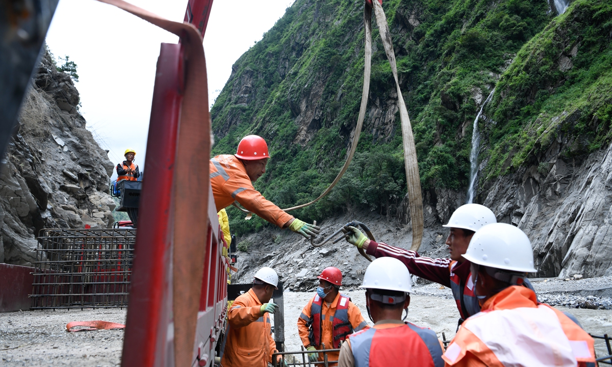
Rescue workers unload reinforced gabions at the Gyirong Port in Southwest China's Xizang Autonomous Region on September 4, 2026 as post-mudslide disaster relief work continues. Photo: VCG
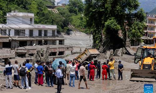
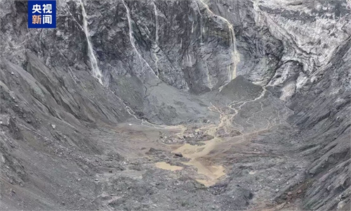
On August 26, an ice-rock avalanche tore down a high-altitude slope in Nepal, unleashing a devastating debris flow that left people dead or missing on both sides of the China-Nepal border.
As of Friday, 31 people have been confirmed dead and 531 others remain missing after a mudslide triggered by the high-altitude glacier collapse in Nepal, struck Gyirong Port on the China-Nepal border in Southwest China's Xizang Autonomous Region, according to local authorities, who have been conducting risks assessment work.
What happened in the mountains was more than a single disaster: it offered a glimpse into how rapidly warming mountain environments can turn increasingly fragile terrain into a source of sudden and deadly hazards.
As glaciers retreat and ice masses become increasingly unstable, ice and ice-rock avalanches are emerging as a growing threat in high-altitude regions - and one that remains extremely difficult to predict.
The danger is not new in essence. From the Alps and Andes to the Caucasus and the Qinghai-Xizang Plateau, major ice avalanches have repeatedly torn through mountain valleys, claiming lives and reshaping landscapes.
What, then, made the August 26 collapse at Mount Langtang Lirung in Nepal different from some of the major ice avalanches of the past? And as climate change alters the behavior of glaciers and ice masses, what can humanity at this ecological juncture do to minimize damages and losses?
To find answers, Global Times reporters combed through some major disasters around the world and spoke with leading international experts, tracing what has changed — and what lessons the past may still hold.
Anticipating complex hazards
Mount Huascarán in Peru's Andes is frequently mentioned in the history of major ice avalanche disasters. Alton C. Byers, a senior research affiliate at the Institute of Arctic and Alpine Research (INSTAAR) at the University of Colorado Boulder, told the Global Times that some of the earliest cases researchers continue to study date back to major avalanches on Huascarán in the latter half of the 20th century. Those events also generated hyperconcentrated slurry-like debris flows similar to the one triggered by the recent Mount Langtang Lirung avalanche, he said.
Byers described the Mount Langtang Lirung disaster as the latest in a series of ice avalanche events in recent years that have followed strikingly similar, in some cases nearly identical, processes. "We could go back even further to the 1970s in Peru," he said.
In 1962, a massive glacier detached from the north peak of the Huascarán, moving 15 kilometers in seven minutes. The debris, deescalating 4,000 meters, engulfed everything in its path, including nine villages and towns, according to the US Geological Survey.
Eight years later, a magnitude-7.7 earthquake triggered a much larger collapse on the same peak. Up to 100 million cubic meters of rocks, snow and ice buried the town of Yungay at speeds of up to 335 kilometers per hour, killing more than 18,000 people, according to the US Geological Survey.
These disasters highlight the cascading hazards of ice avalanches: a single collapse can trigger debris flows and other secondary disasters, as seen in the recent Mount Langtang Lirung event.
Also, an ice avalanche in one place may not be an isolated event. The 2016 Aru Glacier avalanche in Xizang also underscored the need for regional monitoring. Ice-core data from the nearby Guliya Glacier showed a warming and wetting trend, with temperatures reaching a 1,000-year high, prompting calls for monitoring interconnected glaciers and comprehensive watch on ecosystem changes, including lakes and grasslands.
As global temperatures rise, weakening glacier stability and intensified freeze-thaw cycles are increasing ice avalanche risks, with international scientists reaching the consensus that such events could become more frequent.
Amod Mani Dixit, founder of the Nepal National Society for Earthquake Technology, senior geologist, disaster risk management specialist and PIFI visiting scientist at the Aerospace Information Research Institute, Chinese Academy of Sciences, told the Global Times that authorities need to anticipate more complex, interconnected hazards occurring simultaneously.
For example, one warming event could trigger an ice-rock avalanche that breaches a moraine dam, potentially coinciding with heavy rainfall to create a compound disaster that overwhelms conventional defenses designed for individual hazards, Dixit said.
Geological factors matter
One comparison to the Mount Langtang Lirung ice-rock avalanche is the deadly disaster that struck Chamoli in India's Uttarakhand state in February 2021. Like the recent event in Nepal, the Chamoli disaster involved a cascading combination of ice and rock failure.
"The recent event is really only directly comparable to the Indian Chamoli event," Jakob Steiner, a geoscientist at the University of Graz in Austria, told the Global Times on Friday. In both cases, it was the underlying bedrock that first failed, dragging the overlying ice into the collapse. While the two events differed in scale and terrain, "we see similar processes" at work.
The comparison therefore highlights the importance of geological factors in both the Mount Langtang Lirung and Chamoli disasters, he said.
"Rather than the climate effect on ice, the climate effect on rock and permafrost becomes more important to understand," Steiner said, pointing to a broader question for disaster prevention: As climate change reshapes high-altitude environments, understanding how it weakens not only glaciers but also rock and permafrost may be crucial to assessing future risks.
Steiner also noted that in terms of runout and impact, the Mount Lantang Lirung disaster was "much larger than any we recorded in modern times", although not necessarily in terms of its initial volume.
The scale of the disaster, he said, should prompt a fundamental reassessment of how such events are understood and prepared for. "We can learn from these disasters that our probability estimates of certain dimensions happening need to be completely reassessed," Steiner said. At the same time, "any solutions for early warning and potential monitoring need to be adapted to new realities."
"We cannot just go on as we used to," he stressed.
Doing so will require expertise from multiple disciplines and countries, bringing together lessons from the relatively small number of such events that are better understood so far.
Monitoring and early warning
Ice avalanches are among the most destructive cryosphere hazards, with complex dynamics, limited predictability and catastrophic consequences. In the Qinghai-Xizang Plateau region, quick warming accelerates ice retreat, leading to more and larger ice lakes, and unstable glaciers. Growing ice avalanche risks are threatening ecological security, and what can be done to better respond to ice collapse?
Humanity still lacks sufficient understanding of eco processes in the southern slope of the Himalayas. Dixit from Nepal noted that accelerating cryosphere degradation can trigger cascading risks. As glaciers retreat, weakened rock walls and loose glacial deposits can cause slope failures and increase sediment loads, posing risks to downstream areas long after the initial retreat.
He called for risk-based development planning for infrastructure and residential areas, urging multi-hazard risk mapping along entire valley corridors, from river channels to high-altitude ridges, to improve long-term resilience.
Byers from University of Colorado Boulder said the priority should be developing robust early-warning systems tailored to high-magnitude events, with downstream communities prepared to evacuate immediately when a phone alert or siren sounds.
But before such systems can be built, Byers said, the priority is to strengthen risk monitoring. For Nepal, that means identifying high-risk areas where glacial landscapes dominate the upper watershed while towns and cities lie along rivers downstream.
Regular and rigorous analysis of satellite imagery will be crucial, he said. A high-risk area could feature massive overhanging ice on a high-mountain slope, with a river valley descending 10 kilometers toward an urban area.
"How to effectively monitor all of the high-risk areas identified will be a challenge," Byers said. But identifying the danger is only the beginning. In the end, the value of knowing where disaster may strike lies in having enough time to act when it does. As the saying goes, early warning means little without early action.
RELATED ARTICLES