Pinglu Canal and a 6,000-kilometer tourism road network reshape Nanning's landscape, strengthen links with ASEAN
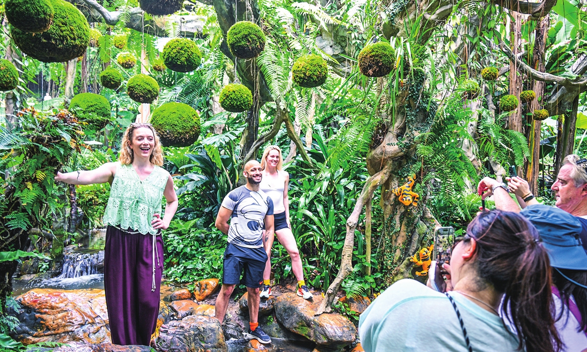
Foreign tourists visit a plant garden in Qingxiu Mountain scenic area in Nanning, South China's Guangxi Zhuang Autonomous Region on May 25, 2026.
Early in the morning, a thin mist lingers over the trails of Qingxiu Mountain in Nanning, South China's Guangxi Zhuang Autonomous Region. The Yongjiang River winds through the landscape while layers of trees line the paths and high-rise buildings appear and disappear amid the greenery.
According to Thomas, a local tourism content creator who regularly shows foreign visitors around the city, the scene often surprises those visiting for the first time.
"Many of them are amazed by how green and well-organized the city is," he told the Global Times, noting that some foreign tourists describe the dense greenery and carefully planned urban landscape as looking "almost like an AI-generated image."
Such reactions reflect Nanning's long-standing reputation as China's "green city." But greenery is no longer simply a backdrop to the city. Guangxi is now seeking to extend Nanning's ecological appeal beyond its parks and riversides by connecting urban landscapes with mountains, waterways, rural areas and the coast.
Beyond sightseeing
The shift is taking shape on a much larger scale than the city's parks and scenic spots.
Guangxi is developing a tourism road network spanning about 6,000 kilometers, linking nine major scenic routes, including those centered on the Pinglu Canal, Guilin's landscapes, the southern border and the Beibu Gulf, according to local authorities.
The network is intended to connect scenic areas, cities, towns and rural communities, turning roads from simple transport links into scenic corridors that also connect local industries and tourism resources along the way.
The timing is significant. Guangxi recently released its regional?15th Five-Year Plan for developing Guangxi into a strong tourism region, for building the region into a stronger tourism destination, calling for a gradual shift from sightseeing-oriented tourism toward leisure and vacation and more immersive travel by 2030.
The plan identifies Nanning as a tourism hub city for opening-up and cooperation with ASEAN, while calling for the development of distinctive tourism destinations in Xingning and Qingxiu districts, as well as Mashan and Shanglin counties.
The city is also expected to strengthen tourism links with Liuzhou, Guilin, Beihai and Laibin through north-south tourism corridors, while connecting with broader markets including the Guangdong-Hong Kong-Macao Greater Bay Area and ASEAN.
For Nanning, the question is no longer simply how to bring tourists to individual attractions, but how to keep them moving through - and staying in - a wider region.
The newly opened Pinglu Canal adds another dimension to that strategy.
A road-and-river link
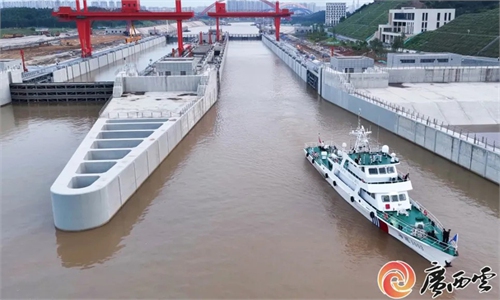
At Pingtang village in Hengzhou, Nanning, where the Pinglu Canal begins, the landscape offers a striking contrast to the busy urban center. Green hills rise around the water, while a cargo vessel loaded with goods moves slowly downstream.
The 134.2-kilometer Pinglu Canal runs from Hengzhou through Lingshan in Qinzhou before reaching the Beibu Gulf. Built at a cost of 72.7 billion yuan ($10.75 billion), it can accommodate vessels of up to 5,000 tons and opened to navigation on September 16.
For cargo from Southwest China, the canal shortens the inland waterway journey to the sea by about 560 kilometers compared with traditional routes through Guangdong.
But its significance for Nanning and Guangxi goes beyond freight, experts noted.
For years, the region's major rivers mainly flowed eastward toward the Pearl River Delta, while the lack of a direct north-south waterway limited links between the inland hinterland and the Beibu Gulf. The Pinglu Canal changes that geography by providing a direct river-to-sea route to the gulf and, from there, international markets, Ge Hongliang, the director of China-ASEAN Maritime Security Research Center at Guangxi Minzu University, told the Global Times.
The 6,000-kilometer tourism road network is being developed alongside this new waterway, creating a complementary land-and-water system, according to the plan.
Unlike the canal, which is designed primarily for large-volume, long-distance freight, tourism roads can reach smaller towns, villages, scenic areas and industrial sites, Ge said. The planned routes are expected to connect canal hubs, industrial parks, distinctive villages and coastal attractions, creating both tourism routes and short-distance distribution links for agricultural and local products, he added.
In practical terms, the canal provides a long-distance waterway backbone, while the roads can extend that connectivity into towns, villages and scenic areas. Together, the two systems could link Nanning with other parts of Guangxi more closely while giving local tourism resources and specialty products better access to larger markets, Ge said.
For tourism, that could mean a visitor arriving in Nanning is no longer limited to the city itself. The same journey could extend to landscapes along the Pinglu Canal, rural destinations in northern Guangxi, the mountains around Guilin or the coastal scenery of the Beibu Gulf, local authorities told the Global Times.
The regional tourism plan explicitly calls for strengthening Nanning's role as a hub for opening-up and cooperation with ASEAN, while the Pinglu Canal is a key project of the New International Land-Sea Trade Corridor linking Central-South and Southwest China with ASEAN and other international markets, Ge said.
The canal is already being viewed in this broader regional context. When it opened, Some major Chinese media such as the Xinhua News Agency described it as providing Southwest China with a shortcut to the coast and overseas markets, particularly those in ASEAN - the country's largest trading partner.
The waterway is expected to reduce comprehensive logistics costs by 18 to 30 percent and save more than 5 billion yuan in transportation costs annually, according to official estimates.
For Nanning, the emerging picture is therefore larger than a tourism upgrade. The city is seeking to extend its "green city" identity beyond its urban landscape, using roads and waterways to connect its parks and rivers with mountains, villages, and coast and the wider region.
The ambition is not simply to move tourists from one scenic spot to another. It is to turn the journey itself into part of the destination - while allowing local products, communities and industries to become part of a broader tourism and economic network connecting Guangxi with the rest of China and ASEAN.
"Guilin's landscape is the best under heaven" has long been one of the ways people see Guangxi - through its mountains and rivers.
But today, there is a new side to the region. Roads are running through mountains, villages and cities, while the Pinglu Canal is opening a new route to the sea. These projects are bringing places closer together, connecting tourism with local communities and industry, and Guangxi with ASEAN and the wider world.
"The mountains and rivers are still there," Thomas said. "But they are no longer just something to look at. They are becoming part of a network that connects people, places and industries, and opens Guangxi up to the world."
RELATED ARTICLES