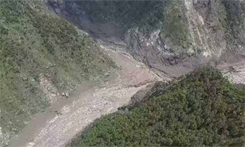
PowerChina-1 satellite captures first post-disaster radar images of mudslide-hit Gyirong Port in Xizang region
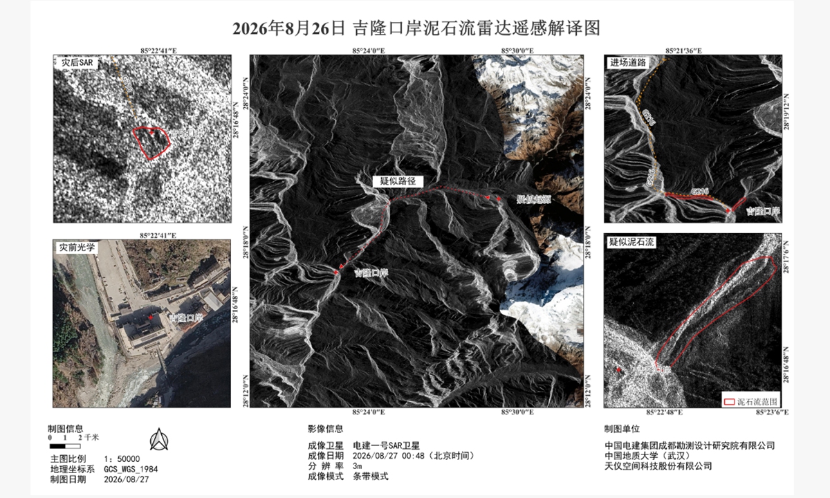
A radar remote-sensing interpretation image of the mudslide-hit Gyirong Port in Gyirong County, Southwest China's Xizang Autonomous Region, on August 26, 2026. Photo: Courtesy of POWERCHINA Chengdu
PowerChina-1, China's first dedicated satellite for energy engineering, passed over the disaster-hit Gyirong Port in Gyirong County, Southwest China's Xizang Autonomous Region, at 12:48 am on Thursday and successfully obtained the first batch of radar remote-sensing images of the area following the disaster, providing timely data support for disaster assessment, the Global Times learned from the satellite's developer POWERCHINA Chengdu.A severe mudslide occurred at around 10:30 am on Wednesday on the Nepalese side and affected Gyirong Port in Xizang, cutting off roads, communications and power supplies, causing casualties and leaving people missing.
Following the disaster, POWERCHINA Chengdu Engineering Corporation worked with its partners to activate an emergency response and urgently tasked the PowerChina-1 satellite with imaging the affected area.
According to POWERCHINA Chengdu, PowerChina-1 is an X-band synthetic aperture radar (SAR) satellite with all-weather, day-and-night imaging capabilities, allowing it to operate regardless of cloud cover or rain and to acquire images at night.
For this mission, the satellite used a stripmap imaging mode with a resolution of 3 meters, enabling it to image through cloud and fog over the disaster-affected zone and obtain key information on surface conditions.
Due to terrain layover effects caused by the complex topography on the southern slopes of the Himalayas, the fine structural details of the buildings at the port were not fully captured in the radar imagery. However, key features including changes in the river channel, areas apparently scoured by the mudslide and roads remained clearly identifiable, according to the company.
A preliminary interpretation of the imagery suggests that the source of the disaster may have been located in a high-altitude ice- and snow-covered area on the Nepalese side east of the port. A sudden collapse or sliding of ice and snow may have triggered a disaster chain involving collapse, river blockage, dam breach and debris flow, according to the company.
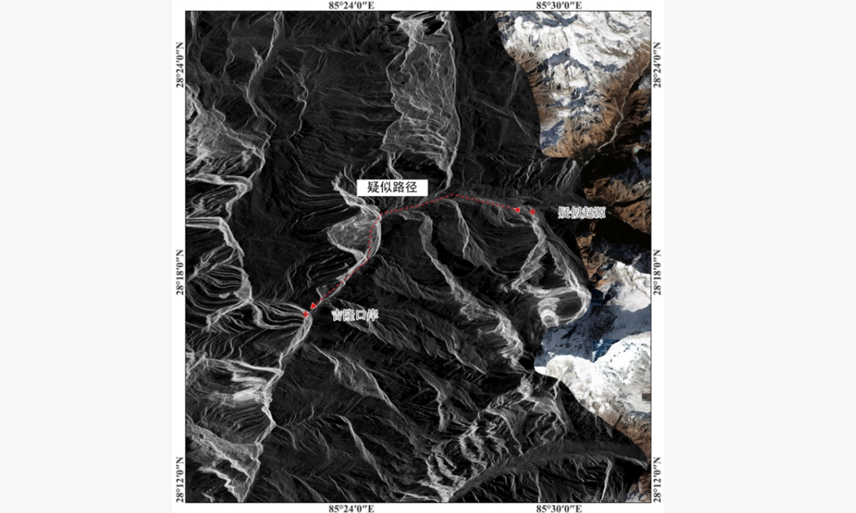
The suspected path of the mudslide, extending from a high-altitude ice- and snow-covered area on the Nepalese side east of Gyirong Port, along the red-marked route from the right side of the image toward the port on the left. Photo: Courtesy of POWERCHINA Chengdu
The imagery also showed suspected traces of debris-flow scouring east of the port and along the southern edge of national highway G216 west of the port. The river channel had visibly widened, while houses and roads along the river were covered by sediment, findings that were consistent with descriptions of the disaster situation.The first batch of satellite images and interpretation results has been shared with a number of national agencies and research institutions, including institutions under China's Ministry of Emergency Management, Ministry of Natural Resources, and Ministry of Water Resources, as well as institutions specializing in geoscience, disaster prevention, transport and power engineering.
POWERCHINA Chengdu told the Global Times in a statement that it will continue to conduct follow-up observations of Gyirong Port and surrounding areas, closely monitoring the risks of secondary disasters as well as progress in post-disaster recovery, while providing remote-sensing data support for disaster assessment, decision-making and emergency rescue operations.
RELATED ARTICLES