Exclusive: Experts national forecast center explain why intensity of El Nino has made record this summer, and how to respond
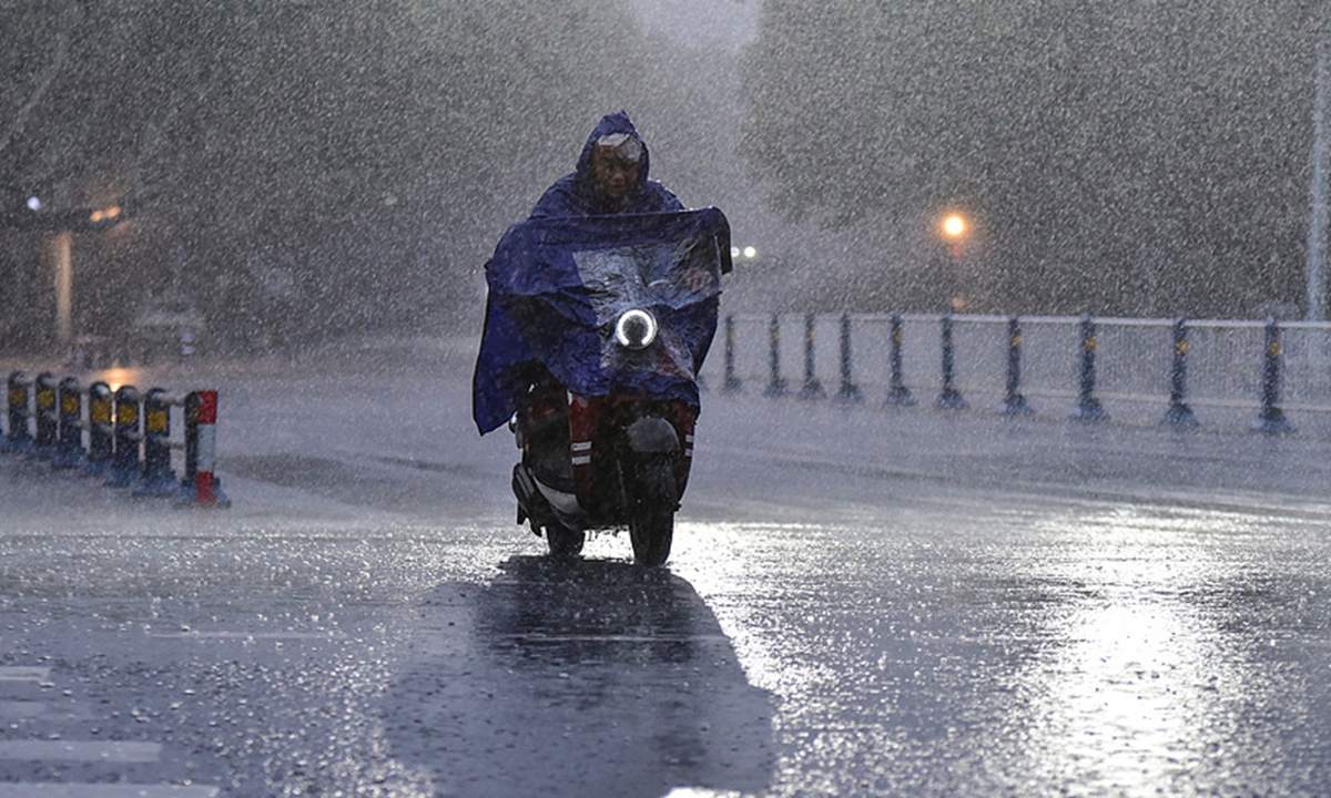
A resident in Fuyang, East China's Anhui Province, travels through heavy rain on August 30, 2026. The city experienced severe rainfall that day under the influence of the remnants of Typhoon Saudel. Photo: VCG
China's coastal waters have come under mounting pressure since the start of summer, with frequent typhoons, strong winds, huge waves and storm surges hitting coastal areas in succession. Against this backdrop, Global Times spoke with experts from the National Marine Environmental Forecasting Center (NMEFC) to examine the factors behind the heightened marine disaster risks this summer.
This year's rapidly developing El Nino could become the strongest on record, with multiple monitoring indicators reaching historic highs, experts told the Global Times.
Tan Jing, a senior engineer at the climate forecast division of the NMEFC, said the event's most striking feature is its unprecedented pace of warming. Sea surface temperatures in the key Nino3.4 region rose from 0.94 C in May to 1.55 C in June, 2.03 C in July and 2.65 C in the first half of August.
According to the center's latest model forecasts, the event could far exceed the 2.5 C threshold for a super El Nino, with peak temperatures in the key region potentially approaching 3.5 C. Its intensity could surpass the major super El Nino events of 1982/83, 1997/98 and 2015/16, potentially making it the strongest since records began.
The combined effects of global warming and the super El Niño have also driven persistently high sea temperatures across China's coastal waters, increasing risks of marine heatwaves, threats to aquaculture and coral bleaching, Tan said.
Typhoon activity in the Northwest Pacific and South China Sea has been unusually active since July, with both the number of storms formed and their landfall intensity above normal levels. Typhoon Baidolphin, for instance, made a powerful landfall in Taizhou, East China's Zhejiang Province, bringing strong winds, huge waves, torrential rain and flooding.
Xing Chuang, an engineer with the Wave Forecasting Office of the National Marine Environmental Forecasting Center, said the unusually strong typhoons this year are closely linked to ocean warming and the formation of marine disasters.
"A strong El Niño will completely alter the sea surface temperature distribution and atmospheric conditions over the Northwest Pacific, creating ideal conditions for the formation, development, and intensification of typhoons," Xing told the Global Times. This round of strong El Niño has shifted the Pacific warm-water zone eastward into the central Pacific. In this region, convective activity is vigorous and vertical wind shear is weak, making it extremely favorable for the genesis and growth of typhoon embryos. As a result, typhoons this year have generally formed farther east, and the number of distant-ocean typhoons generated east of 150°E has exceeded the average of previous years.
Xing regards the more easterly genesis locations as the main reason for stronger intensity and longer lifespan. "The farther east a typhoon forms, the longer its track toward China becomes. It stays longer over the ocean, continuously absorbing heat and moisture from deep warm waters, steadily building energy and maintaining high intensity," he said. He cited two examples: Super Typhoon 2609 "Bavi" and Super Typhoon 2613 "Baihaitun" both formed east of 160°E and lasted 13 and 15 days respectively. Their prolonged ocean development allowed them to intensify into super typhoons before making landfall in Taizhou, Zhejiang, at typhoon and severe-typhoon strength.
These long-lived super typhoons produced intense disastrous waves. As of 19 August, China's nearshore waters recorded 17 disastrous wave events—slightly fewer than the recent 10-year average of 19.8—but intensity was extreme. Three typhoon-related events reached red-alert level, compared with only one on average in the same period over the past decade, he said.
Both experts agree that strong El Nino has amplified cumulative marine-disaster risk. Storm surges and disastrous waves along the Chinese coast have occurred in rapid succession with short recovery windows, keeping coastal areas under continuous high pressure.
Meanwhile, the risk of typhoons moving north has increased. Tan Jing noted that the subtropical high this summer has been stronger and farther north in July-August, steering strong typhoons into the Yellow and Bohai Seas. These semi-enclosed shallow waters experience pronounced water-stacking effects, so storm surges and waves are more destructive than in the East China Sea. Northward typhoons can also meet cold air, creating compound extremes of wind, rain, waves and surge.
Cross-department coordination is strengthening coastal disaster resilience. For the rapid pre-peak phase of El Nino in August-October, experts issued risk alerts: nearshore waters must guard against marine heatwaves from elevated sea temperatures to protect aquaculture, while northern South China Sea coasts should prevent red tides and coral bleaching. Shipping, fisheries, coastal projects and the public are urged to follow official marine warnings and avoid going to sea or watching waves during typhoons.
In long term, against the backdrop of global warming and frequent El Nino events, China's nearshore disaster pattern is shifting. Xing noted that typhoon-related disastrous waves may slightly decrease in frequency but grow more extreme in intensity, with extreme disasters becoming more common.
Tan stressed that single-hazard warnings are insufficient for more complex combined disasters, therefore cross-department coordination is essential. Ocean, meteorological and water-conservancy agencies are building a full-chain closed-loop system: meteorology forecasts typhoon paths and rainfall; ocean agencies model storm surges and waves; water agencies assess floods. Real-time data sharing aims to produce integrated warnings for better local response.
Xing also outlined three priorities: applying AI to improve wave forecast accuracy and lead time; assimilating satellite data to enhance swell prediction for offshore wind safety; and developing fine-scale warnings for islands and coasts (breaking waves, rip currents) with tailored products to boost overall coastal resilience.
RELATED ARTICLES