GT investigates: Why the mudslide disaster brings different impacts to China, Nepal
Nepal experts explain casualty gaps, rescue difficulties and the need for cooperation
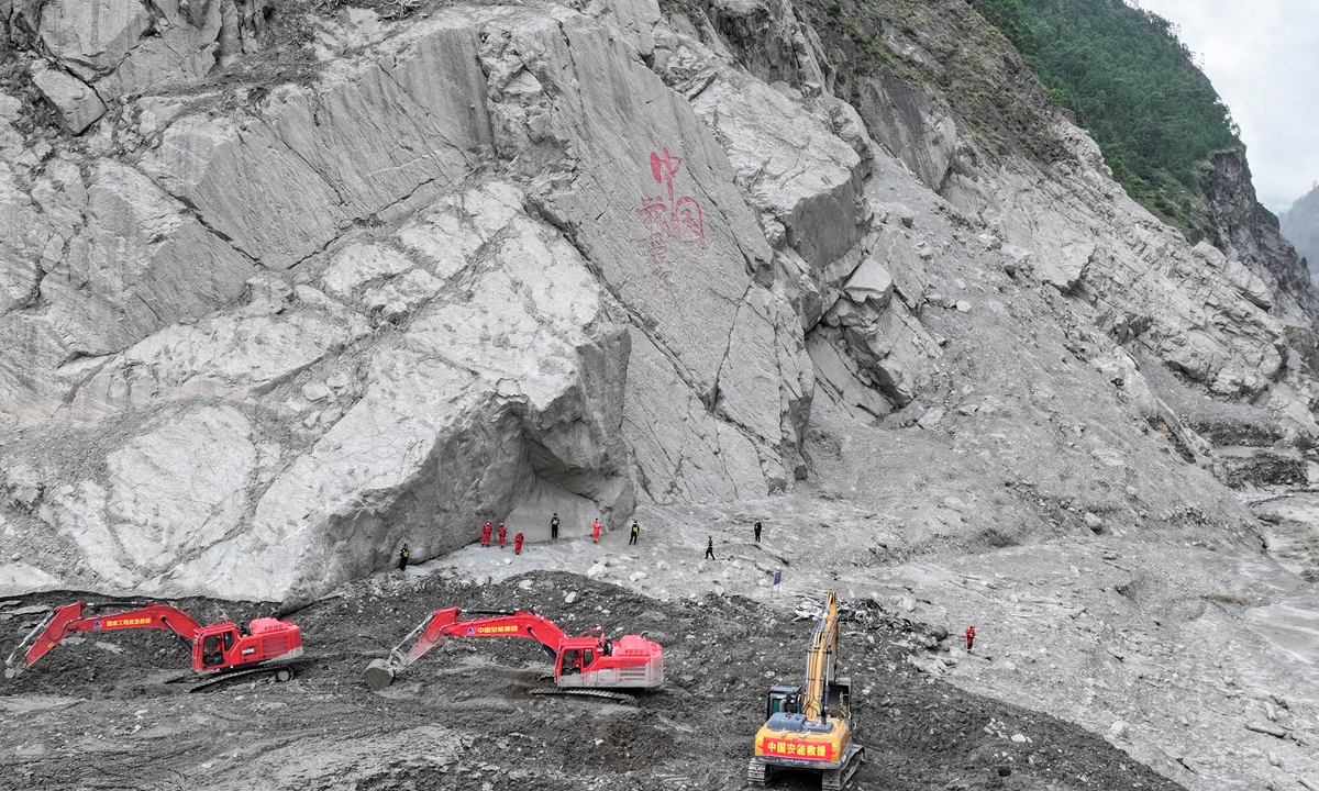
Eleven days have passed since the mudslide disaster hit Gyirong, Southwest China's Xizang Autonomous Region, on August 26, with rescue and relief efforts continuing. The photo shows excavators, loaders and other heavy equipment operating in the core disaster-hit area of Gyirong Port. Photo: VCG
Rescue and relief operations following the devastating mudslides along the China-Nepal border are continuing in an orderly manner, as authorities on both sides race against difficult terrain and other challenges to search for those still missing.
As of 6 pm on September 5, the emergency rescue command center for the August 26 mudslide disaster that struck Gyirong County, Southwest China's Xizang Autonomous Region, reported 43 deaths and 519 people still missing. In Nepal, 1,353 bodies had been recovered from mudslide-hit areas as of 8 pm local time on September 6, according to figures released by Nepal Police.
Why is there such a wide disparity in the number of people killed or missing in the two countries? How did the disaster and rescue challenges differ on the two sides? And where can China and Nepal strengthen disaster warning and prevention efforts going forward?
The Global Times spoke with experts in China and Nepal to understand why the disaster unfolded so differently on both sides and what could be done to better prepare for similar cross-border hazards.
Different challenges
A glacier on the north slope of Mount Langtang Lirung in Nepal fractured at an altitude of about 5,200 meters on August 26, triggering an ice-rock avalanche that developed into a high-speed debris flow. After hitting the Gyirong Zangbo River, the flow split in two directions, with one moving nearly 3 kilometers upstream and the other continuing downstream into Nepal for tens of kilometers, CCTV News reported.
"Based on what we observed at the site, this disaster had clear cross-border and cascading characteristics. It was initially triggered by a high-altitude glacier collapse in Nepal, with the falling ice rapidly moving downslope and carrying large amounts of glacial debris, sediment and boulders. The flow gradually developed into a high-speed debris flow and mudslide, traveling downstream along the river valley and ultimately causing severe impacts on both sides of the China-Nepal border," Li Xin, deputy director of the Institute of Tibetan Plateau Research under the Chinese Academy of Sciences, told the Global Times on Monday.
The disaster took different forms on the two sides, Li said. In China, the impact was concentrated around Gyirong Port, where the sudden, high-energy flow severely damaged infrastructure. In Nepal, the disaster spread farther downstream along the river valley, affecting settlements, roads, bridges and hydropower facilities. "It is not accurate to simply say which side was hit harder. Rather, the same cross-border disaster took different forms under different terrain and infrastructure conditions," Li said.
The impact on the Chinese side, in Gyirong, was severe but relatively concentrated around the source and border corridor, where the initial ice-rock avalanche and flood surge carried extremely high energy, said Basanta Raj Adhikari, director of the Disaster Study Centre at the Institute of Engineering of Tribhuvan University in Nepal.
Rasuwa and Nuwakot were among the worst-affected areas in Nepal. In Rasuwa, the flow entered steep, confined valleys that helped maintain its velocity and intensified erosion, while also picking up sediment, boulders and debris from the river channel, Adhikari explained.
"The added material increased the volume and destructive power of the flow. In Nuwakot, as the valley widened, the flow slowed, but floodwaters and sediment deposits spread across a much larger area, affecting settlements, farmland and infrastructure."
Experts noted that densely populated towns are located along both banks of the Bhote Koshi River in Nepal, which was affected by the disaster, according to public reports. The river valley is also home to a well-known mountain trekking route that attracts visitors from around the world.
The narrow canyon and deeply buried infrastructure around Gyirong Port have made access, excavation and victim identification extremely difficult, Mohan Bahadur Chand, a Himalayan glaciologist and assistant professor in the Department of Environmental Science at Kathmandu University, told the Global Times. "Unstable slopes also pose ongoing risks of secondary disasters,'' he added.
Adhikari similarly noted that the steep, narrow Gyirong valley concentrated the flow's energy, while unstable slopes, deep debris, rockfalls and limited access around the port complicated search and rescue efforts.
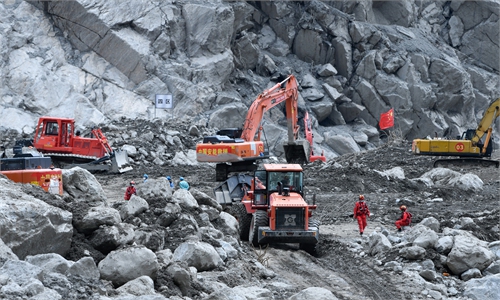
According to previous reports, it took seven days and nights to reopen a 3-kilometer stretch of National Highway 7 in Gyirong, with workers advancing less than 5 meters in two hours at the most difficult point. The access route to the core area of Gyirong Port was largely reopened on the morning of September 2. The extremely narrow work area left little room for large machinery to operate continuously, while the limited space for equipment movement and maneuvering further slowed repairs.
In Nepal, the affected area is wider and stretches much farther, Chand said, creating different challenges as damaged bridges, roads, settlements and hydropower facilities are scattered across tens of kilometers. Rescue operations therefore require simultaneous efforts, including tunnel work, helicopter access and the restoration of transport links.
In Rasuwa, steep terrain and damaged roads and bridges can isolate settlements and hydropower sites, making rescue dependent on helicopters, local teams and alternative access, Adhikari said. In Nuwakot, wider valleys allowed floodwaters and debris to spread across larger areas, creating broader search zones and more dispersed damage.
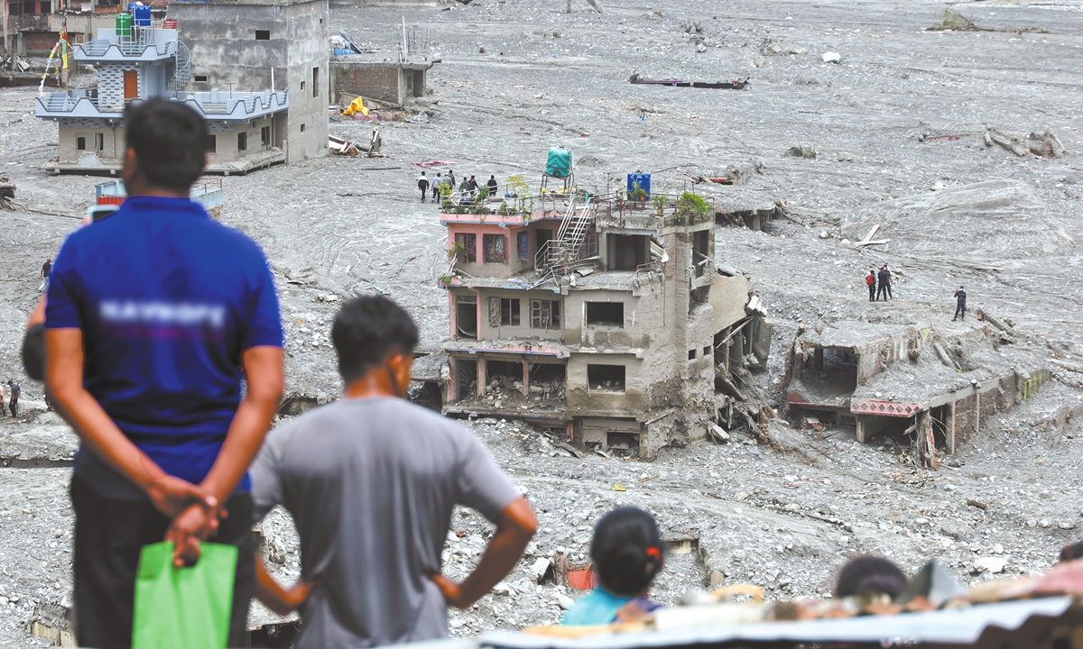
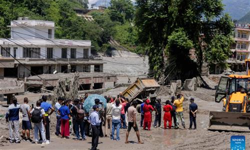
A photo taken on September 6, 2026, shows a village in Bidur, Nepal, that was devastated by massive flooding, with buildings swept away or buried under mud and debris. Photo: VCG
Bolstering disaster warning and response
Against the backdrop of global warming, intensifying freeze-thaw cycles are weakening glacier stability and increasing the risk of ice collapses. Hazard chains involving ice collapses, debris flows and glacial lake outburst floods (GLOFs) are also expected to become more frequent and destructive.
"Establishing a formal network that directly connects various institutions involved in disaster management and response is essential," Prakash Pokhrel, a geologist at Nepal's National Disaster Risk Reduction and Management Authority (NDRRMA), told the Global Times. To minimize the growing risks posed by disasters, NDRRMA is planning to establish an integrated early warning system and install various types of sensors in areas vulnerable to disasters, he said.
Looking ahead, Chand called for China and Nepal to establish a real-time transboundary high-mountain hazard monitoring and data-sharing system. The system should incorporate satellite and UAV surveillance, seismic and ground sensors, monitoring of glacial lake and river levels, and automated detection of major ice-rock failures.
"Early warnings should be promptly exchanged across the border by means of established protocols, involving joint hazard maps, downstream impact scenarios, evacuation triggers, communication channels and regular cross-border emergency exercises," Chand said. "Importantly, the warning systems must cover rapid cascading events that have only minutes of travel time, not just the usual GLOFs. All of this should come through joint research from universities of both sides."
Adhikari, meanwhile, proposed establishing a regional platform called a "Himalaya Monitoring Center." This center should " bring together China, Nepal, India, Bhutan, Pakistan and other Himalayan countries to jointly monitor glaciers, unstable slopes, high-altitude lakes and river systems using seismic sensors, satellites, GNSS and hydrometeorological networks," he said.
The center should enable real-time cross-border data sharing, common risk thresholds and rapid warning protocols, so countries can detect ice-rock avalanches and cascading floods at their source and trigger evacuation and emergency response before destructive flows reach downstream communities, he said.
The warning window for ice-rock avalanche and debris-flow hazards can be only a few minutes, while traditional single-point monitoring cannot cover risks across an entire river basin, said Su Pengcheng, a researcher at the Institute of Mountain Hazards and Environment under the Chinese Academy of Sciences, during a media briefing on Sunday.
Su called for deeper research into cross-border cryosphere hazards in the Himalayas, an integrated satellite-air-ground monitoring system and stronger cross-border research and early-warning cooperation, including basin-wide data sharing and rapid warning channels.
"China and Nepal should strengthen joint surveys, assessment, monitoring and early warning of cross-border basin disasters and establish a data-sharing mechanism," Kang Shichang, director of the Institute of Mountain Hazards and Environment under the Chinese Academy of Sciences, told the Global Times on Monday.
Expert Li Xin said China and Nepal have already cooperated for years on glacier and glacial-lake databases. More efficient and comprehensive data sharing would further improve disaster response, he said.
Beyond joint monitoring systems, the two sides should also explore a mechanism for cross-border UAV operations, Li said, noting that drones are vital for rapid disaster response.
RELATED ARTICLES